
Positioning quality of global navigation satellite system receivers

a global navigation satellite and receiver technology, applied in satellite radio beaconing, measurement devices, instruments, etc., can solve the problem that the navigation receiver can switch to a different operational mode with lower accuracy, and achieve the effect of improving the positioning quality

Active Publication Date: 2017-01-03
TOPCON POSITIONING SYST INC
View PDF17 Cites 2 Cited by
  • Summary
  • Abstract
  • Description
  • Claims
  • Application Information

AI Technical Summary

Benefits of technology

The patent describes a navigation system that uses estimates of coordinates and an accuracy estimate to guide vehicles. When the accuracy estimate changes during operation, the system generates smoothed estimates of coordinates to improve positioning accuracy. The technical effect is smoother and more accurate navigation.

Problems solved by technology

Many of the errors in calculating coordinates from GNSS measurements, such as satellite clock drifts and signal propagation delays through the ionosphere and troposphere, are highly correlated at the rover and the base, if the rover and the base are sufficiently close.
When normal DN operation is disrupted, navigation receivers can switch to a different operational mode with lower accuracy.

Method used


Image

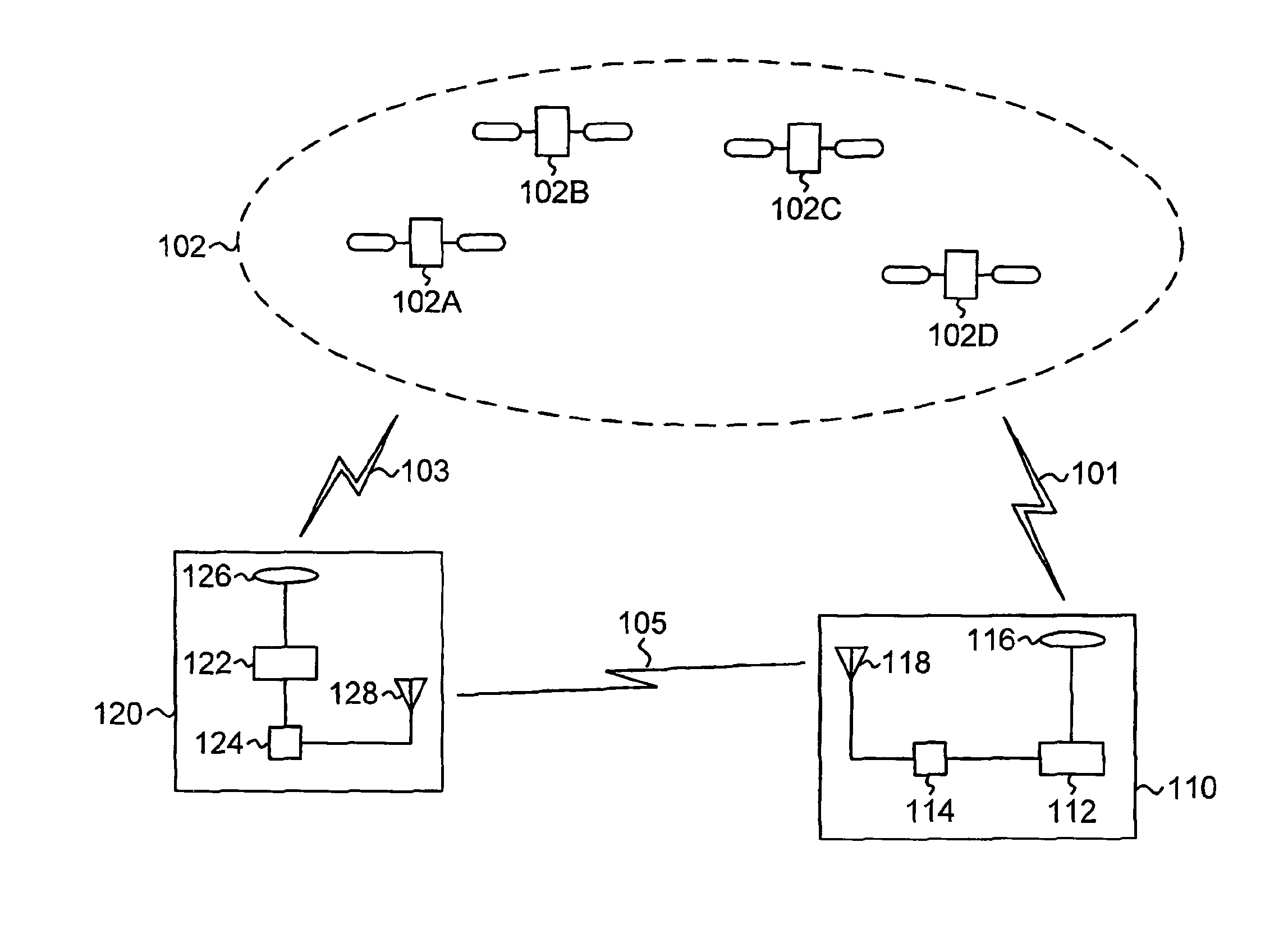
  • Positioning quality of global navigation satellite system receivers
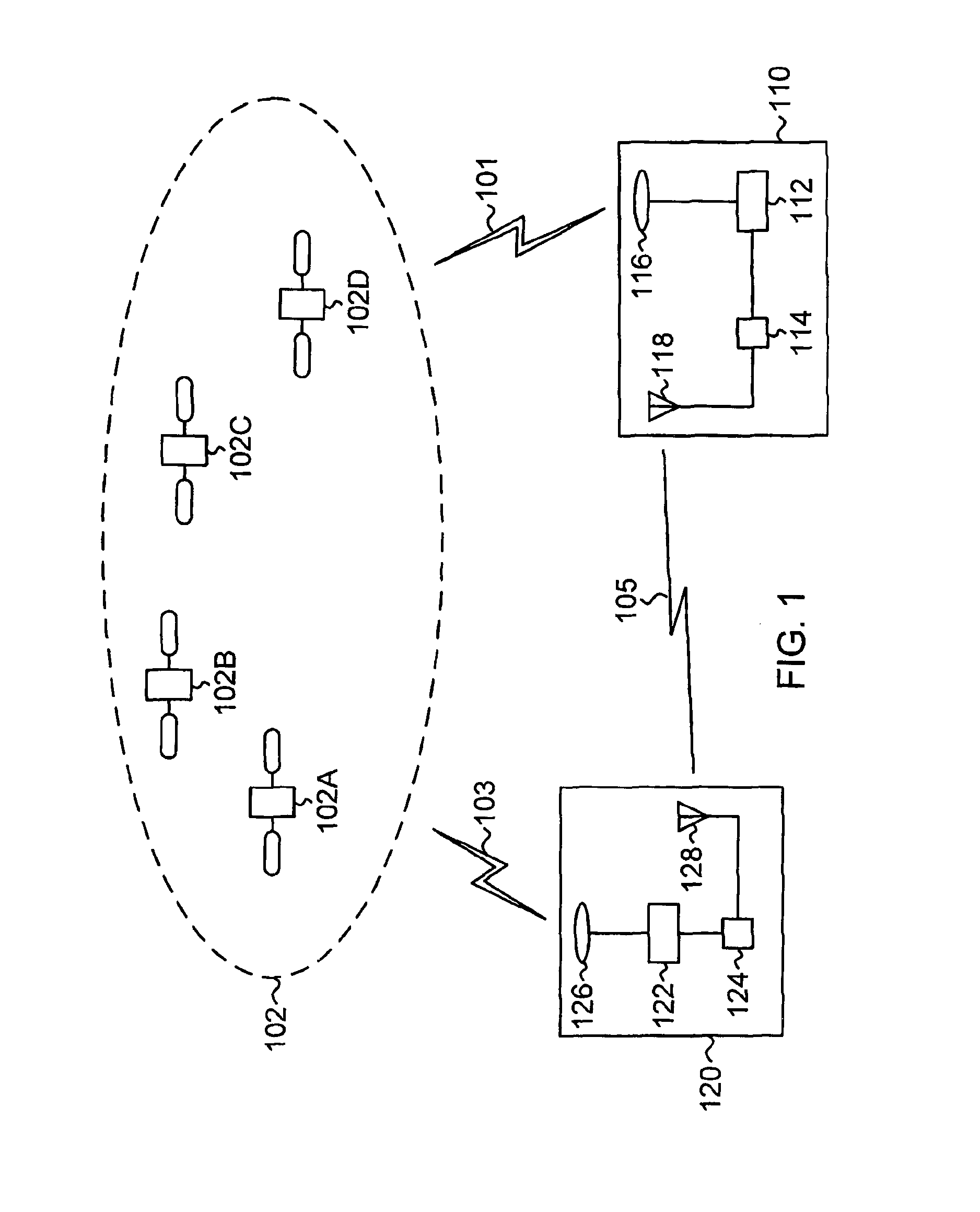
  • Positioning quality of global navigation satellite system receivers
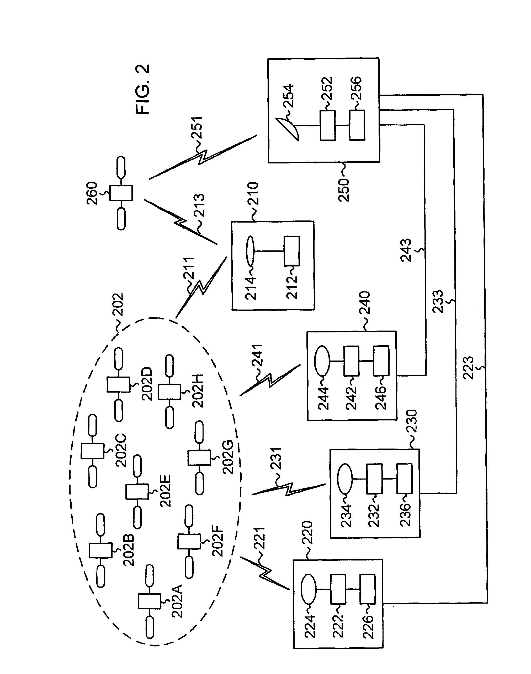
  • Positioning quality of global navigation satellite system receivers

Examples


example 1

[0135]This example illustrates Variant 1 of building the adaptive nonlinear filter (see Table 1 in FIG. 4), when the receiver operates in the OmniSTAR mode and classification method (I) is used. Table 2 (FIG. 5) lists the available solution types (column 502) and the assigned AR values (column 504).

[0136]According to logic expressions (E5) and (E6), with classification method (I), at time intervals when AR=3, the smoothed estimates of coordinates are generated as extended estimates of coordinates. At time intervals when AR=1, the smoothed estimates of coordinates are generated by the closed loop. At time intervals when AR=2, the smoothed estimates of coordinates are generated either by the closed loop or as extended estimates of coordinates, depending on the previous AR value. Table 3 (FIG. 6) gives examples of values for the parameters of the functional transformation, if nonlinearity (E9) is used in the closed loop. Column 602 lists the parameters of the functional transformation....

example 2

[0138]This example illustrates Variant 2 of building the adaptive nonlinear filter (see Table 1 in FIG. 4), when the receiver operates in the OmniSTAR mode and classification method (II) is used. Table 4 (FIG. 7) lists the available solution types (column 702) and the assigned AR values (column 704).

[0139]According to logic expressions (E5) and (E6), with classification method (II), the smoothing loop will be closed only over time intervals when AR=1; for the other time intervals, extended estimates of coordinates are used as smoothed estimates of coordinates. Table 5 (FIG. 8) gives examples of values for the parameters of the functional transformation, if nonlinearity (E11) is used in the closed loop. Column 802 lists the parameters of the functional transformation. Column 804 gives the values for AR=1.

[0140]This example shows that Variant 2 of the adaptive nonlinear filter improves the accuracy and smoothness of estimates of coordinates under harsh operational environments by sele...

example 3

[0141]This example illustrates Variant 3 of building the adaptive nonlinear filter (see Table 1 in FIG. 4), when the receiver operates in one of two different modes (OmniSTAR and DGPS) and classification method (II) is used. Table 6 (FIG. 9) lists the available modes (column 902), the available solution types (column 904), and the assigned AR values (column 906).

[0142]According to logic expressions (E5) and (E6), with classification method (II), the smoothing loop is closed over time intervals when the solution types belong to the first accuracy rating (AR=1); for AR=2, extended estimates of coordinates are generated and used for the smoothed estimates of coordinates. Table 7A (FIG. 10) gives examples of values for the parameters of the functional transformation, if nonlinearity (E10) is used in the closed loop. Column 1002 lists two parameters, the limit threshold and the limit level. Column 1004 gives the values for AR=1.

[0143]Table 7B (FIG. 10B) gives examples of values for the t...


PUM


Abstract

A navigation receiver operating in a differential navigation mode transmits primary estimates of coordinates with an accuracy estimate that can vary during operation. To improve the positioning quality when the accuracy estimate changes, smoothed estimates of coordinates are generated according to a two-branch algorithm. The current-epoch accuracy estimate is compared to a current-epoch value of threshold accuracy. Upon determining that the current-epoch accuracy estimate is greater than or equal to the current-epoch value of threshold accuracy, the current-epoch smoothed estimates of coordinates are set equal to the current-epoch extended estimates of coordinates calculated from the sum of the previous smoothed estimates of coordinates and coordinate increments calculated from carrier phases. Upon determining that the current-epoch accuracy estimate is less than the current-epoch value of threshold accuracy, the current-epoch smoothed estimates of coordinates are generated based on the sum of the current-epoch extended estimates of coordinates and a correction signal.

Description

BACKGROUND OF THE INVENTION[0001]The present invention relates generally to global navigation satellite systems, and more particularly to improving the positioning quality of global navigation satellite system receivers operating in the differential navigation mode.[0002]Global navigation satellite systems (GNSSs) can determine locations with high accuracy. Currently deployed GNSSs include the United States Global Positioning System (GPS) and the Russian GLONASS. Other GNSSs, such as the European GALILEO system, are under development. GNSSs are used in a wide range of applications, such as surveying, geology, and mapping. GNSS sensors estimating positions and velocities are also integrated into automatic control systems for agricultural and construction machines.[0003]In a GNSS, a navigation receiver receives and processes radio signals transmitted by satellites located within a line-of-sight of the navigation receiver. The satellite signals comprise carrier signals modulated by pse...

Claims


Application Information

Patent Timeline
Patent Type & Authority Patents(United States)
IPC IPC(8): G01S19/13G01S19/40G01S19/43G01S19/41
CPCG01S19/13G01S19/40G01S19/43G01S19/41
Inventor VEITSEL, VLADIMIR VIKTOROVICHVEITSEL, ANDREY VLADIMIROVICHNIKITIN, DMITRY PAVLOVICHZHODZISHSKY, MARK ISAAKOVICHPLENKIN, ANDREY VALERYEVICHVEITSEL, VIKTOR ABRAMOVICH
Owner TOPCON POSITIONING SYST INC
Learn More