
Method for real time bookbinding and processing navigating point for unmanned aerial vehicle

A processing method and unmanned aerial vehicle technology, applied in the direction of integrated navigator, etc., can solve the problem of fast, real-time, accurate and reliable operation of a large number of waypoints, achieve flexible and fast binding and processing, improve execution efficiency, simplify The effect of the program

Inactive Publication Date: 2008-08-27
BEIHANG UNIV
View PDF0 Cites 13 Cited by
  • Summary
  • Abstract
  • Description
  • Claims
  • Application Information

AI Technical Summary

Problems solved by technology

However, the existing waypoint binding and processing methods using an array or a single linked list are difficult to meet the fast, real-time, accurate and reliable operation of a large number of waypoints.

Method used


Image

  • Method for real time bookbinding and processing navigating point for unmanned aerial vehicle
  • Method for real time bookbinding and processing navigating point for unmanned aerial vehicle
  • Method for real time bookbinding and processing navigating point for unmanned aerial vehicle

Examples


Embodiment Construction

[0021] A real-time binding and processing method of waypoints applied to unmanned aerial vehicles according to the present invention will be described in detail below in conjunction with the accompanying drawings.

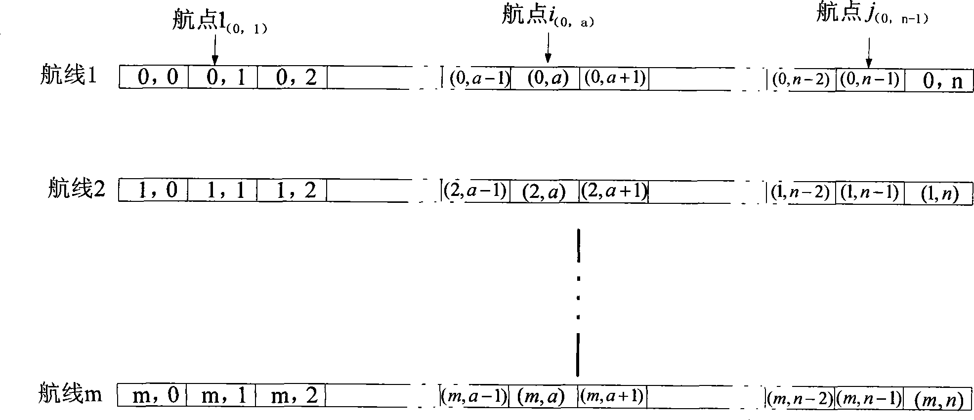
[0022] The present invention is a real-time binding and processing method for a large number of waypoints applied to unmanned aerial vehicles. By defining the waypoint structure type and the two-dimensional array of waypoint structure types, waypoint binding and waypoint modification, waypoint deletion, and waypoint The processing operations of inserting, waypoint query, route query, and setting the starting point have realized various real-time operation requirements of the drone for route waypoints.

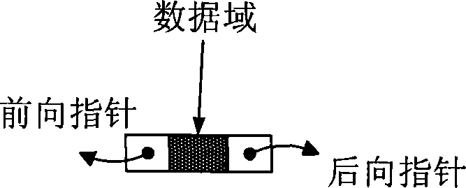
[0023] The present invention first defines a waypoint structure type WAY_POINT, and the waypoint structure type WAY_POINT includes information such as forward pointer, backward pointer, line number, point number, binding mark, longitude, latitude, height, etc., and t...


PUM


Abstract

The invention discloses a waypoint real-time collating and processing method applied on an unmanned aircraft. Through the storage mode of an array integrated with linked lists, the real-time planning operations of a plurality of waypoints on a plurality of airways are realized with the waypoint structural variables as base data elements to define a two-dimensional array of waypoint structural type, wherein each element in the array is corresponding to a waypoint, the first dimension is corresponding to a line number, and the second dimension is corresponding to a point number; each airway in the array is constructed into a double linked list, wherein the precedence order of the nodes in the linked list is corresponding to the precedence order of the waypoints in the airway; the realizable operations on the waypoints comprise waypoint collating, waypoint modifying, waypoint inserting, waypoint inquiring, waypoint deleting, airway inquiring, starting point setting, waypoint shifting, etc. The waypoint real-time collating and processing method can meet various real-time operation requirements on the airways and waypoints of the unmanned aircraft with simple realization of the program and static allocation of the airway storage space, thereby realizing the reliability and quickness of the waypoint operations.

Description

technical field [0001] The invention belongs to the field of aviation automation control, and in particular relates to a real-time and reliable binding and processing method for a large number of waypoints applied to an unmanned aerial vehicle. Background technique [0002] UAVs usually pre-book routes before performing missions. After the plane takes off, it first cuts into the route from the set starting point, and then flies along the route. During the flight, the task may change, and a new route needs to be rebooked, and a starting point should be set to quickly guide the aircraft to the new route. Or, the flight route needs to be adjusted, such as waypoint modification, waypoint deletion, waypoint insertion, etc. Sometimes, it is also necessary to check and confirm the route or waypoint on the plane, such as waypoint inquiry and route inquiry. [0003] For UAVs with long flight time and long range, it is necessary to book a large number of waypoints on multiple route...

Claims


Application Information

Patent Timeline
Patent Type & Authority Applications(China)
IPC IPC(8): G01C21/24
Inventor 王宏伦舒婷婷田波
Owner BEIHANG UNIV
Learn More