

River network regional water system connectivity measurement method based on geographic information system technology
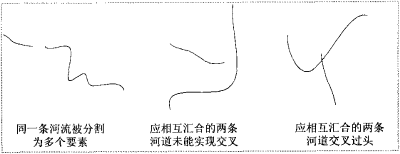
A geographic information system and connectivity technology, applied in the field of landscape ecological planning, can solve problems such as confusion in measurement methods, difficulty in accurately judging the complexity of river networks, river network nodes and river chains, and achieve the effect of reducing errors.
- Summary
- Abstract
- Description
- Claims
- Application Information
AI Technical Summary
Problems solved by technology
Method used
Image

Examples
Embodiment Construction
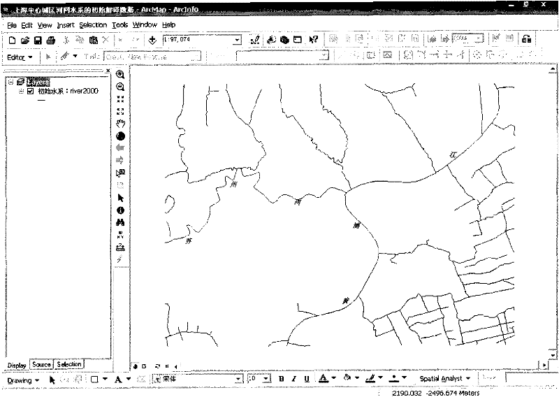
[0036] Taking the measurement of the connectivity of the river network and water system in the central urban area of Shanghai in 2000 as an example, the implementation steps of the specific technology are described in detail, and the realization of the key steps can be found in the relevant drawings.
[0037] (a) Obtain the initial interpretation data of the river network system in the study area
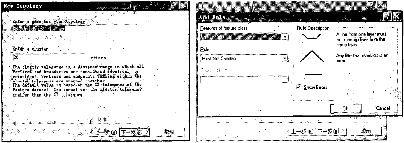
[0038] Taking the remote sensing image data of the central urban area of Shanghai in 2000 as the data source, ArcGIS 9.2 software was used to perform registration correction, noise reduction enhancement, and data fusion processing, and then quantitatively interpret the area-shaped river element (polygon) in the study area, and store it in shp format. Use the conversion tools tool module in Arctoolbox to convert the polygon format data of the rivers in the central urban area of Shanghai to Coverage format, and then use the tool Collapse Dual Line To Centerline in Arctoolbox to g...
PUM
 Abstract
Description
Claims
Application Information