System for extracting urban grid management space information

A technology of urban gridding and spatial information, which is applied in the field of urban grid management spatial information extraction system, can solve the problems of low-efficiency manual extraction, heavy work, and high cost, and achieve convenient editing and operation, easy promotion, and easy installation Effect

Inactive Publication Date: 2009-08-19
NANJING UNIV
View PDF0 Cites 18 Cited by
  • Summary
  • Abstract
  • Description
  • Claims
  • Application Information

AI Technical Summary

Problems solved by technology

For ordinary users, even professional technicians, extracting spatial attribute information through existing GIS software is also a difficult task
This prevents the urban management department from making full use of the existing GIS platform data and adopts a heavy and inefficient method of manually extracting information. As a result, the construction of the urban grid management database becomes long-term and costly.

Method used


Image

  • System for extracting urban grid management space information
  • System for extracting urban grid management space information
  • System for extracting urban grid management space information

Examples


Embodiment Construction

[0038] The technical solution of the present invention will be further described below in conjunction with the accompanying drawings.
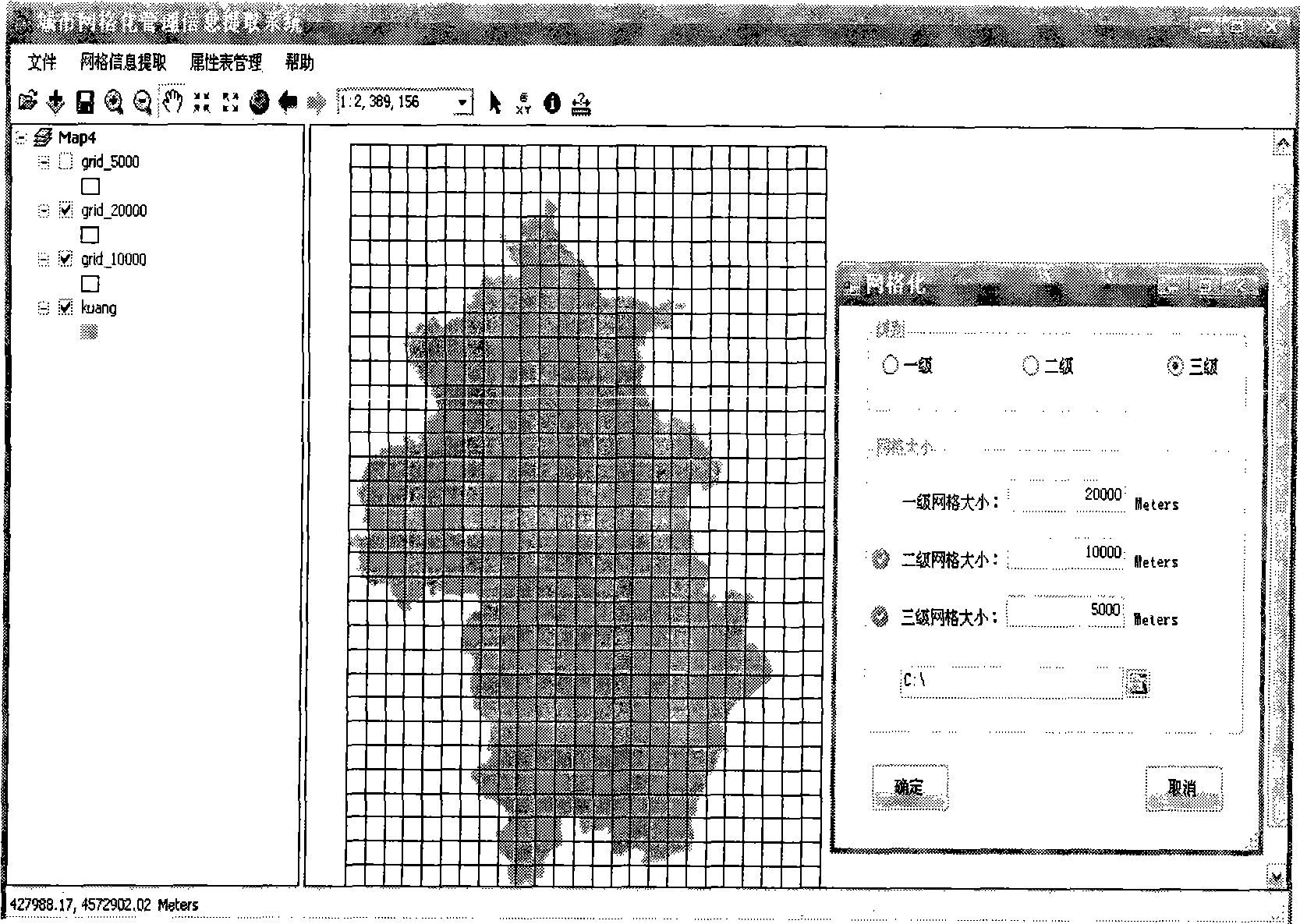
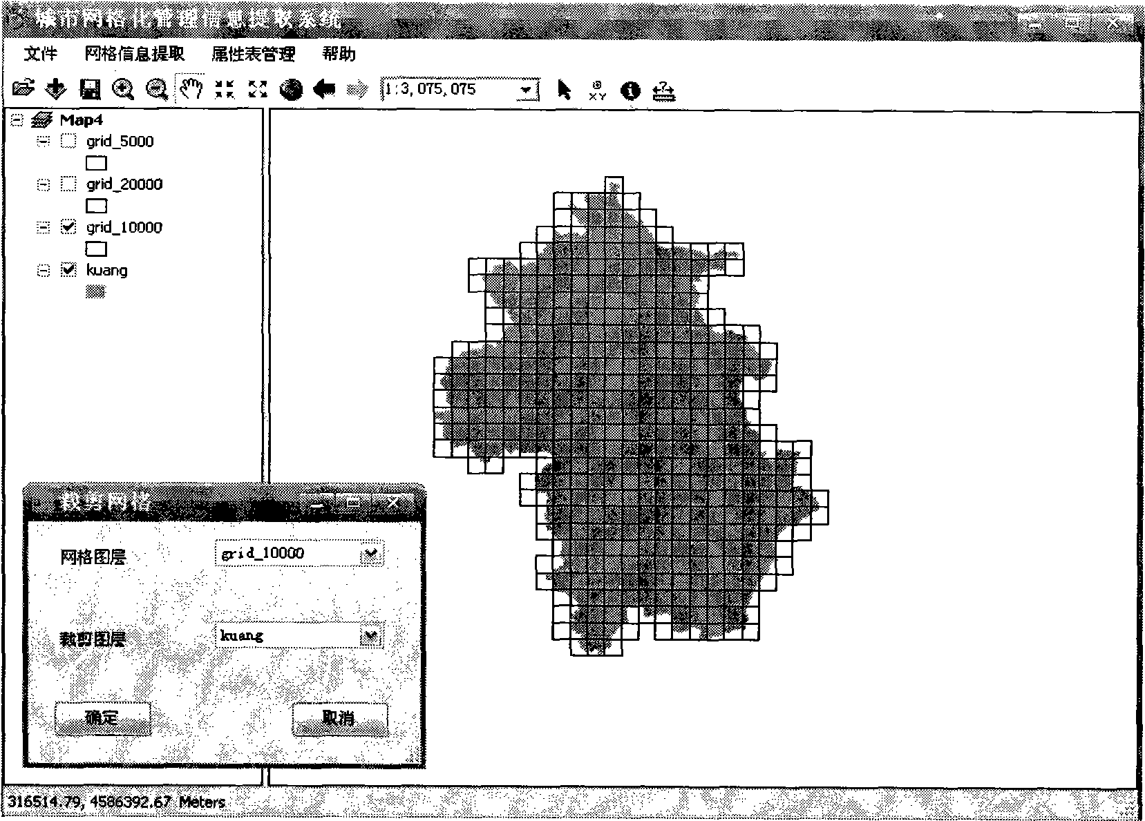
[0039] 1. Gridding

[0040] When generating a multi-level grid, the grid generation rules must be followed, that is, the size of the upper-level grid must be an integer multiple of the size of the lower-level grid. If there is an error, the system will automatically detect it and prompt that the grid size definition error , the next step is prohibited.

[0041] Since the grids involved in urban grid management are all squares, and the outer border of the base map is not necessarily a square, it is first necessary to determine the size of the base map boundary. In order to ensure that the generated grid can cover the entire management area, the present invention adopts the method of "dividing, rounding and adding one", that is, dividing the length or width of the base map by the size of the unit grid, taking out the integer part of the divisio...


PUM


Abstract

The invention discloses a space information extracting system in urban grid management, consisting of a grid unit, a grid cutting unit, a space information extraction unit, a grid attribute information displaying and statistical unit and a grid attribute information management and outputting unit. The system adopts a secondary development technology of AE plus VB.net, generates an installation program by packing, can run independently in a Windows operation system and is convenient in operation and easy in popularization. The system can extract space data with Arcgis format by diversity space attribute data extracting technology, and provide technical support for the establishment of database in the urban grid management work so as to lead the collecting and inputting of the space data to be more efficient and accurate, thereby saving the cost for establishing the grid space database and shortening the establishing period.

Description

1. Technical field [0001] The invention relates to a spatial information extraction system for urban grid management. Specifically, it automatically extracts a variety of spatial information into a grid database through GIS secondary development technology, and solves the problem of basic spatial data in urban grid management. Technical problems such as collection, input, and database establishment are mainly used in the field of modern urban management. 2. Background technology [0002] The urban grid management mode is a new urban management mode produced under the background of the rapid construction and development of "digital cities". Grid management can realize digital, closed-loop, refined and dynamic management, and has a good development prospect . Many domestic cities have successively established urban grid management systems. Taking the 10,000-meter grid management method as an example, it refers to dividing the area under its jurisdiction into several grid-sha...

Claims


Application Information

Patent Timeline
Patent Type & Authority Applications(China)
IPC IPC(8): G06Q10/00G06Q50/00G06F9/44G06F17/30G06Q10/06
Inventor 宗跃光何金廖张晓瑞韩昱薛松
Owner NANJING UNIV
Why Eureka
Try Eureka