Method and system for organizing geographic data
A geographic data and organization technology, applied in electrical digital data processing, special data processing applications, maps/plans/charts, etc., can solve problems such as limiting system flexibility and scalability, achieve good response to user operation requests, and facilitate effect achieved
- Summary
- Abstract
- Description
- Claims
- Application Information
AI Technical Summary
Problems solved by technology
Method used
Image
Examples
Embodiment
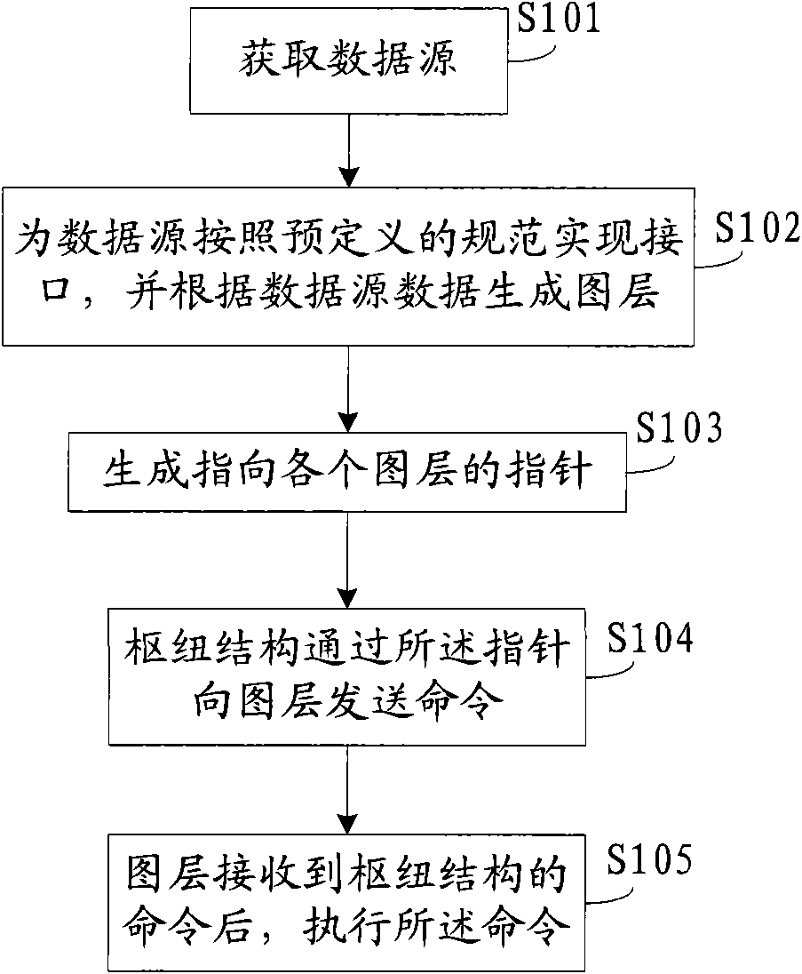
[0049] Examples, see figure 1 , the method for organizing geographical data provided by the embodiment of the present invention includes the following steps:
[0050] S101: Obtain a data source;
[0051] Wherein, the data source may be data downloaded from the network, or data stored locally, and in practical applications, it may be obtained accordingly as required.
[0052] S102: Implement an interface for the data source according to a predefined specification, and generate a layer according to the data source data;
[0053] Different from the map layering method in the prior art, the map layering method adopted in the embodiment of the present invention is to define the interface specification in the system design stage, as long as the data source that realizes the interface of the specification can be added to the system; therefore When designing a map, you can determine which data needs to be added according to the needs of the actual business, and then after obtaining ...
PUM
 Abstract
Description
Claims
Application Information
 - R&D
- Intellectual Property
- Life Sciences
- Materials
- Tech Scout
- Unparalleled Data Quality
- Higher Quality Content
- 60% Fewer Hallucinations
Browse by: Latest US Patents, China's latest patents, Technical Efficacy Thesaurus, Application Domain, Technology Topic, Popular Technical Reports.
© 2025 PatSnap. All rights reserved.Legal|Privacy policy|Modern Slavery Act Transparency Statement|Sitemap|About US| Contact US: help@patsnap.com


