Method for realizing remote sensing image simulation under given external orientation element

A technology of external orientation elements and remote sensing images, which is applied in the field of remote sensing imaging simulation and can solve problems such as simulation result errors

Inactive Publication Date: 2009-12-16
BEIHANG UNIV
View PDF0 Cites 3 Cited by
  • Summary
  • Abstract
  • Description
  • Claims
  • Application Information

AI Technical Summary

Problems solved by technology

Therefore, using proportional average or distance-weighted average a

Method used


Image

  • Method for realizing remote sensing image simulation under given external orientation element
  • Method for realizing remote sensing image simulation under given external orientation element
  • Method for realizing remote sensing image simulation under given external orientation element

Examples


Embodiment Construction

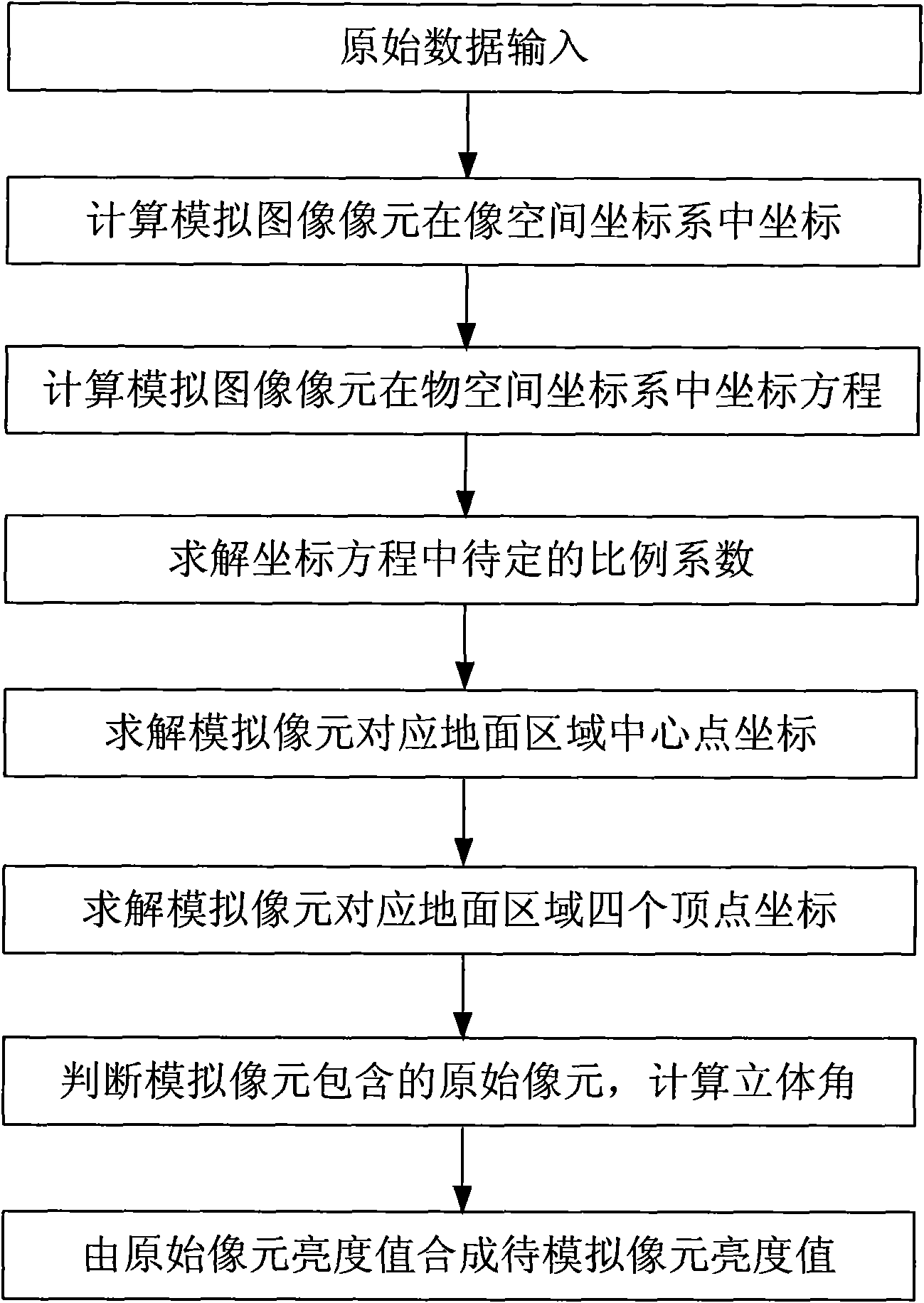
[0037] Taking the simulation process of the remote sensing image under the given sensor outer azimuth elements in the Qulong area of ​​Tibet as an example, as follows: figure 1 Shown, the concrete implementation method of the present invention is as follows:

[0038] (1) Input the original data, including the digital elevation model, the original surface image, the external orientation elements of the sensor and the field of view.

[0039] A digital elevation model with a ground resolution of 30m and surface radiance data in the Qulong area of ​​Tibet is used. Taking the upper left corner point of the surface digital elevation model data as the center, 30m as a unit length, the east and north are the x-axis and the y-axis respectively, and the elevation direction is the z-axis, establish the object space coordinate system, and the outer orientation elements of the sensor are (1678, 500, 23500) and (0°, 0°, 0°), the field angles of the sensor in the along-track direction and the...


PUM


Abstract

The invention provides a method for realizing remote sensing image simulation under a given external orientation element. The method comprises the following steps: (1) inputting initial data; (2) calculating coordinates of a simulation image element in an image space coordinate system; (3) calculating a spin matrix from the image space coordinate system to an object space coordinate system, and transforming the coordinates of the simulation image element of the step (2) from the image space coordinate system to the object space coordinate system; (4) solving an undetermined proportionality coefficient in a coordinate equation; (5) solving coordinates of a center point of a ground imaging area corresponding to the simulation image element; (6) solving coordinates of four vertexes of the ground imaging area corresponding to the simulation image element; (7) determining an original surficial image element contained in the simulation image element, and calculating a solid angle of the original surficial image element in an instantaneous field of view of the simulation image element; and (8) transforming spatial resolution, and generating a remote sensing simulated image under the external orientation element of a given sensor. The method solves the problem of realizing high precision simulation of the remote sensing image by the external orientation element and a viewing angle under the position and posture of the given sensor.

Description

technical field [0001] The invention relates to a method for realizing remote sensing image simulation under a given outer orientation element, which is of great value in remote sensing image geometric correction and remote sensing imaging simulation, and belongs to the technical field of remote sensing imaging simulation. Background technique [0002] The research on remote sensing imaging simulation theory and implementation methods has important application value in the fields of remote sensing task prediction, imaging system design, image quality evaluation and image processing algorithm verification. The early remote sensing imaging simulation was mainly based on physical simulation. With the development of computer technology, remote sensing imaging simulation technology has also made new progress, and many computer simulation technologies have emerged. [0003] The position and attitude of the sensor change with time. This change changes the geometric relationship bet...

Claims


Application Information

Patent Timeline
IPC IPC(8): G01S7/48
Inventor 赵慧洁王亚超贾国瑞李娜
Owner BEIHANG UNIV
Why Eureka
Try Eureka