Method for performing real-time measurement on track and position of satellite or aircraft
A precision measurement and aircraft technology, applied in the space field, can solve problems such as being vulnerable to attack and destruction, and achieve the effects of low operating costs, simple equipment, and low cost
- Summary
- Abstract
- Description
- Claims
- Application Information
AI Technical Summary
Problems solved by technology
Method used
Image
Examples
Embodiment Construction
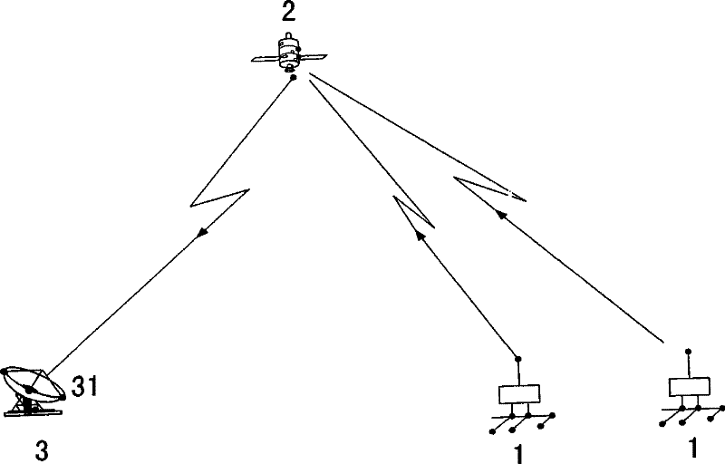
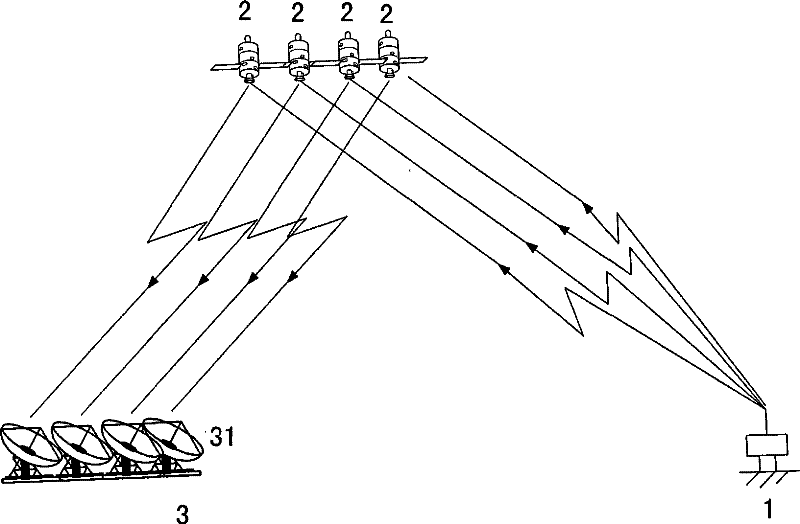
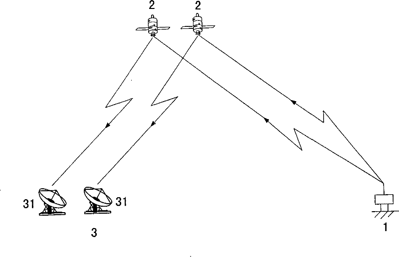
[0023] The method of the invention adopts the pseudo-range measurement principle of inverse GPS (Global Positioning System) and inverse CAPS (China Area Positioning System). The signal is transmitted in reverse, known as inbound measurement or inbound positioning. That is, the signal is sent by the measurement terminal 1, forwarded by the satellite 2, and the pseudo-range measurement is completed by the ground center station 3. If the position of the measurement terminal 1 and the pseudo-range from the measurement terminal 1 to the ground central station 3 via the satellite 2 have been accurately determined, the orbital position of the satellite 2 can be determined. In order to eliminate the time delay error in the signal transmission path, two pseudoranges (see attached figure 1 ) to get the pseudo-range difference by solving the hyperboloid equations to get the precise orbital position of satellite 2. After the orbital position is accurately determined, the precise positio...
PUM
 Abstract
Description
Claims
Application Information
 - R&D
- Intellectual Property
- Life Sciences
- Materials
- Tech Scout
- Unparalleled Data Quality
- Higher Quality Content
- 60% Fewer Hallucinations
Browse by: Latest US Patents, China's latest patents, Technical Efficacy Thesaurus, Application Domain, Technology Topic, Popular Technical Reports.
© 2025 PatSnap. All rights reserved.Legal|Privacy policy|Modern Slavery Act Transparency Statement|Sitemap|About US| Contact US: help@patsnap.com


