Multispectral earth observation laser radar system
An earth observation and lidar technology, applied in the field of surveying, mapping and remote sensing, can solve problems such as less than geodesic methods, and achieve the effect of reducing volume and weight, reducing cost, and improving feasibility
- Summary
- Abstract
- Description
- Claims
- Application Information
AI Technical Summary
Problems solved by technology
Method used
Image
Examples
Embodiment Construction
[0022] Below in conjunction with accompanying drawing, the present invention will be further described with specific embodiment:
[0023] The multi-spectral earth observation laser radar system provided by the present invention specifically adopts the following technical solutions.
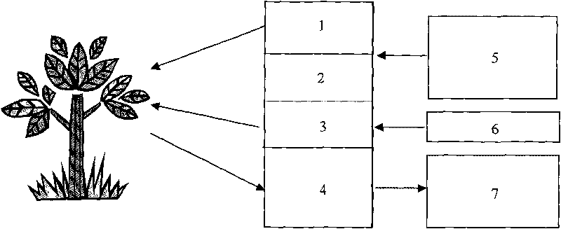
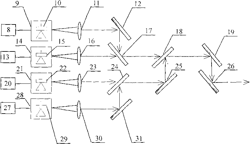
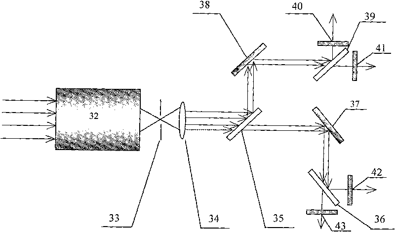
[0024] see figure 1 , including semiconductor and solid-state laser transmitter 1, laser scanner 2, laser rangefinder 3, optical receiver 4, laser scanning controller 5, rangefinder controller 6, signal processing circuit and computer 7; semiconductor and solid-state laser The laser light emitted by 1 reaches the detection object after passing through the laser scanner 2. At the same time, the laser light emitted by the laser rangefinder 3 also reaches the detection object. The wave signal is captured by the optical receiver 4, and the signal captured by the optical receiver 4 and the distance information obtained by the laser range finder 3 are sent to the signal processing circuit and the compu...
PUM
 Abstract
Description
Claims
Application Information
 - R&D
- Intellectual Property
- Life Sciences
- Materials
- Tech Scout
- Unparalleled Data Quality
- Higher Quality Content
- 60% Fewer Hallucinations
Browse by: Latest US Patents, China's latest patents, Technical Efficacy Thesaurus, Application Domain, Technology Topic, Popular Technical Reports.
© 2025 PatSnap. All rights reserved.Legal|Privacy policy|Modern Slavery Act Transparency Statement|Sitemap|About US| Contact US: help@patsnap.com


