Combined navigation unit and implementing method thereof
A technology of combined navigation and implementation methods, applied in measurement devices, services based on location information, advanced technologies, etc., can solve problems such as inaccurate positioning, and achieve the effects of complete functions, rich interfaces, and low power consumption
- Summary
- Abstract
- Description
- Claims
- Application Information
AI Technical Summary
Problems solved by technology
Method used
Image
Examples
Embodiment Construction
[0061] The technical scheme of the invention will be described in detail below in conjunction with the drawings:
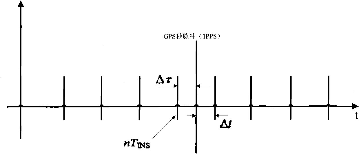
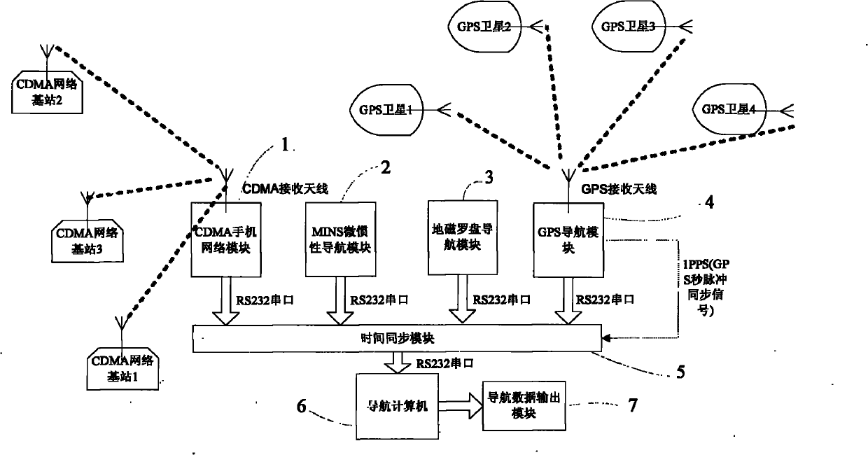
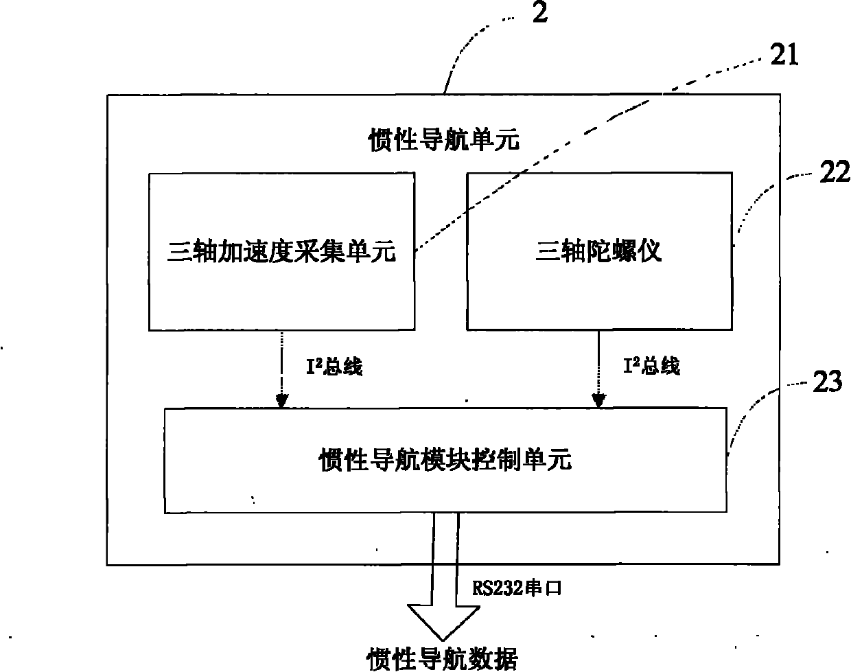
[0062] A (MINS / GPS / CDMA mobile phone network / geomagnetic compass) combined navigation device and method according to an embodiment of the present invention analyzes GPS navigation data by receiving GPS signals, and performs triangulation through the arrival time difference of the CDMA mobile phone network pilot signals. The inertial navigation data collected by the acquisition module in real time, the geomagnetic data is collected through the geomagnetic compass, and the heading angle of the carrier is determined in real time. According to GPS signal strength and CDMA mobile phone network signal strength, press Figure Four The method shown dynamically determines the distribution coefficient of inertial navigation information in each sub-filter, and uses the federated Kalman filter in the navigation computer to perform MINS micro-inertial navigation data, GPS satellit...
PUM
 Abstract
Description
Claims
Application Information
 - R&D
- Intellectual Property
- Life Sciences
- Materials
- Tech Scout
- Unparalleled Data Quality
- Higher Quality Content
- 60% Fewer Hallucinations
Browse by: Latest US Patents, China's latest patents, Technical Efficacy Thesaurus, Application Domain, Technology Topic, Popular Technical Reports.
© 2025 PatSnap. All rights reserved.Legal|Privacy policy|Modern Slavery Act Transparency Statement|Sitemap|About US| Contact US: help@patsnap.com


