System for manufacturing road digital orthophoto map

A digital orthophoto and road technology, applied in the system field of surveying and mapping technology, can solve problems such as low freshness, high cost, and difficulty in obtaining, and achieve the effect of improving freshness, reducing costs, and lifting safety restrictions

Active Publication Date: 2010-11-24
SHANGHAI JIAO TONG UNIV
View PDF7 Cites 22 Cited by
  • Summary
  • Abstract
  • Description
  • Claims
  • Application Information

AI Technical Summary

Problems solved by technology

The invention solves the problems of high cost, low freshness and difficult acquisition in the original technolog

Method used


Image

  • System for manufacturing road digital orthophoto map
  • System for manufacturing road digital orthophoto map
  • System for manufacturing road digital orthophoto map

Examples


Embodiment

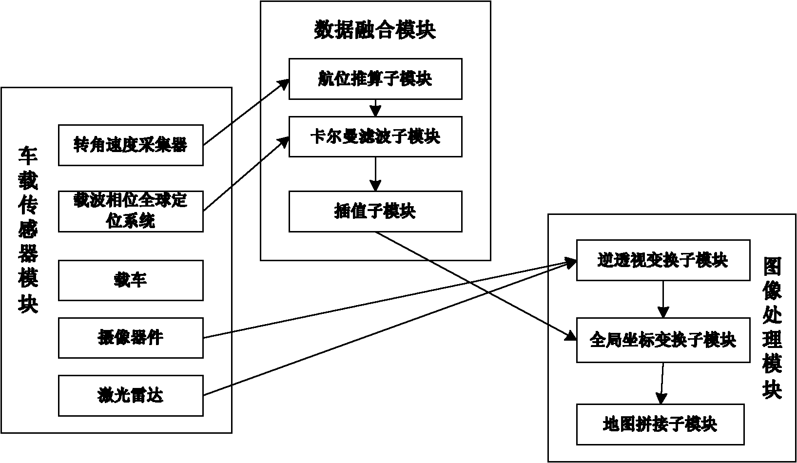
[0023] Such as figure 1 As shown, this embodiment includes: a vehicle-mounted sensing module, a data fusion module and an image processing module, wherein: the vehicle-mounted sensing module is connected to the data fusion module to transmit vehicle body positioning information, and the image processing module is connected to the vehicle-mounted sensing module to transmit road information , the data fusion module is connected with the image processing module to transmit the real-time positioning information of the car body, and the image processing module outputs the road digital orthophoto map.

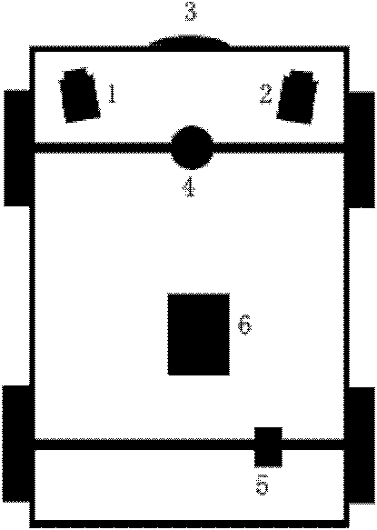
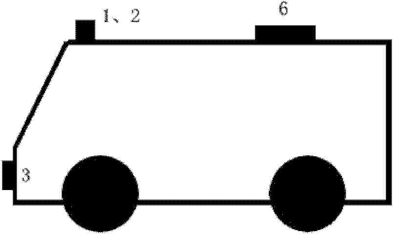
[0024] Such as figure 2 and image 3 As shown, the vehicle-mounted sensing module collects road information and vehicle body positioning information, including: vehicle-mounted, imaging device, angular velocity collector, carrier phase global positioning system 6 and laser radar 3, wherein: the imaging device is arranged on-board Around the headlights outside the vehicle, the angu...


PUM


Abstract

The invention relates to a system for manufacturing a road digital orthophoto map, belonging to the plotting technical field. The system comprises a vehicle-mounted sensing module, a data fusion module and an image processing module, wherein the vehicle-mounted sensing module is connected with the data fusion module to transmit vehicle body positioning information, the image processing module is connected with the vehicle-mounted sensing module to transmit road information, and the data fusion module is connected with the image processing module to transmit real-time positioning information of the vehicle body. The system greatly improves the freshness of the road digital photo map, reduces the collecting cost of the digital photo map, relieves the safe limit for manufacturing the road digital photo map, civilianizes the manufacturing process of the digital photo map, and enables more enterprises to selectively manufacture the digital photo map meeting their own requirements.

Description

technical field [0001] The invention relates to a system in the technical field of surveying and mapping, in particular to a system for making road digital orthophoto maps. Background technique [0002] Image map is a kind of map with ground remote sensing images. Most of them use aerial photos or satellite remote sensing images, through geometric correction, projection transformation and scale naturalization, and use certain map symbols and annotations to directly reflect the geographical characteristics and characteristics of mapping objects. Spatial distribution map. In today's era of digitalization and informationization, digital geographic information has become an indispensable support condition for cities and even the whole country in macro-decision-making and planning management. [0003] Digital orthophoto technology uses computer image processing, pattern recognition and other technologies to objectively reflect the performance of the ground through realistic effe...

Claims


Application Information

Patent Timeline
IPC IPC(8): G01C21/32B60R11/00G06T11/00
Inventor 杨明陈放王春香王冰
Owner SHANGHAI JIAO TONG UNIV
Why Eureka
Try Eureka