Microwave remote sensing pixel element decomposing method based on land and water living beings classifying information

A hybrid pixel decomposition and land object classification technology is applied in the field of microwave remote sensing hybrid pixel decomposition based on water and land object classification information, which can solve the problem of poor data inversion accuracy, low spatial resolution of microwave remote sensing data, and limited data application scope. problems, such as high spatial resolution, and the effect of improving spatial resolution

Inactive Publication Date: 2011-02-02
NORTHEAST INST OF GEOGRAPHY & AGRIECOLOGY C A S
View PDF0 Cites 56 Cited by
  • Summary
  • Abstract
  • Description
  • Claims
  • Application Information

AI Technical Summary

Problems solved by technology

[0009] The purpose of the present invention is to provide a microwave remote sensing mixed pixel decomposition method based on the classification information of water and land objects, so as to solve the problem of poor data inversion accuracy and limited data application range due to the low spatial resolution of microwave remote sensing data at present. sexual issues

Method used


Image

  • Microwave remote sensing pixel element decomposing method based on land and water living beings classifying information
  • Microwave remote sensing pixel element decomposing method based on land and water living beings classifying information
  • Microwave remote sensing pixel element decomposing method based on land and water living beings classifying information

Examples


Embodiment 1

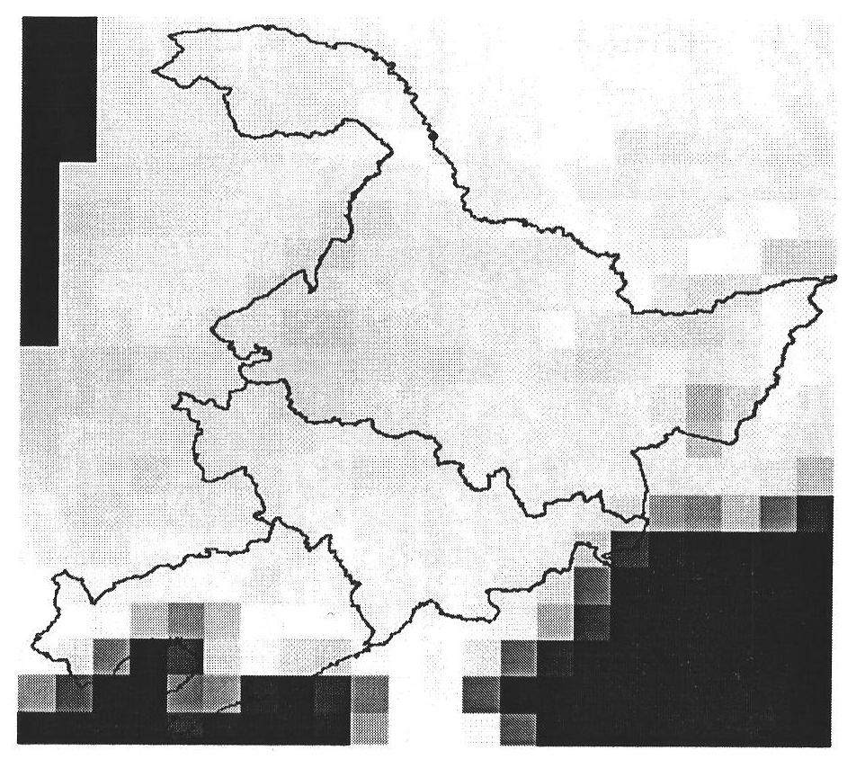
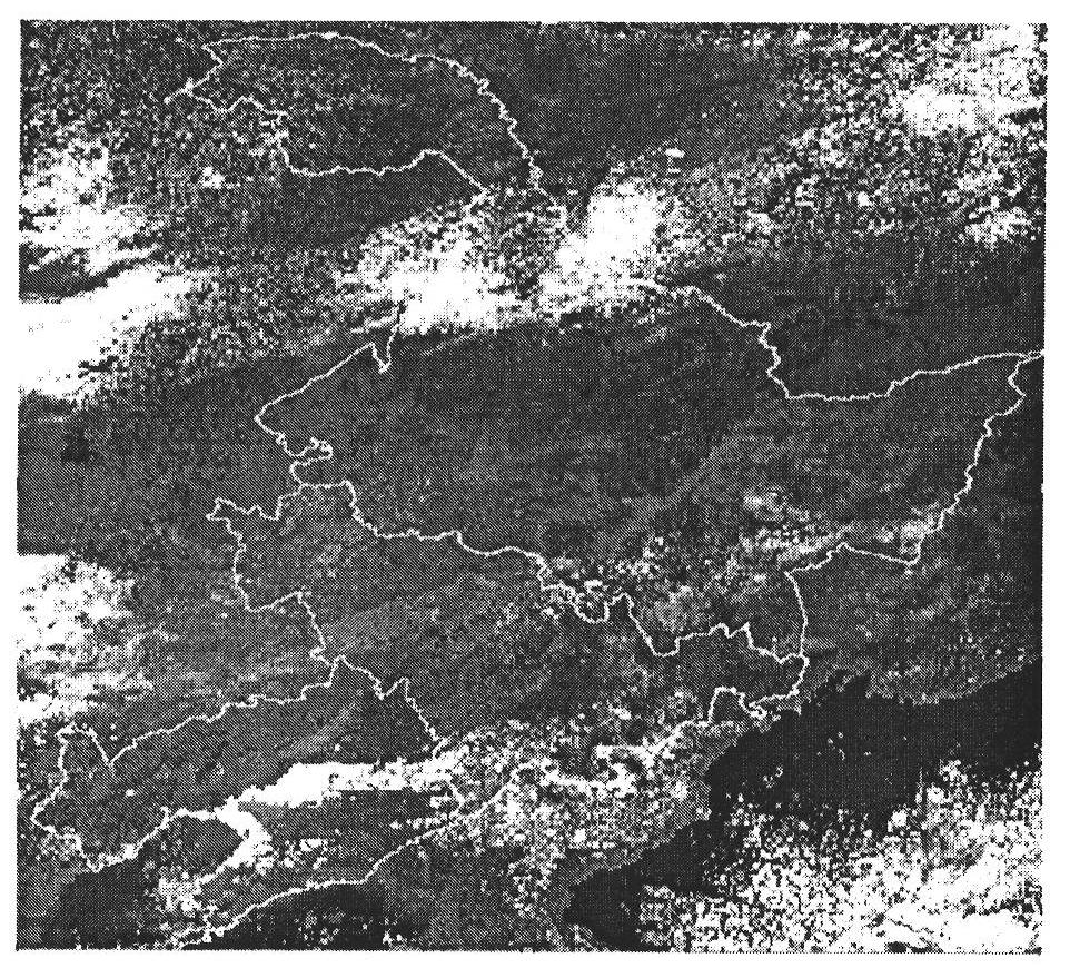
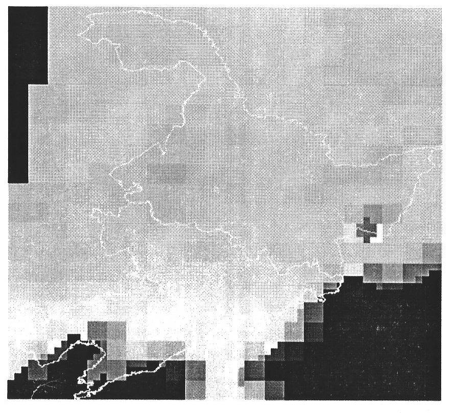
[0093] Embodiment 1: The present invention uses MWRI microwave remote sensing data and MODIS spectral remote sensing data, combined with the microwave remote sensing mixed pixel decomposition method based on the classification information of water and land objects, to realize the observation of water and land in the three provinces of Northeast China on November 17, 2009. Efficient Decomposition of Boundary Microwave Mixed Cells.

[0094] Technical scheme of the present invention comprises the following steps:

[0095] 1. Remote sensing data preprocessing:

[0096] (1) Download MWRI L1 level microwave remote sensing data from Fengyun Satellite Remote Sensing Data Service website, which has been preprocessed by calibration, atmospheric correction, geographic correction and standardization;

[0097] The data collection time is November 17, 2009 local time, which is the global orbital descent data. Considering that the comprehensive spatial resolution of MWRI is 75km, all its c...

Embodiment 2

[0167] Embodiment 2: The present invention uses AMSR-E microwave remote sensing data and MODIS spectral remote sensing data, combined with the microwave remote sensing mixed pixel decomposition method based on the classification information of water and land objects, to realize the super large scale in Yongji County, Jilin Province on September 28, 2010 Decomposition of microwave mixed pixels on water and land boundaries in flood disaster observation area.

[0168] Technical scheme of the present invention comprises the following steps:

[0169] 1. Remote sensing data preprocessing:

[0170] (1) Download the AMSR-E L2A microwave remote sensing data from the AMSR-E microwave remote sensing data website, which has been preprocessed by calibration, atmospheric correction, geographic correction and standardization;

[0171] The data collection time is July 28, 2010, local time, which is the global de-orbit data. The integrated spatial resolution of AMSR-E is 25km, and all its ch...


PUM


Abstract

The invention provides a microwave remote sensing pixel element decomposing method based on land and water living beings classifying information, which comprises the steps of: by using land and water living beings classifying information of spectrum remote sensing data, establishing a microwave mixed pixel element decomposing module, and calculating component brightness temperature in a microwavemixed pixel element by solving an underdetermined equation set. Through obtaining positions and brightness temperature values of different components in the microwave mixing pixel element, the space resolution of the microwave mixing pixel element of water and land boundary is remarkably improved, microwave brightness temperature values and classifying information of the water and land living beings in an observing region are obtained, and the precision of post stage inversion of the microwave remote data is improved. The invention has the important meanings of completing the decomposition ofthe microwave mixing pixel element data of the water and land boundary in a global region, ensuring that the decomposed microwave remote data space resolution is similar to the spectrum remote sensing data space resolution adopted in the classification, solving the problem of low space resolution of the microwave remote sensing data, and broadening the application field of the microwave remote sensing data.

Description

technical field [0001] The invention relates to the technical field of microwave remote sensing, in particular to a microwave remote sensing mixed pixel decomposition method based on classification information of land and water objects. Background technique [0002] The wavelength of microwave remote sensing is generally from 1cm-1m. Due to the longer wavelength, its energy can penetrate clouds, fog, sand and dust, and other atmospheric states except heavy rain. These advantages enable spaceborne passive microwave remote sensing to monitor the microwave emission characteristics of the surface under almost all weather conditions, and determine the surface type and related quantitative parameter inversion through the analysis of the scattering and absorption characteristics of microwave signals by different types of surfaces, such as Surface temperature, soil moisture, vegetation, etc. Another feature of passive microwave remote sensing is its high time resolution, which is c...

Claims


Application Information

Patent Timeline
Patent Type & Authority Applications(China)
IPC IPC(8): G01S13/89G01S7/41
Inventor 顾玲嘉赵凯
Owner NORTHEAST INST OF GEOGRAPHY & AGRIECOLOGY C A S
Why Eureka
Try Eureka