Road extraction method using non-subsampled contourlet direction field

A non-subsampling contour, road extraction technology, applied in the field of image processing, can solve the problems of incomplete road extraction results, offset road centerline positioning, loss of road detail information, etc., to achieve good road continuity, improve accuracy, The effect of suppressing noise and background

Inactive Publication Date: 2011-02-16
XIDIAN UNIV
View PDF4 Cites 4 Cited by
  • Summary
  • Abstract
  • Description
  • Claims
  • Application Information

AI Technical Summary

Problems solved by technology

Another example: using the morphological extraction method will widen the width of the original road, causing the location of the road centerline to shift; while only using the fre

Method used


Image

  • Road extraction method using non-subsampled contourlet direction field
  • Road extraction method using non-subsampled contourlet direction field
  • Road extraction method using non-subsampled contourlet direction field

Examples


Embodiment Construction

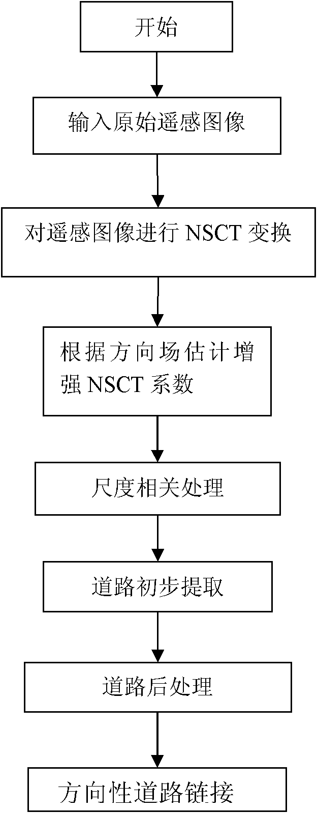
[0039] Refer to attached figure 1 , the present invention utilizes the road extraction method of non-subsampled contourlet direction field, comprises the following steps:

[0040] Step 1, perform non-subsampled contourlet transformation on the input image c.

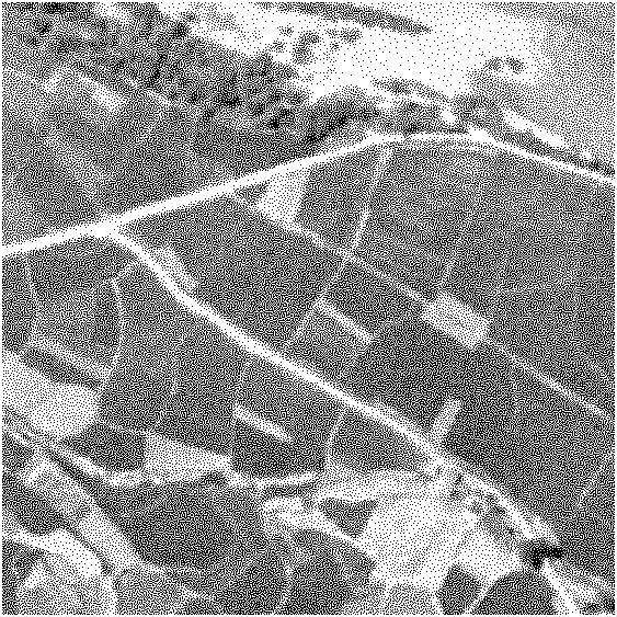
[0041] will be like image 3 The shown image c is used as input, and the input image is subjected to non-subsampled contourlet transformation, and the transformation is decomposed into three layers, in which the number of direction decompositions in each layer is 4, and the kth direction of the dth layer after transformation is set The subbands are:

[0042] x d k , k = 1,2,3,4 , d = 1,2,3 ;

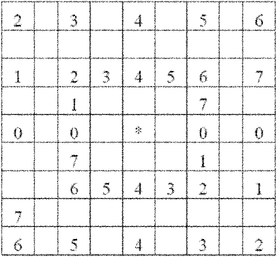
[0043] When k=1, d=3, the direction subband The feature map of Figure 4 shown.

[0044]Step 2, pair the subbands Make directional corrections.

[0045] 2.1) The direction sub-bands in the sa...


PUM


Abstract

The invention discloses a road extraction method using a non-subsampled contourlet direction field, which mainly overcomes the shortcomings that the road extraction is incomplete and the road is wrongly linked or incompletely linked in the original road extraction method for remote sensing images. The method comprises the following steps: (1) performing non-subsampled contourlet transform (NSCT) on an input remote sensing image to obtain a direct sub-band needing to be processed; (2) estimating the direction field of a direction sub-band and performing directional sub-band correction; (3) performing scale correlation processing on the processed direction sub-band; (4) primarily extracting the road; (5) post-processing the primary road extraction result according to the characteristics of length, direction and shape of road segments; and (6) linking the road segments according to the characteristics of the road segment direction field and the road mutual characteristics. The method can perfectly extract relatively fuzzy road characteristics of the remote sensing images and eliminate interference of the non-road information, ensures relatively accurate extraction result and is applicable to the road extraction application for the remote sensing images.

Description

technical field [0001] The invention belongs to the technical field of image processing, in particular to a method for extracting roads from remote sensing images, which can be used for extracting roads from remote sensing images. Background technique [0002] The rapid development of space technology and information technology has provided us with a large amount of remote sensing data, and extracting target information from remote sensing images has become an important means of spatial information update at this stage. Therefore, how to intelligently interpret massive remote sensing data has become an important issue in the process of informatization construction. In remote sensing image processing, feature extraction plays an important role. Feature extraction can generally be divided into three parts: point feature extraction, line feature extraction and surface feature extraction, among which the extraction of line features has the function of linking the preceding and ...

Claims


Application Information

Patent Timeline
IPC IPC(8): G06T7/00G06T5/00G06K9/46
Inventor 钟桦焦李成朱丹王爽侯彪王桂婷马文萍尚荣华
Owner XIDIAN UNIV
Why Eureka
Try Eureka