Civil airport surface monitoring system

A monitoring system and airport scene technology, applied in the transmission system, anti-collision system, electrical components, etc., can solve the problems of lack of positioning accuracy, missing targets, long time, generally 2 to 3 minutes, etc., to improve calculation accuracy , the effect of reducing interference

Inactive Publication Date: 2011-04-20
CIVIL AVIATION UNIV OF CHINA
View PDF4 Cites 33 Cited by
  • Summary
  • Abstract
  • Description
  • Claims
  • Application Information

AI Technical Summary

Problems solved by technology

However, GPS has the following problems: (1) GPS positioning accuracy is generally 30-50 meters, which cannot meet the positioning accuracy requirements of airport vehicles; (2) The first capture time of GPS is too long, generally within 2 to 3 minutes; (3) Vehicles When entering the warehouse, passing through the underground passage, or being blocked by airport buildings or facilities, such as corridor bridges, the GPS system is not very reliable or...

Method used


Image

  • Civil airport surface monitoring system
  • Civil airport surface monitoring system
  • Civil airport surface monitoring system

Examples


Embodiment Construction

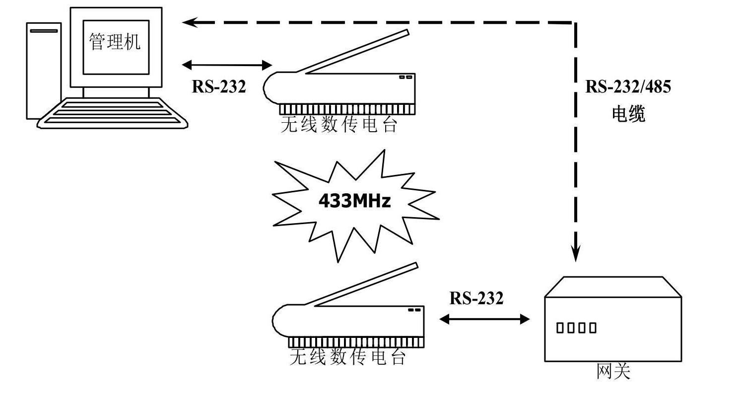
[0030] The main components of this system include: PC monitoring system and ZigBee wireless network positioning system. Among them, the host computer monitoring system is located in the airport scene monitoring room, and the Zigbee wireless network positioning system is located within the range of the apron. ZigBee wireless network positioning system consists of three network devices: fixed reference node equipment, vehicle (mobile) positioning node equipment and coordinator gateway. The upper computer monitoring system is connected with the Zigbee wireless network positioning system through wired or wireless communication to realize the collection and display of real-time positioning data and complete the function of monitoring system command downloading.

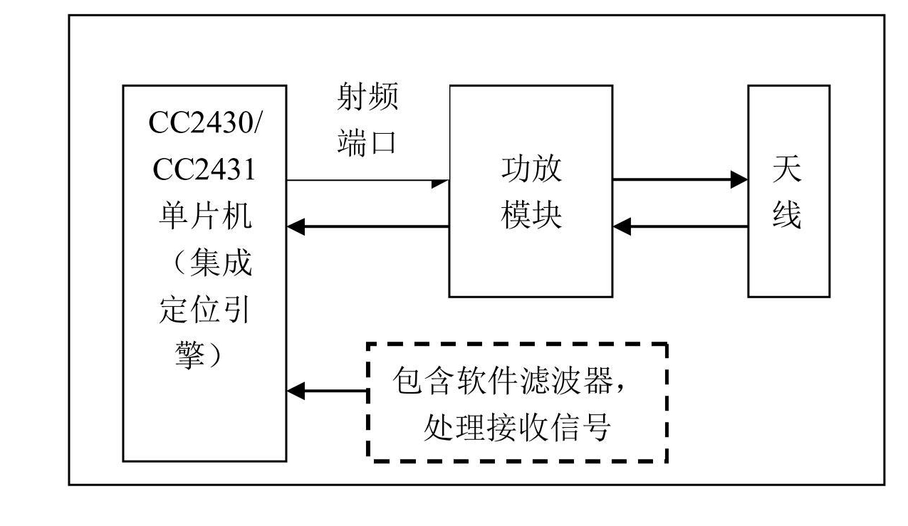
[0031] The Zigbee wireless network completes the positioning calculation and information functions of the active target. The network is composed of a fixed reference node device (1), a mobile vehicle positioning node devic...


PUM


Abstract

The invention discloses a civil airport surface monitoring system. The system comprises a supervisory computer monitoring system and a ZigBee wireless network positioning system, wherein the supervisory computer monitoring system is positioned in an airport surface monitoring room; and the ZigBee wireless network positioning system is positioned in a parking apron range and consists of three kinds of network equipment, namely fixed reference node equipment, vehicle-mounted mobile positioning node equipment and a coordinator gateway. The system can immediately and accurately reflect the condition of a moving vehicle; and when the distance between the moving vehicle and an airplane reaches a preset value, an alarm can be sent to a driver so as to immediately prevent the accident of collision between the moving vehicle and the airplane. A visible and convenient vehicle information management platform is provided for airport station site management, and the on-site operation command management level of an airport and the operation safety and the operation efficiency of the airport are improved.

Description

【Technical field】 [0001] The invention relates to a civil aviation airport scene monitoring and management system, in particular to a civil aviation airport scene monitoring system capable of sending prompts to vehicles approaching or working near an aircraft to avoid collision accidents. 【Background technique】 [0002] When a vehicle hits an aircraft on the tarmac or taxiway, such accidents are mainly caused by the driver of the vehicle driving illegally (such as the vehicle not following the prescribed path, approaching the aircraft at an excessive speed), approaching the aircraft unconsciously, etc. In 2003, a passenger plane of an airline was crashed by a tractor at Ningbo Lishe Airport and scrapped; in 2005, three passenger planes were crashed by vehicles at Baiyun Airport, Xianyang International Airport, and Capital Airport respectively. In recent years, accidents and incidents in which aircraft are collided by vehicles on the tarmac continue to occur. [0003] Nowada...

Claims


Application Information

Patent Timeline
IPC IPC(8): G08G1/16H04W64/00H04L29/08
Inventor 孙毅刚陈维兴
Owner CIVIL AVIATION UNIV OF CHINA
Why Eureka
Try Eureka