Point location data and remote sensing image data-based regional farmland quality monitoring method

A remote sensing image and quality monitoring technology, applied in character and pattern recognition, instruments, computer components, etc., can solve the problems that the accuracy cannot be guaranteed, and the spatial distribution characteristics of cultivated land quality cannot be represented in large areas.

Inactive Publication Date: 2011-05-25
CHINA AGRI UNIV
View PDF0 Cites 34 Cited by
  • Summary
  • Abstract
  • Description
  • Claims
  • Application Information

AI Technical Summary

Problems solved by technology

However, the accuracy of this method of extending the monitoring results of points to regions cannot be guaranteed, and it cannot represent the spatial distribution characteristics of large areas of cultivated land quality.

Method used


Image

  • Point location data and remote sensing image data-based regional farmland quality monitoring method
  • Point location data and remote sensing image data-based regional farmland quality monitoring method
  • Point location data and remote sensing image data-based regional farmland quality monitoring method

Examples


Embodiment Construction

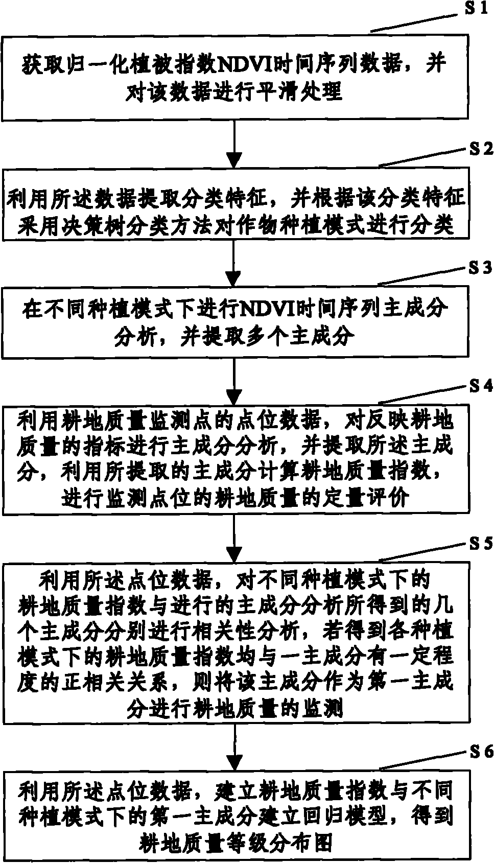
[0031] The specific implementation manners of the present invention will be described in further detail below in conjunction with the accompanying drawings and examples. The following examples are used to illustrate the present invention, but are not intended to limit the scope of the present invention.

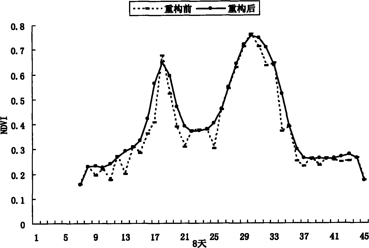
[0032] Vegetation remote sensing information contains comprehensive information such as leaves and their growth conditions, which directly indicate the accumulation of dry matter and the amount of biomass of crops. Some studies have pointed out that NDVI has a good correlation with crop yield and biomass, and is used to characterize farmland productivity. Farmland productivity depends on three factors: crop cultivation patterns, cultivated land quality and farmland management practices. Therefore, using the high-time resolution Normalized Difference Vegetation Index (NDVI) year series of remote sensing data to realize the remote sensing monitoring of regional cultivated land...


PUM


Abstract

The invention discloses a point location data and remote sensing image data-based regional farmland quality monitoring method. The method comprises the following steps of: S1, acquiring a normalized difference vegetation index (NDVI) time sequence data, and performing smoothing processing; S2, extracting classification characteristics and classifying crop planting modes according to the classification characteristics; S3, performing principal component analysis on an NDVI time sequence in different planting modes, and extracting a plurality of principle components; S4, performing the principal component analysis on indexes which reflect farmland quality by utilizing point location data, extracting the principle components, calculating farmland quality index numbers, and performing quantitative evaluation on the farmland quality of a monitoring point; S5, respectively performing correlation analysis on the farmland quality index numbers and the principal components of the NDVI time sequence in different planting modes by utilizing the point location data; and S6, establishing a regression model by utilizing the point location data according to the farmland quality index numbers and a first principal component in different planting modes to obtain a farmland quality grade distribution graph. The method can completely reflect farmland quality grade distribution essentially and can acquire good differentiation.

Description

technical field [0001] The invention relates to the technical fields of remote sensing monitoring technology and agricultural resources application. In particular, it relates to a regional cultivated land quality monitoring method based on point data and remote sensing image data. Background technique [0002] With economic development, accelerated urbanization process and adjustment of agricultural utilization structure, both the quantity and quality of cultivated land resources have been affected. Decision makers must not only understand the quantity of cultivated land resources, but also understand the characteristics and laws of changes in the quality of cultivated land, so as to ensure the sustainable use of cultivated land resources and ensure food ecological security. Therefore, there is an urgent need for long-term, stable, comprehensive and scientific monitoring of cultivated land quality. [0003] In the 26 years since my country began to monitor the quality of c...

Claims


Application Information

Patent Timeline
Patent Type & Authority Applications(China)
IPC IPC(8): G06K9/62
Inventor 孙丹峰李红张微微周连第刘建光王雅
Owner CHINA AGRI UNIV
Why Eureka
Try Eureka