Method for generating raster interpolation and device

A grid and interpolation technology, applied in the field of geographic information, can solve problems such as large differences, and achieve the effects of fast speed, step plaque removal, and high efficiency

Active Publication Date: 2012-02-01
BEIJING DATUM TECH DEV
View PDF2 Cites 2 Cited by
  • Summary
  • Abstract
  • Description
  • Claims
  • Application Information

AI Technical Summary

Problems solved by technology

In this way, the accuracy can be guaranteed and the speed can be improved at the same time. However, since only a small number of sample points are selected for each grid to participate in the calculation, there will be two adjacent gr

Method used


Image

  • Method for generating raster interpolation and device
  • Method for generating raster interpolation and device
  • Method for generating raster interpolation and device

Examples


Embodiment Construction

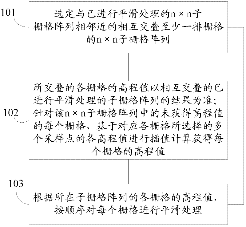
[0039] In order to make the above objects, features and advantages of the present application more obvious and comprehensible, the present application will be further described in detail below in conjunction with the accompanying drawings and specific implementation methods.

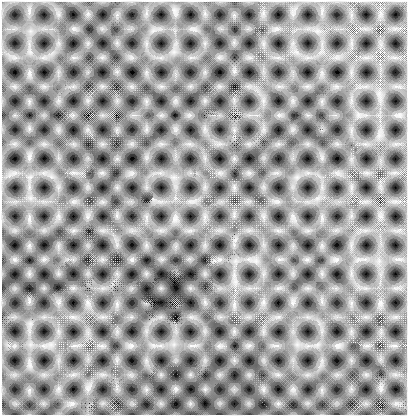
[0040] This application uses the n×n sub-grid array in the entire grid array as a unit to perform smoothing according to the elevation value obtained directly from the sampling point, wherein the next adjacent sub-grid array is overlapped with each other The result of the smoothed grid array shall prevail, and the smoothing process shall be performed in a loop, so that the speed and efficiency are high when generating the raster image, and the step plaque problem is removed, and a smooth raster image is obtained.

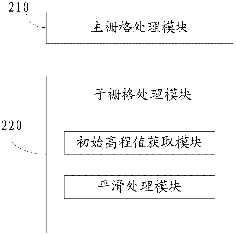
[0041] A method for generating raster interpolation in the present application includes:

[0042] Starting from the n×n sub-grid array at one end of the entire grid array, all n×n sub-grid arr...


PUM


Abstract

The invention provides a method for generating a raster interpolation and a device, and relates to the field of geographic information. The method comprises the following steps of: beginning with n*n sub grid arrays at one end of an integrated grid array to sequentially carry out processing on all the n*n sub grid arrays; and after completing processing the n*n sub grid arrays, outputting the integral grid array, wherein at least one row of grids of adjacent two grid arrays are mutually overlapped and the next sub grid array is subjected to smoothing processing by taking the previous sub grid array being subjected to smoothing processing as the reference. In the invention, the smoothing processing is carried out by taking the n*n sub grid arrays in the integral grid array as units according to an altitude value directly acquired by a sampling point, wherein the adjacent next sub grid arrays are circularly subjected to smoothing processing by taking a result of the overlapped grid arrays being subjected to smoothing processing as the reference, so that when a grid map is generated, the speed is high and the efficiency is high. Moreover, the problem of step plaques is solved and the smooth grid map is obtained.

Description

technical field [0001] The present application relates to the field of geographic information, in particular to a method and device for generating grid interpolation. Background technique [0002] After 40 years of development, GIS (Geographic Information System) has gradually become a fairly mature technology and has been widely used. Especially in recent years, GIS has played an increasingly important role in GPS and route optimization with its powerful geographic information spatial analysis function. GIS geographic information system is based on geospatial database, with the support of computer software and hardware, using the theory of system engineering and information science, scientifically manages and comprehensively analyzes geographic data with spatial connotation, so as to provide information required for management and decision-making. technology system. In GIS applications, it is necessary to perform interpolation calculations on raster data, that is, it is n...

Claims


Application Information

Patent Timeline
IPC IPC(8): G06F17/30
Inventor 史明昌黄兆伟李团宏曹刚孙成宝李嵩
Owner BEIJING DATUM TECH DEV
Why Eureka
Try Eureka