

Elevation calibration method and device for digital elevation model data
A digital elevation model and data technology, applied in measurement devices, height/level measurement, instruments, etc., can solve the problems of digital elevation model error, low surface elevation of digital elevation model, affecting the elevation accuracy of digital elevation model, etc. The effect of improved accuracy
- Summary
- Abstract
- Description
- Claims
- Application Information
AI Technical Summary
Problems solved by technology
Method used
Image

Examples
Embodiment Construction
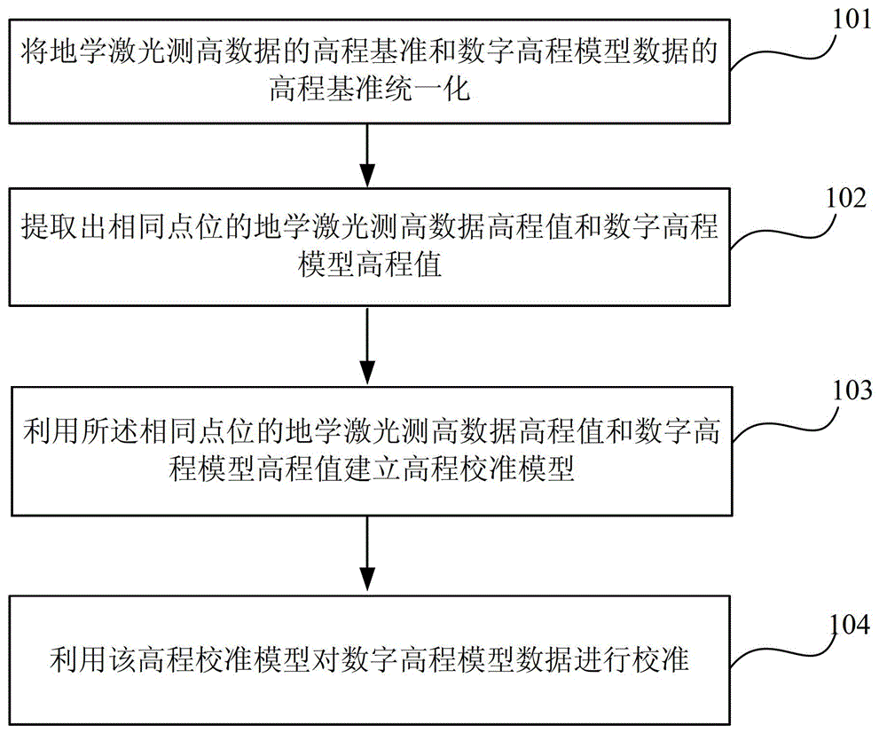
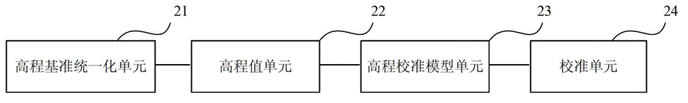
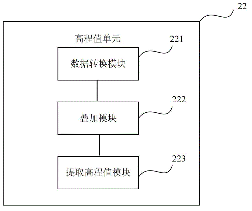
[0043] The following will clearly and completely describe the technical solutions in the embodiments of the present invention with reference to the accompanying drawings in the embodiments of the present invention. Obviously, the described embodiments are only some, not all, embodiments of the present invention. Based on the embodiments of the present invention, all other embodiments obtained by persons of ordinary skill in the art without making creative efforts belong to the protection scope of the present invention.
[0044] In January 2003, NASA launched the ICESAT satellite (Ice, Cloud, and land Elevation Satellite, ICESAT), which is specially used to measure the height of ice and snow, clouds and the ground. Its equipped Geoscience Laser Altimeter System, GLAS) can accurately measure the surface elevation by sampling a light spot with a diameter of about 65m every 172m, and its accuracy can reach 0.02m on a flat ice surface. Because ice cloud and ground height satellite ...
PUM
 Abstract
Description
Claims
Application Information