Associated parallel matching method for multi-source multi-track long-strip satellite remote sensing images

A satellite remote sensing image and matching method technology, applied in the field of surveying and mapping science, multi-source and multi-track long-strip satellite remote sensing image joint parallel matching, can solve the problems of matching algorithm failure and inability to completely eliminate, so as to improve the success rate and avoid errors. Matching phenomena, the effect of removing geometric and radiation distortions

Active Publication Date: 2013-05-22
WUHAN UNIV
View PDF3 Cites 30 Cited by
  • Summary
  • Abstract
  • Description
  • Claims
  • Application Information

AI Technical Summary

Problems solved by technology

In addition, the existing methods cannot completely eliminate the differences in spatial resolution, incident angle, phase, and imaging mechanism between images, result

Method used


Image

  • Associated parallel matching method for multi-source multi-track long-strip satellite remote sensing images
  • Associated parallel matching method for multi-source multi-track long-strip satellite remote sensing images
  • Associated parallel matching method for multi-source multi-track long-strip satellite remote sensing images

Examples


Embodiment Construction

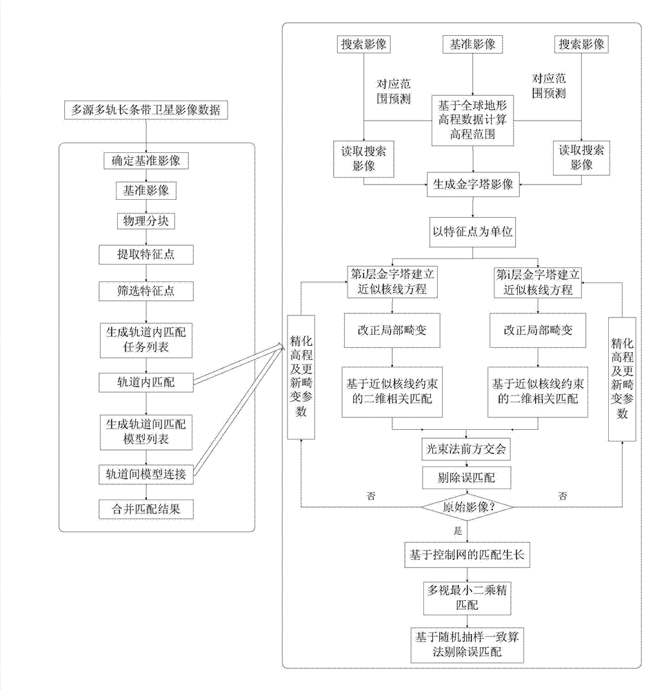
[0042] During specific implementation, the technical solution of the present invention adopts computer software to realize automatic operation. The technical solution of the present invention will be described in detail below in conjunction with the drawings and embodiments.

[0043] see figure 1 , the present invention provides a method for joint parallel matching of multi-source, multi-track long-strip satellite remote sensing images. Parallel match processing. The specific implementation method of the embodiment comprises the following steps:

[0044] Step 1. In each track, select a long strip image close to vertical photography as the reference image, use physical blocks to obtain independent reference image blocks, and record the corresponding relationship between each reference image block and the original reference image ; When physically dividing into blocks, there is a certain overlap between blocks in the column and row directions.

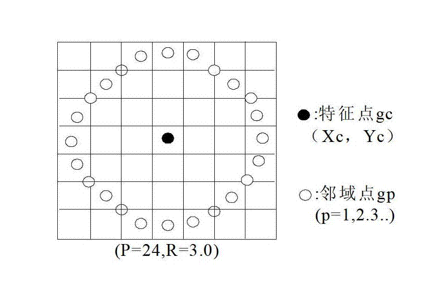
[0045] The embodiment perform...


PUM


Abstract

The invention discloses an associated parallel matching method for multi-source multi-track long-strip satellite remote sensing images. The spatial structure and contrast of local textures of images are subjected to statistical analysis through introducing a characteristic evaluation operator; by using an associated matching strategy for multi-track satellite images, the maximum overlapping times of connecting points among tracks is ensured; under the assistance of global SRTM (shuttle radar topography mission) data, an approximate epipolar geometric constraint is established by using topographic fluctuation changes, thereby greatly reducing epipolar prediction errors caused by elevation errors; a small-surface-element geometric correction method and a control network based matching growth algorithm are comprehensively utilized, and through continuously refining a difference compensation model, geometric and radial distortions among multi-source images are eliminated, and finally, stable and high-precision matching results are obtained; through carrying out integration and improvement on a matching process and a matching strategy, a more perfect matching scheme is provided for the associated processing of multi-source multi-track long-strip satellite images, and a guarantee is provided for the integrated application of massive satellite remote sensing data.

Description

technical field [0001] The invention belongs to the field of surveying and mapping science and technology, and relates to a multi-source multi-track long-strip satellite remote sensing image joint parallel matching method, which is mainly used in the fields of aerial triangulation, digital surface model production and the like. Background technique [0002] In the past 20 years, with the rapid development of aerospace technology, the number of satellites in orbit has increased sharply, and more and more satellite data have been applied to the field of photogrammetry. The use of satellite data for the production of surveying and mapping products has become an important means of geospatial information acquisition. . Since the satellite imaging system has the characteristics of wide coverage, short operation period, stable attitude, and many redundant observations when flying at high altitude, this is of great significance for the elimination of "sick solutions" in image matchi...

Claims


Application Information

Patent Timeline
IPC IPC(8): G01C11/34
Inventor 张永军熊金鑫段延松
Owner WUHAN UNIV
Why Eureka
Try Eureka