GIS (Geographic Information System)-based region-meshed spatial population density computing method

A population density and calculation method technology, applied in calculation, special data processing applications, instruments, etc., can solve the problem of failure to reflect the unique random distribution law of population distribution and the regional characteristics of population spatial distribution, and the failure to reflect the impact of population distribution degree, influence on the accuracy of the model, etc., to achieve the effect of grid expression, good operability, and easy access

Active Publication Date: 2013-07-24
苏州星宇测绘科技有限公司
View PDF1 Cites 18 Cited by
  • Summary
  • Abstract
  • Description
  • Claims
  • Application Information

AI Technical Summary

Problems solved by technology

[0004] In the traditional GIS-based regional grid population density spatial calculation method, each grid adopts the same statistical model, which fails to reflect the degree of influence of various land use types on population distribution; fails to reflect the extremely concentrated population areas and Due to the unique random distribution law of population distribution in extremely sparse areas and the regional characteristics of population spatial distribution, the calculation process is too rough, which affects the accuracy of the model

Method used


Image

  • GIS (Geographic Information System)-based region-meshed spatial population density computing method
  • GIS (Geographic Information System)-based region-meshed spatial population density computing method
  • GIS (Geographic Information System)-based region-meshed spatial population density computing method

Examples


Embodiment Construction

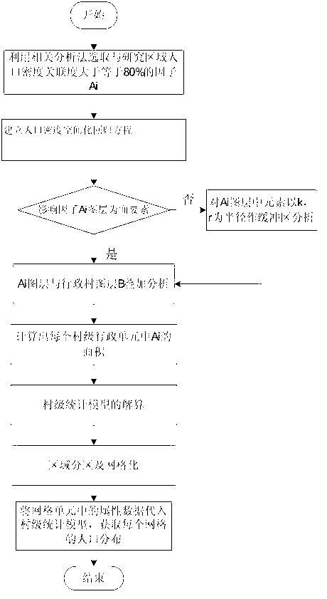
[0032] Below in conjunction with accompanying drawing, the present invention is described in further detail:

[0033] Such as figure 1 As shown, the present invention has designed a kind of GIS-based regional grid population density spatial calculation method, in the specific embodiment, we take Jiading District, Shanghai as an example, including the following specific steps:

[0034] Step (1): Count the village-level population data in Jiading District: get the population data M of each village in Jiading District n , n=1,2,3...m, where m is defined as the total number of villages in the study area;

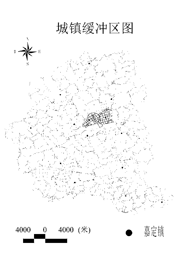
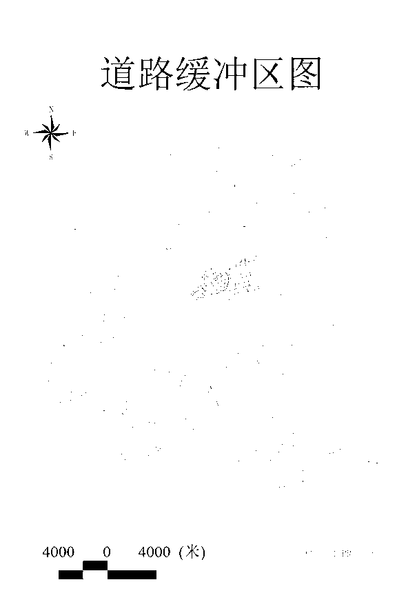
[0035] Step (2): Through the correlation analysis method, the factors with a correlation degree of 80% or more with the population density of Jiading District are obtained, which are respectively cultivated land, construction land, residential land, traffic road accessibility and urban influence as the influencing factors of population spatialization A i , i=1,2,3...q, where ...


PUM


Abstract

The invention discloses a GIS (Geographic Information System)-based region-meshed spatial population density computing method. According to the method, regional distribution characteristics of natural and socio-economic factors affecting population density are taken into full consideration, a statistical model is established in a manner that a village, namely a smallest regional administrative unit, serves as a unit, a research region is subjected to 100m*100m meshing, and the village-level statistical model is inverted to all meshes so as to describe population distribution by using the mesh units. The GIS-based region-meshed spatial population density computing method disclosed by the invention has the advantage that the spatial population analysis accuracy can be better improved.

Description

technical field [0001] The invention relates to a GIS-based method for calculating the spatialization of population density in regional grids. Background technique [0002] Population is a general term for people living in a specific social system and in a specific region with a certain quantity and quality. Population information is important information on national conditions, which is of great significance to administrative management, population research, understanding market supply and demand, and formulating social and economic development plans. The population problem spans many fields of nature, society and economy, and is one of the major issues facing the world today that affect sustainable development. [0003] The GIS-based regional grid population density spatial calculation method, through the combination of qualitative description and quantitative analysis, adopts appropriate parameters and models, inverts the distribution of population density in the regiona...

Claims


Application Information

Patent Timeline
Patent Type & Authority Applications(China)
IPC IPC(8): G06F19/00
Inventor 薛丰昌盛洁如耿焕同钱洪亮
Owner 苏州星宇测绘科技有限公司
Why Eureka
Try Eureka