
Cutting method based on integrated three-dimensional GIS model

A cutting method and model technology, applied in the processing of 3D images, image data processing, instruments, etc., can solve the problems that affect the cutting algorithm speed, the model cannot maintain the topology relationship, and the query and analysis cannot be carried out, so as to improve the cutting efficiency. Effect

Inactive Publication Date: 2013-11-27
NANJING NORMAL UNIVERSITY
View PDF0 Cites 36 Cited by
  • Summary
  • Abstract
  • Description
  • Claims
  • Application Information

AI Technical Summary

Problems solved by technology

In addition, in the face of massive data, the efficiency of the existing cutting methods is low, so that the cutting results cannot be generated quickly and effectively
[0005] (2) The surface of real ground objects is often approximated by continuous triangulation in the 3D surface model, while the existing 3D surface cutting method obtains scattered triangular grid data (only the spatial coordinate information of the grid), lacking grid data Topological information between geometric elements, the cut model cannot maintain the topological relationship, so the cut surface is difficult to directly reconstruct and optimize, and the reconstructed surface model and simple graphics cannot be queried and analyzed due to lack of semantic information
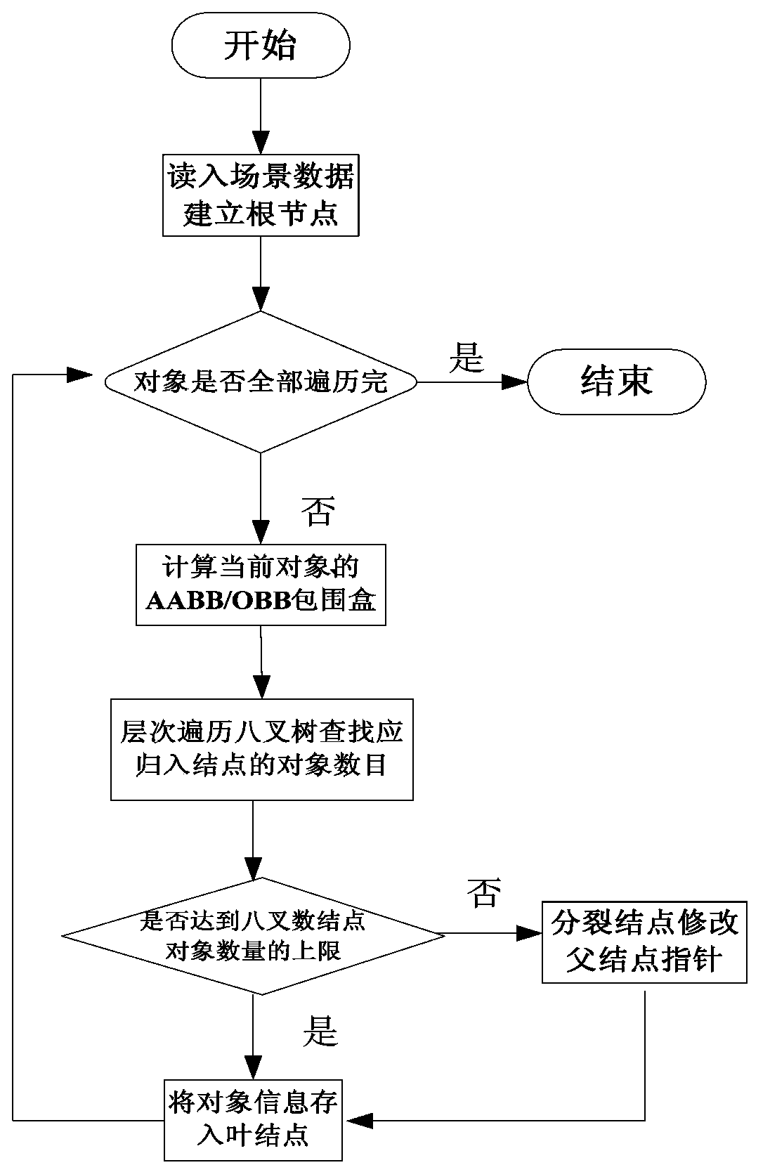
[0006] (3) The efficiency of the cutting algorithm mainly depends on the speed of finding the surface triangles that collide with the cutting surface and the reconstruction speed of the cut surface after cutting. The original triangle meshing algorithm needs to traverse all the triangle patches of the 3D model in the entire 3D scene number, and calculate each triangular surface separately, which consumes a lot of time, thus affecting the speed of the cutting algorithm

Method used


Image

  • Cutting method based on integrated three-dimensional GIS model
  • Cutting method based on integrated three-dimensional GIS model
  • Cutting method based on integrated three-dimensional GIS model

Examples


Embodiment Construction

[0030] The present invention will be described in further detail below in conjunction with the accompanying drawings and specific examples.

[0031] The main classes and interfaces in the design and implementation process of the present invention are shown in Table 1.

[0032] Table 1 Main classes and functions

[0033]

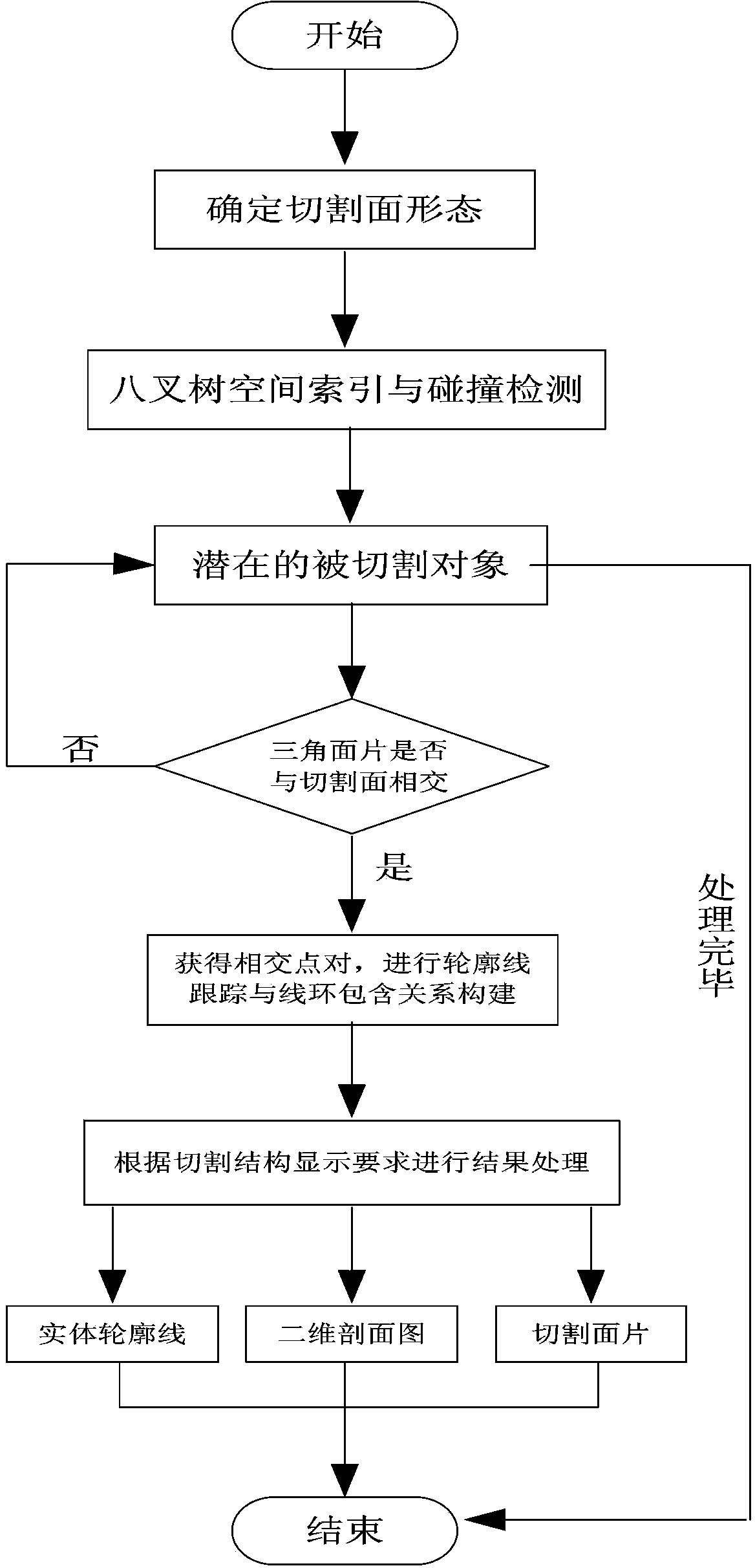
[0034] The first step is to load all kinds of data in the three-dimensional space scene, including geological bodies, tunnels, pipelines, roads and buildings;

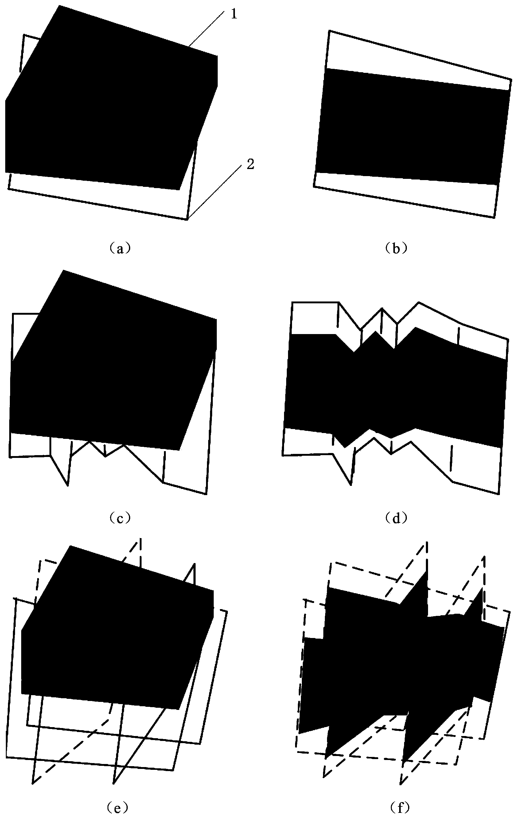
[0035] In the second step, any interactive cutting is divided into the following three cutting paths: plane cutting, folding surface cutting and combined cutting (see figure 2 ). According to the position of the cutting axis, "plane cutting" can be divided into four modes: X plane position, Y plane position, Z plane position, and arbitrary space rotation plane position. "Fold surface cutting" forms a path according to the trend and rotation angle of the spatial polyline segment, that is, the ve...


PUM


Abstract

The invention discloses a cutting method based on an integrated three-dimensional GIS model. The cutting method comprises the following steps that: cutting paths are defined; expression mode conversion is performed on different data models in the integrated three-dimensional GIS model, and spatial indexes are constructed for potential cutting objects; collision detection is performed so as to precisely determine whether the objects are involved in cutting, and surface triangles which intersect with cutting surfaces are obtained fast; triangle pairs which are subjected to cutting in a triangle mesh of the cutting surfaces and cut objects are obtained, and intersection computation is performed; repeat points are removed, and cutting intersecting lines in cut models are tracked; and cutting structure display can be formed according to structure types of cutting bodies. According to the invention, unified cutting operation is performed on the three-dimensional GIS model, and perception for inner structures of different types of objects can be realized, and reference to the results of interplay between different objects can be provided, and defects of the application of traditional cutting analysis to a three-dimensional GIS can be eliminated, and cutting efficiency can be effectively improved.

Description

technical field [0001] The invention relates to a cutting method based on an integrated three-dimensional GIS model, specifically, a multi-state section cutting method for a three-dimensional GIS data model integrating ground, floor, indoor and outdoor. Background technique [0002] Cutting analysis is an important analysis function, which is widely used in geoscience, medicine, finite element analysis and other fields. When a certain part of the data or internal information of the object of interest is covered by the surface structure or other objects, it is necessary to cut the three-dimensional space model, and observe the internal natural attributes and characteristics through the size, shape, internal organizational structure and spatial position of the cutting surface Variety. Cutting analysis has important practical needs and geological significance in 3D GIS: (1) Cutting the stratum, the generated section or slice can clearly display the details inside the geologica...

Claims


Application Information

Patent Timeline
IPC IPC(8): G06T7/00G06T15/00G06T7/11
Inventor 刘学军胡加佩杨洋刘丹
Owner NANJING NORMAL UNIVERSITY
Learn More