Night lamplight observation accuracy improving method based on geographic auxiliary data

A technology of night lighting and observation accuracy, applied in electrical digital data processing, special data processing applications, instruments, etc., can solve problems such as difficulty in effectively responding to strong lights, inability to detect electromagnetic waves, etc., to reduce saturation and improve accuracy.

Active Publication Date: 2013-12-11
HENAN UNIVERSITY
View PDF3 Cites 6 Cited by
  • Summary
  • Abstract
  • Description
  • Claims
  • Application Information

AI Technical Summary

Problems solved by technology

[0004] The purpose of the present invention is to provide a method for improving the accuracy of night light observation based on geographic auxiliary data, so as to solve the problem that the night light d

Method used


Image

  • Night lamplight observation accuracy improving method based on geographic auxiliary data
  • Night lamplight observation accuracy improving method based on geographic auxiliary data
  • Night lamplight observation accuracy improving method based on geographic auxiliary data

Examples


Embodiment Construction

[0024] Such as figure 1 As shown, the steps of the method for improving the accuracy of night light observation based on geographic assistance data are as follows:

[0025] (1) According to the three indicators of human comfort index SI, terrain relief index F and land cover index LCI in the area to construct the resident activity index HAI,

[0026] HAI={α·[1-(SI-SI min ) / (SI max -SI min )]+β·[1-(F-F min ) / (F max -F min )]}×LCI×100, where α, β are set values ​​within the range of (0,1), where α=0.53, β=0.47, SI min and SI max are the minimum and maximum values ​​of SI, respectively, and F min and F max are the minimum and maximum values ​​of F, respectively;

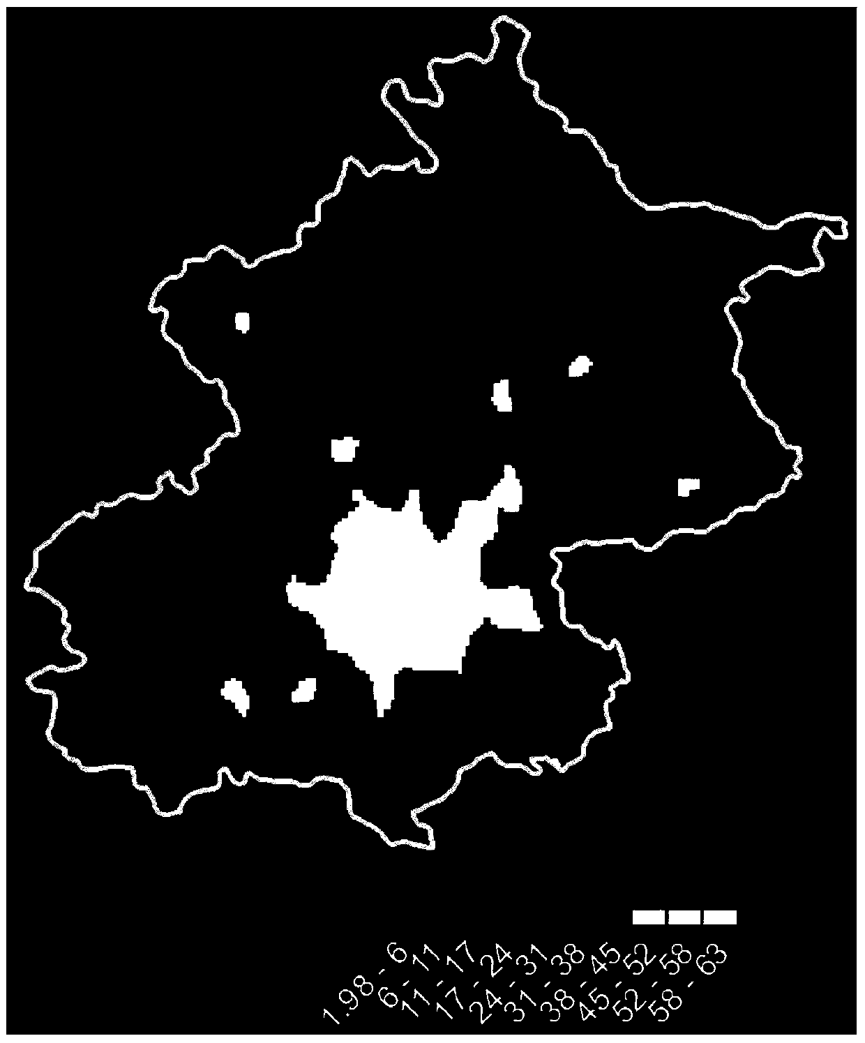
[0027] (2) First, standardize the night light data in the area, and the processing formula is OLS'=(OLS-OLS min ) / (OLS max -OLS min ), where OLS is the night light data, OLS' is the processed night light data, OLS min and OLS max They are the minimum and maximum values ​​of OLS; set the threshold, and acc...


PUM


Abstract

The invention relates to a night lamplight observation accuracy improving method based on geographic auxiliary data. The method includes the following steps: first, constructing resident activity indexes through the geographic auxiliary data such as body comfort indexes, topographic relief degree indexes and cover indexes, second, building a regression model through the correlation between a night lamplight unsaturation linear region and the resident activity indexes, and third, inversing a night lamplight saturation region and a region without lamplight through the regression model. According to the method, processed lamplight data are acquired by applying the model built according to the unsaturation linear region to the saturation region and the region without data, saturation of the night lamplight data is reduced, night lamplight data of the region without the lamplight are also acquired, and therefore accuracy in observing resident activities through the night lamplight is improved.

Description

technical field [0001] The invention relates to a method for improving night light observation accuracy based on geographic auxiliary data. Background technique [0002] The U.S. DMSP satellites equipped with OLS sensors began with DMSP Block5D-1SatelliteF-1 launched in September 1976, and the DMSP satellite systems currently in use (F-12, F-13, F-14) are all equipped with OLS sensors. The sensor has two channels: 1) visible light and near-infrared channel (VNIR, 0.4-1.0μm, spectral resolution is 6bit); 2) thermal infrared channel (TIR, 10-13μm, spectral resolution is 8bit), which acquires The width of the image is 3000km, and the spatial resolution of the full resolution data (FullResolution) is 0.56km. The satellite flies at a speed of 14 orbits a day, and each OLS sensor can acquire night and day images covering the whole world every day. The entire satellite system can provide global observation data for four periods of dawn, daytime, dusk and night in one day. The or...

Claims


Application Information

Patent Timeline
IPC IPC(8): G06F19/00
Inventor 卢鹤立刘桂芳秦耀辰
Owner HENAN UNIVERSITY
Why Eureka
Try Eureka