Geological radar fine processing method and system

A technology of geological radar and processing method, which is applied in geophysical measurement, radio wave measurement system, sound wave re-radiation, etc., can solve the difficulty of wide application of high-precision geological radar detection data, does not provide source program and data interface, processing Solve the problems of single method and means, achieve the effects of fast imaging and parallel processing, improve processing efficiency, and flexible processing methods

Inactive Publication Date: 2014-02-05
JIANGMEN POLYTECHNIC
View PDF3 Cites 9 Cited by
  • Summary
  • Abstract
  • Description
  • Claims
  • Application Information

AI Technical Summary

Problems solved by technology

At present, almost all geological radar processing software is provided by various geological radar instrument manufacturers, all of which are developed based on the Windows platform. The processing method is single, the software is not open source, and source programs and data interfaces are not provided.
These many restrictions are not conducive to the development of new methods and new technologies, and have brought difficulties to the wide application of high-precision ground radar detection data.

Method used


Image

  • Geological radar fine processing method and system
  • Geological radar fine processing method and system
  • Geological radar fine processing method and system

Examples


Embodiment Construction

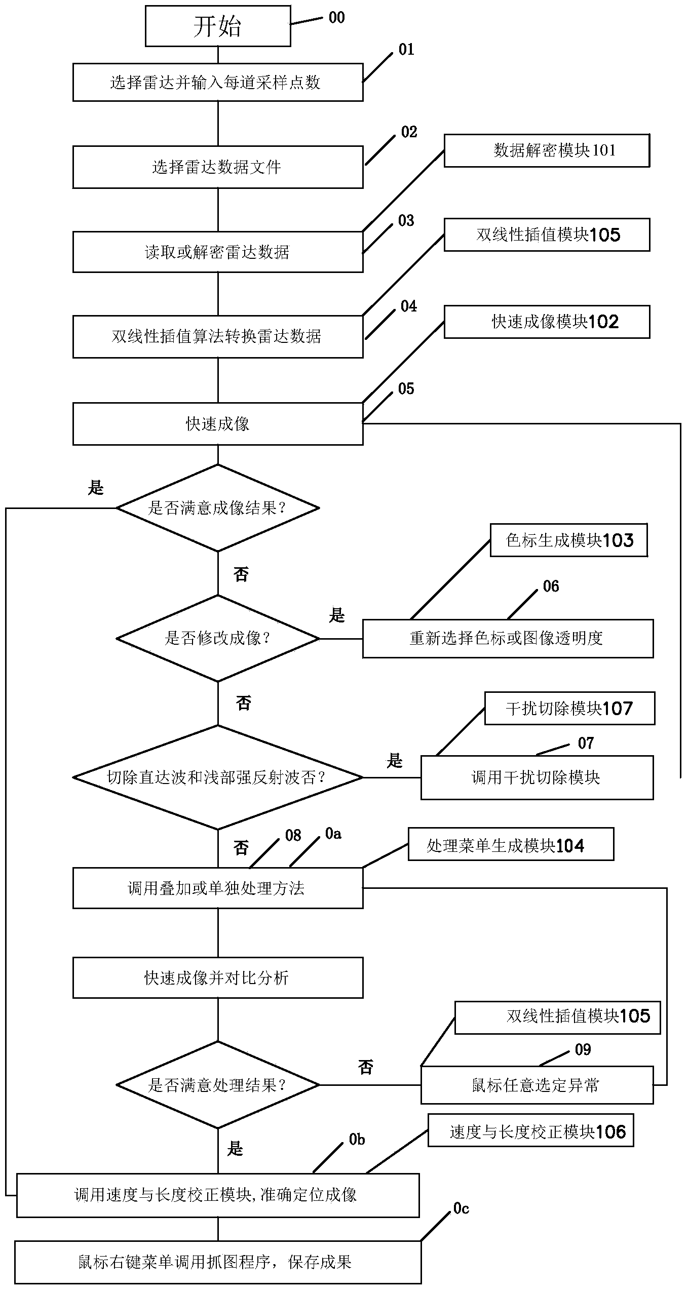
[0037] refer to figure 1 , the geological radar data fine processing system proposed by the present invention is generally composed of the following components:

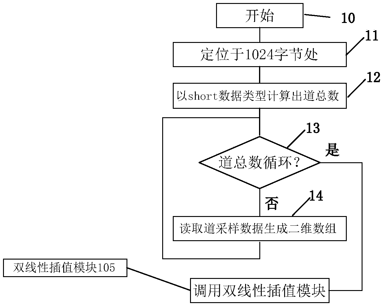
[0038] Data decryption module 101 for reading various geological radar data, fast imaging module 102 for real-time display of processing results, color scale generation module 103 for generating color scales of any order, right-click processing menu generation module 104 for integrated multi-processing methods, optional The bilinear interpolation module 105 that realizes the microscope function after determining the abnormality, the speed and length correction module 106 that can modify the radar wave velocity and the length of the observation section arbitrarily, and effectively cut off the direct wave and shallow strong reflection wave, and highlight the deep weak reflection wave The interference removal module 107 of .

[0039] Of course, those skilled in the art can understand that, in addition to the above-ment...


PUM


Abstract

The invention discloses a geological radar fine processing method and system. The method includes the steps of calling each preset sampling number, reading or deciphering geological radar data, converting the geological radar data by means of a bilinear interpolation algorithm, generating a color code and finishing quick imaging, calling a plurality of processing methods to process the geological radar data in a superposition processing mode or an independent processing mode, carrying out bilinear interpolation processing on a chosen abnormal region to achieve a microscope function, repeating the preceding step to achieve fine processing of the chosen abnormal region, and finally storing processed geological radar images. According to the method and system, a quick integral geological radar fine processing system is developed in a QT-CUDA joint compiling framework based on Linux, the method and system can be widely used in the field of geological radar data processing, and therefore application capacity and the application range of geological radar are expanded.

Description

technical field [0001] The invention relates to the field of earth exploration and information technology, in particular to a fine processing method and system for geological radar data. Background technique [0002] GPR or Ground Penetrating Radar (Ground Penetrating Radar) detection technology is an electromagnetic detection method that uses electromagnetic wave reflection to determine the distribution of underground media. A new technology of high-efficiency geophysical exploration developed rapidly due to the needs of evaluation. Geological radar detection technology can play an important role in specific tasks such as foundation treatment, underground pipeline detection, subgrade quality inspection, tunnel geological prediction and health inspection, detection of fault planes, karst and fracture-intensive zones, etc. At present, almost all geological radar processing software is provided by various geological radar instrument manufacturers, all of which are developed b...

Claims


Application Information

Patent Timeline
Patent Type & Authority Applications(China)
IPC IPC(8): G01V3/38
Inventor 彭土有
Owner JIANGMEN POLYTECHNIC
Why Eureka
Try Eureka