Marine scalar field volume rendering method based on earth sphere model

A volume rendering and scalar field technology, which is applied in the field of ocean scalar field volume rendering based on the earth sphere model, which can solve the problems of complex data structure, surge in data volume, and inability to integrate the earth sphere model, and achieves good visualization effect and high rendering efficiency. , the effect of good scalability

CN103761761AInactive Publication Date: 2014-04-30INST OF REMOTE SENSING & DIGITAL EARTH CHINESE ACADEMY OF SCI
3 Cites 15 Cited by

Patent Information

Authority / Receiving Office
CN · China
Current Assignee / Owner
Publication Date
2014-04-30
Estimated Expiration
Not applicable · inactive patent

Smart Images

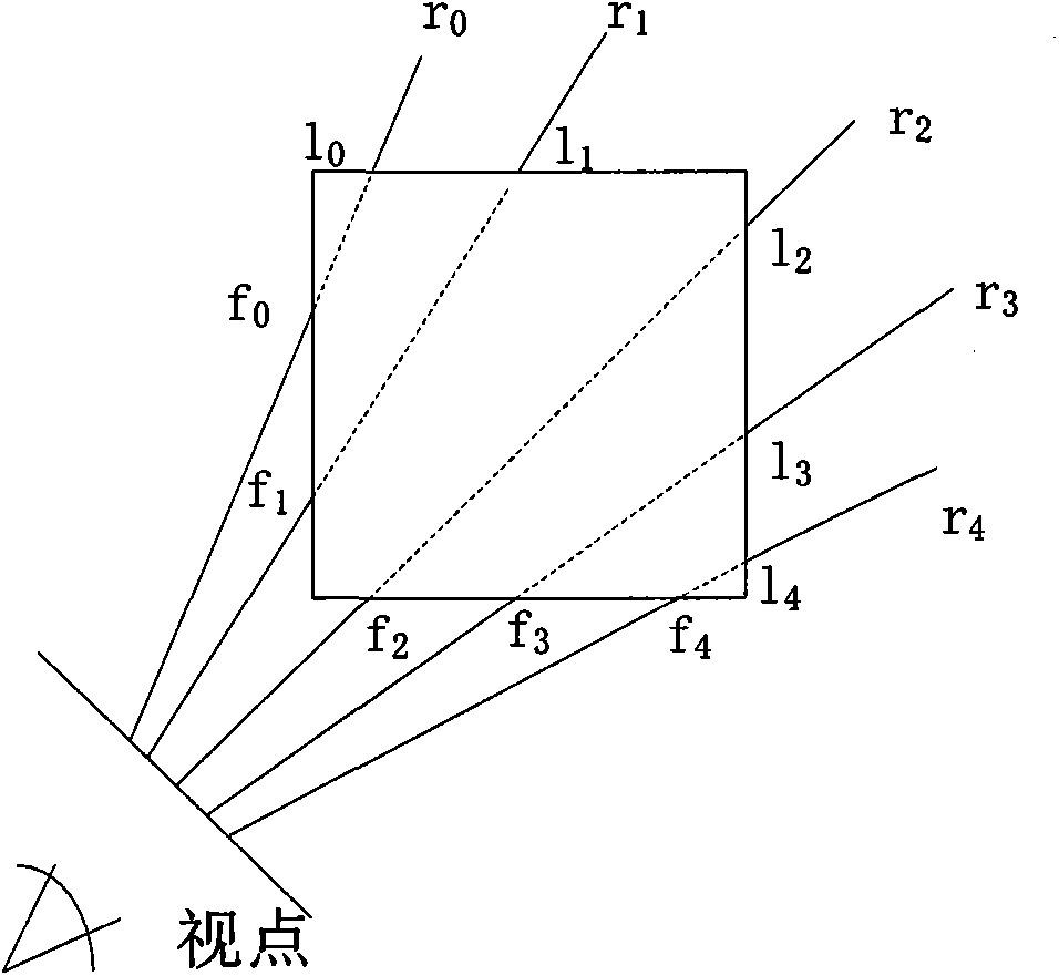
  • Figure 1
    Figure 1
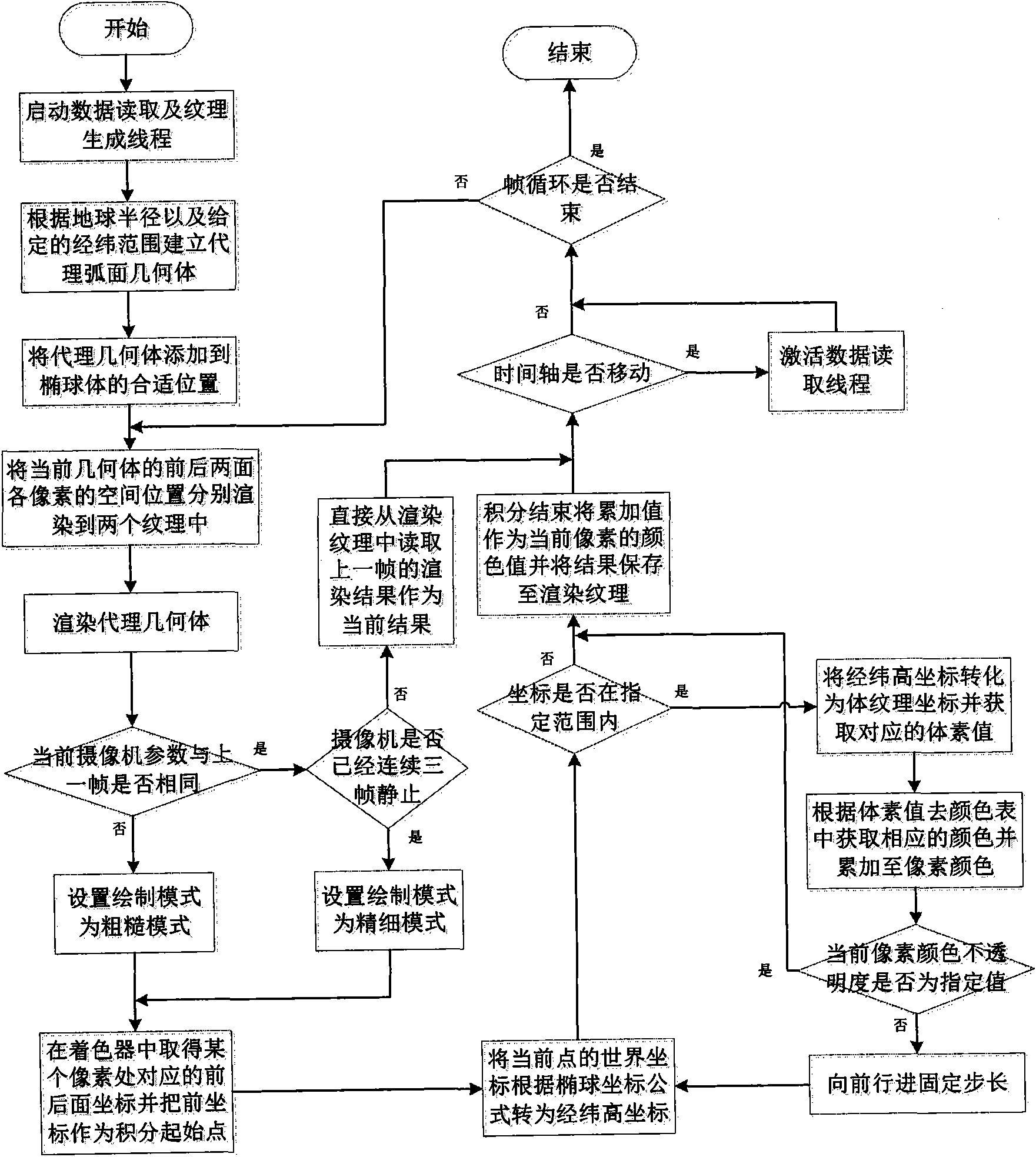
  • Figure 2
    Figure 2
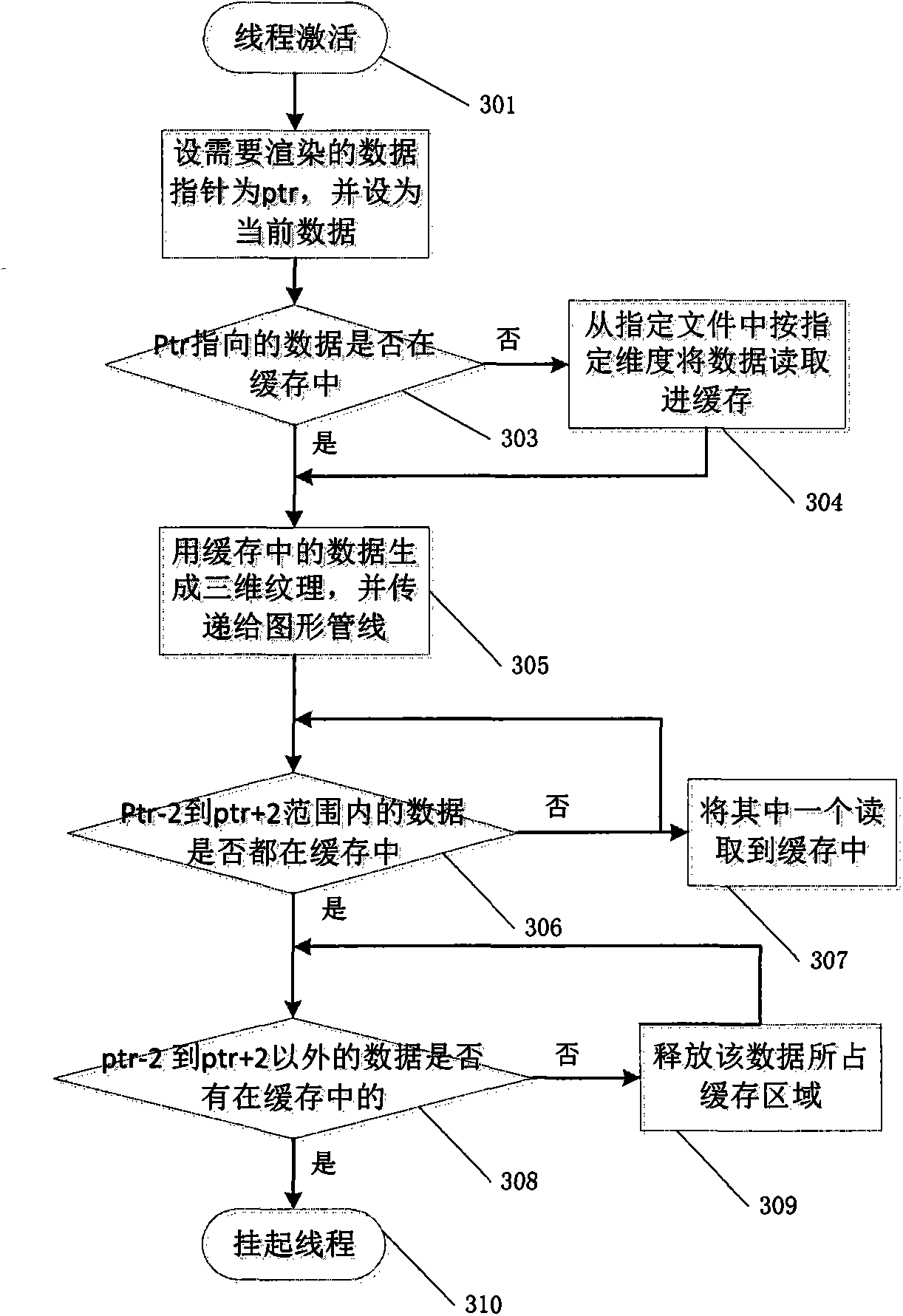
  • Figure 3
    Figure 3
Patent Text Reader

Abstract

The invention discloses a marine scalar field volume rendering method based on an earth sphere model. The method concretely comprises the following steps: adopting an arc-shaped body composed of six gridding faces to substitute a cuboid as an agent geometry; conducting coordination transformation on the agent geometry composed of the arc-shaped body in the process of light projection, and converting a light projection path from world coordinates to high warp / weft coordinates; improving the frame rate of dynamic rendering through dynamic changing multithreading pre-loading of visualization effect and the LOD rendering method of the arc-shaped body; adopting a coloring language GLSL to realize the light projection volume rendering algorithm based on the sphere model on a GPU. According to the method, through coordinate transformation, drawn bodies can be attached to the surface of the earth precisely, and data and the boundary of the land are accurate. The method has the advantages of being good in visualization effect and high in rendering efficiency, and has good expandability at the same time.
Need to check novelty before this filing date? Find Prior Art

Description

technical field

[0001] The invention relates to a method for rendering an ocean scalar field, in particular to a method for rendering an ocean scalar field based on an earth sphere model. Background technique

[0002] The visualization of ocean water body is an important content of "digital ocean" research, and the volume rendering of three-dimensional data field is the focus and difficulty of ocean water body visualization.

[0003] The sphere model system is currently a research hotspot in the field of GIS. With its powerful spatial data management capabilities and rich and intuitive information presentation capabilities, it has rapidly become a powerful platform for spatial information integration and sharing, and is the basis for the construction of "Digital Earth" and "Digital Ocean". The data structure of the ocean water body is complex. The three-dimensional field data of the ocean water body derived from the data model has three dimensions: longitude, dimension and d...

Examples

Embodiment Construction

[0045] The preferred embodiments of the present invention will be described in further detail below in conjunction with the accompanying drawings.

[0046] The ocean scalar field volume rendering method based on the earth sphere model provided by the present invention:

[0047] 1) The traditional ray-casting algorithm is improved by using an arc composed of six mesh faces instead of a cube as the proxy geometry. The cube refers to the proxy geometry of the traditional ray-casting algorithm. By changing the cube proxy geometry in the traditional algorithm to a spherical proxy geometry with a specified radius, latitude and longitude range and thickness, coordinate transformation is performed during the ray casting process, and the path of the ray projection is converted from the world coordinates to the high latitude and longitude coordinates. The correct value and accumulation in the volume data, and finally realize the visualization of the ocean scalar field data based on the ...