Vacuum speed resolving method for air data/serial inertial navigation combined navigation system

A technology of integrated navigation system and inertial navigation system, which is applied in the field of true airspeed calculation and can solve problems such as true airspeed lag, affecting wind speed calculation, flight control performance, etc.

Inactive Publication Date: 2014-06-11
NANJING UNIV OF AERONAUTICS & ASTRONAUTICS
View PDF1 Cites 25 Cited by
  • Summary
  • Abstract
  • Description
  • Claims
  • Application Information

AI Technical Summary

Problems solved by technology

[0006] The technical problem to be solved by the present invention is to overcome the defect that the existing vacuum speed calculation method that relies on atmospheric temperature parameters has a serious shortage of vacuum speed lag due to the large temperature measurement time constant, and avoid the serious influence of the true air speed by the atmospheric environment parameters and the estimation of the true air speed. The method is dependent on uncertain external information such as aircraft dynamics parameters, and provides a method for calculating true air speed that is not affected by the measurement lag of true air speed and environmental factors. This method is suitable for atmospheric data / strapdown inertial navigation systems, Based on the characteristics of horizontal flow in the high-altitude atmosphere, according to the vector relationship between the true speed, ground speed and wind speed, the proportional factor between the true speed and the ground speed is calculated by using the angle of attack, sideslip angle and the attitude of the carrier. The calculation solves the true air speed, which avoids the interference of environmental factors on the true air speed, and solves the problem that the lag of true air speed measurement affects the wind speed calculation and flight control performance

Method used


Image

  • Vacuum speed resolving method for air data/serial inertial navigation combined navigation system
  • Vacuum speed resolving method for air data/serial inertial navigation combined navigation system
  • Vacuum speed resolving method for air data/serial inertial navigation combined navigation system

Examples


Embodiment Construction

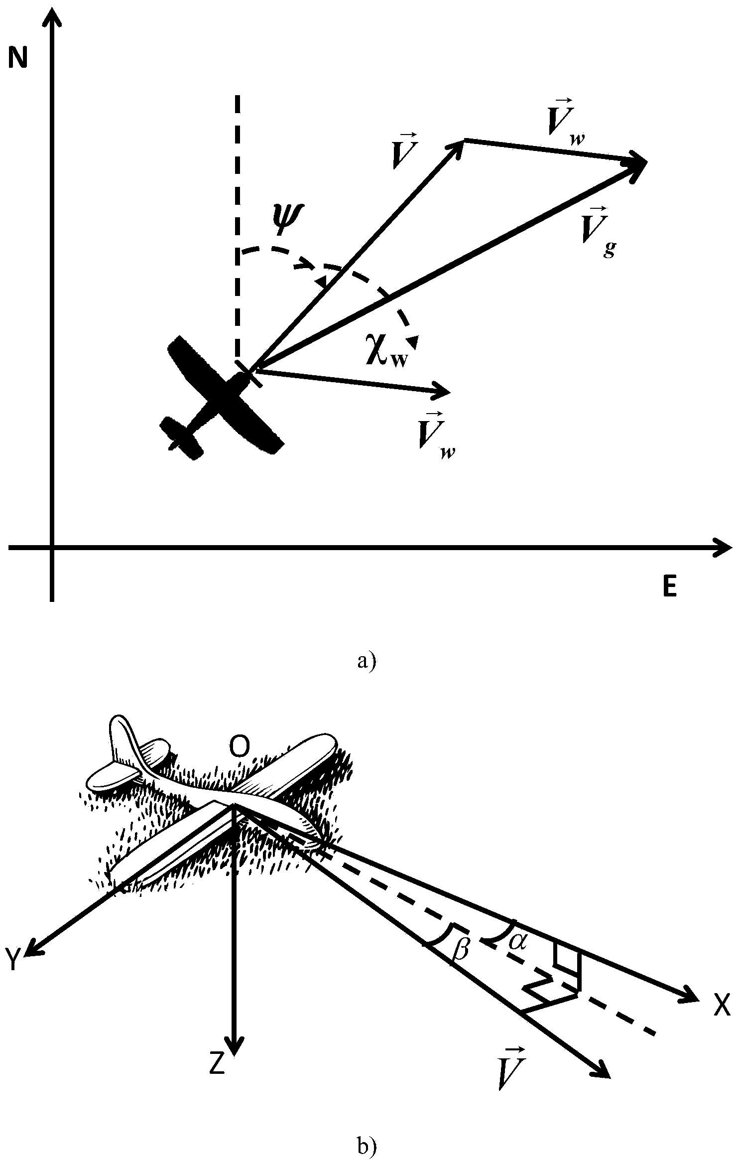
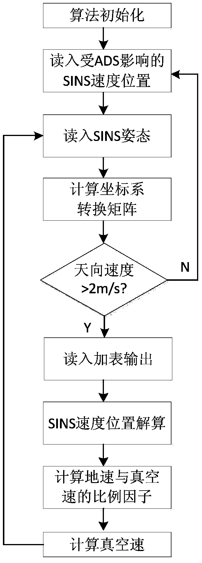
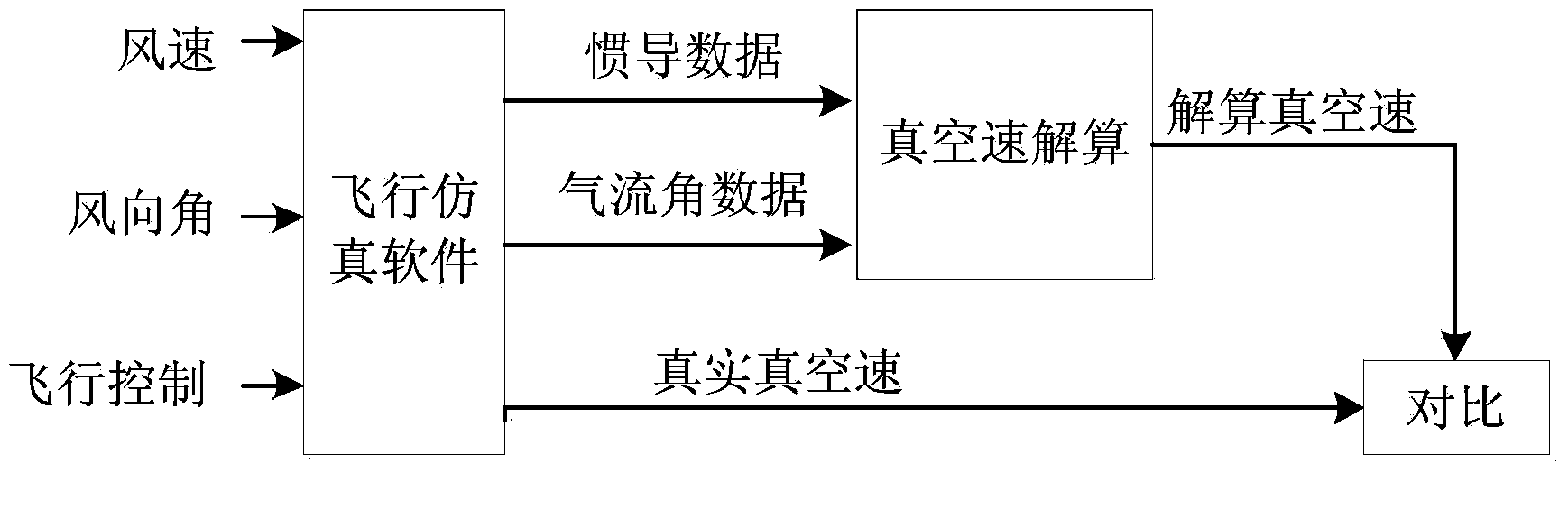
[0047] figure 1 Shown is the schematic diagram of the principle of the true air velocity solution method proposed by the present invention, figure 1 In .a), the coordinate axis represents the geographic coordinate system, the horizontal axis E represents the east direction, and the vertical axis N represents the north direction, represents the wind speed, Indicates ground speed, Indicates true air speed, ψ indicates heading angle, χ w represents the wind angle, figure 1 In .b), OXYZ represents the body coordinate system, Indicates the true airspeed, α indicates the angle of attack, and β indicates the sideslip angle. By adopting the method of the invention, the calculation of the true air speed can be performed at any time without the accumulation of measured values.

[0048] The present invention is used for the true air speed calculation method of the atmospheric data / strapdown inertial navigation system, which relates to the atmospheric data system and the strapdo...


PUM


Abstract

The invention discloses a vacuum speed resolving method for an air data / serial inertial navigation combined navigation system. The method comprises the following steps: calculating a scale factor between the vacuum speed and ground velocity according to a vector relation among the vacuum speed, ground velocity and wind speed based on the characteristic that upper atmosphere is mainly in horizontal flow by utilizing an attack, a sideslip angle and posture of a carrier, and resolving the vacuum speed through numerical calculation. According to the method, the defect that the vacuum speed is severely lagged due to the temperature measurement time constant in a conventional vacuum speed calculation method depending on atmospheric temperature parameters is overcome, and influence of the vacuum speed which is severely influenced by the atmospheric temperature parameters and dependence of uncertain external information of the vacuum speed estimation method on aircraft dynamics parameters are avoided, so that the measuring lag of the vacuum speed and influence on environmental factors are solved.

Description

Technical field: [0001] The invention relates to a method for calculating true speed, in particular to a method for calculating true speed used in an air data / strapdown inertial navigation integrated navigation system. Background technique: [0002] The air data system (Air Data System, referred to as ADS) is an important airborne avionics device that completes the perception, measurement, calculation and output of atmospheric parameters. It uses sensors (pressure / temperature / angle sensors) to measure atmospheric characteristic parameters around the aircraft, and then After relevant calculation and correction by the air data computer, the total pressure, static pressure, dynamic pressure, static temperature, angle of attack, sideslip angle, altitude, vertical speed, indicated airspeed, true speed, Mach number, etc. of the free flow are completed. Measurement of atmospheric data. Strapdown Inertial Navigation System (SINS for short) is an autonomous navigation method that ob...

Claims


Application Information

Patent Timeline
Patent Type & Authority Applications(China)
IPC IPC(8): G01C21/20
CPCG01C21/005G01C21/20
Inventor 陆辰李荣冰刘建业雷廷万郭毅付强曾庆化何波
Owner NANJING UNIV OF AERONAUTICS & ASTRONAUTICS
Why Eureka
Try Eureka