

Urban historical map restoration method based on spatial grid hierarchical positioning
A map and city technology, applied in maps/plans/charts, special data processing applications, instruments, etc., can solve the problems of lack of quantitative data support, cumbersome planning technology process, low work efficiency, etc., to shorten planning work time, The effect of improving interpretation efficiency and reducing time-consuming
- Summary
- Abstract
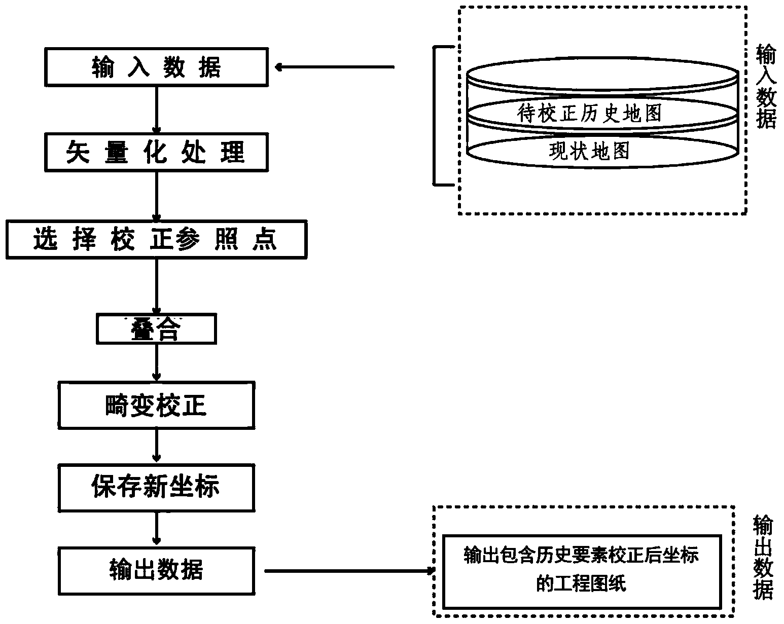
- Description
- Claims
- Application Information
AI Technical Summary
Problems solved by technology
Method used
Image

Examples
Embodiment Construction
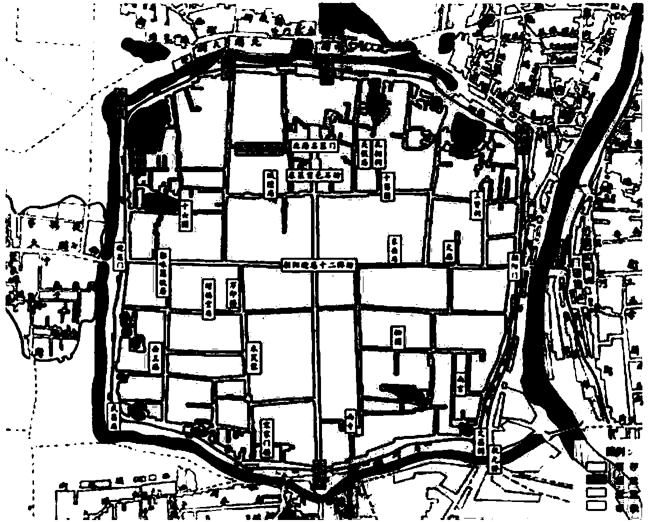
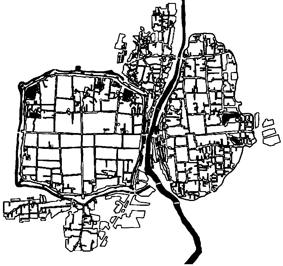
[0030] This example uses a historical map of Weifang City. Through the analysis of historical ancient maps, it can be known that Weifang has a long history. By the Ming and Qing Dynasties, a unique urban form of "turtle and snake two cities interdependent" was basically formed. After 1912, the city developed rapidly. By 2000 The walls and foundations of the two cities of Guishe and Snake basically disappeared. In order to restore the city's historical features, Weifang City Planning Department, through the analysis of historical documents, believes that the urban form of "turtle and snake interdependent" is one of the core values of Weifang's urban history and culture, and is an important material carrier of Weifang's local cultural characteristics. Therefore, the "turtle The reappearance of the urban morphological characteristics of "snakes relying on each other" is a key point in future development planning.
[0031] According to the interpretation of local county annals a...
PUM
 Abstract
Description
Claims
Application Information