A Vector Modeling Method of Urban Three-Dimensional Space Based on Paper Plane Data
A technology of flat data and three-dimensional space, applied in 3D modeling, image data processing, electrical digital data processing, etc., to achieve the effect of increased operability, efficient and reasonable use, and improved work efficiency
- Summary
- Abstract
- Description
- Claims
- Application Information
AI Technical Summary
Problems solved by technology
Method used
Image
Examples
Embodiment
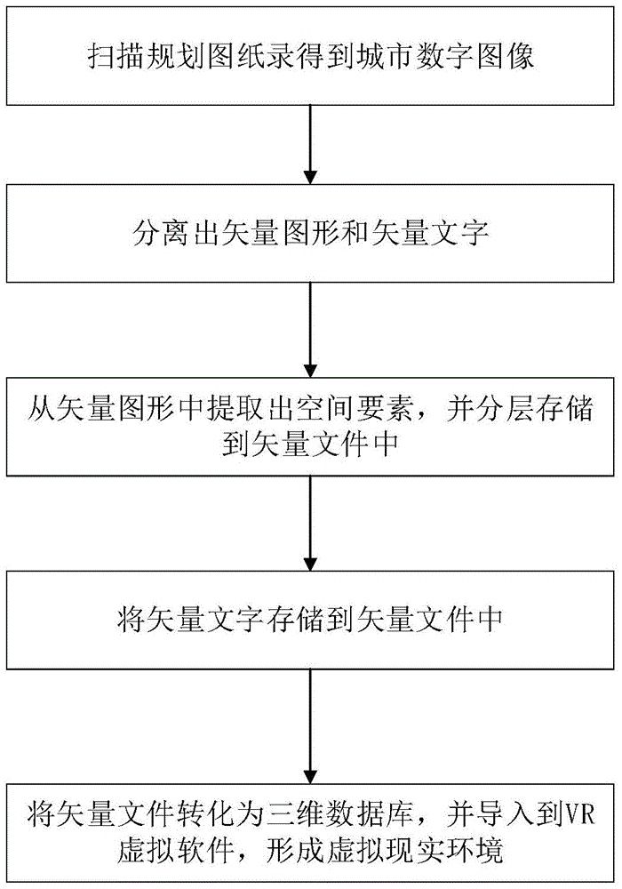
[0025] The urban three-dimensional space vector modeling method based on paper plane data of the present embodiment, such as figure 1 shown, including the following steps:
[0026] 1) Use scanning equipment to input the planning drawings of the city into the computer, and perform binarization processing to obtain a digital image of the city;
[0027] 1.1) Selection of scanning equipment: Since urban planning drawings are often large in size, large-format A0 scanners should be selected for instrument selection (if there is no large-format scanner, paper drawings can be folded and scanned, and finally scanned in Adobe Photoshop software) splicing) to input the planning drawings of the city. A large-format scanner is a graphic scanning input device with a close-connected image sensing system as a sensor. It takes a city planning drawing like a photo through multiple image sensing systems, and converts it into a dot matrix by itself. into the computer.
[0028] 1.2) Use the sca...
PUM
 Abstract
Description
Claims
Application Information
 - R&D
- Intellectual Property
- Life Sciences
- Materials
- Tech Scout
- Unparalleled Data Quality
- Higher Quality Content
- 60% Fewer Hallucinations
Browse by: Latest US Patents, China's latest patents, Technical Efficacy Thesaurus, Application Domain, Technology Topic, Popular Technical Reports.
© 2025 PatSnap. All rights reserved.Legal|Privacy policy|Modern Slavery Act Transparency Statement|Sitemap|About US| Contact US: help@patsnap.com


