Network object and event integral monitoring method based on GIS (Geographic Information System) super cloud computing

A network monitoring and network technology, applied in the field of network information security, can solve the problems such as the difficulty of spatial positioning and prevention monitoring, the inability to meet the needs of big data processing efficiency and real-time, and the inability to obtain network-related data distributed in time and space. To achieve the effect of security governance

Inactive Publication Date: 2014-10-01
SHENZHEN INST OF ADVANCED TECH
View PDF2 Cites 2 Cited by
  • Summary
  • Abstract
  • Description
  • Claims
  • Application Information

AI Technical Summary

Problems solved by technology

At present, due to the lack of efficient network search and automatic identification technology, it is impossible to obtain network-related data distributed over time and space, and there is no spatial positioning technology that truly combines complex IP. It is difficult to effectively carry out spatial positioning and prevention monitoring for network emergencies.
[0004] Since the retrieval, processing and analysis of network violations and emergencies involves large-scale web pages, pictures, videos and other types of data, based on traditional data processing and management technologies, it has been unable to meet the efficiency and real-time requirements of big data processing. , there is an urgent need for an effective combination of supercomputer and cloud computing technology with the retrieval and analysis of network emergencies

Method used


Image

  • Network object and event integral monitoring method based on GIS (Geographic Information System) super cloud computing
  • Network object and event integral monitoring method based on GIS (Geographic Information System) super cloud computing

Examples


Embodiment 1

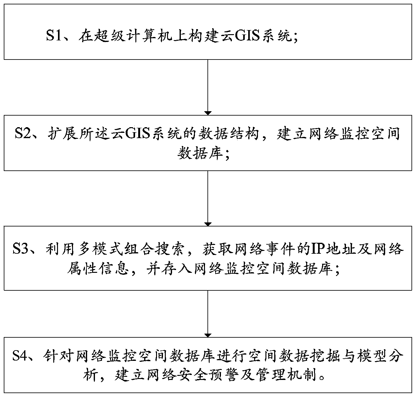
[0030] The present embodiment provides an integrated monitoring method based on cloud GIS, comprising the following steps:

[0031] S1. Build a cloud GIS system on a supercomputer;

[0032] S2. Expanding the data structure of the above-mentioned cloud GIS system, integrating the IP database into the above-mentioned cloud GIS system, expanding the spatial geographic information (x, y) into three-dimensional spatial geographic information (x, y, IP), and establishing a network monitoring spatial database.

[0033] The above-mentioned extension also includes extending the real attribute information of the network object to "real-virtual" attribute information, and the above-mentioned "virtual" attribute information is the network attribute information of the above-mentioned network object.

[0034] The above-mentioned real attribute information is the real space attribute where the above-mentioned network object is located, including area attribute information, street attribute i...

Embodiment 2

[0040] On the basis of embodiment 1, the integrated monitoring method based on cloud GIS comprises the following steps:

[0041] S1. Build a cloud GIS system on a supercomputer;

[0042] Usually the above-mentioned supercomputer is composed of hundreds or even more processors, which can handle large-scale and complex computing tasks that ordinary computers cannot complete. Most of them use a heterogeneous fusion system combining CPU and GPU. The hardware part is mainly composed of distributed processing system, communication system, input and output system, monitoring and diagnosis system and infrastructure system, and the software part is mainly composed of operating system, compiling system, parallel program development environment and scientific computing visualization system. The above-mentioned cloud GIS uses the cloud computing architecture for GIS to realize functions such as collection, storage, processing, and application of spatial data and its attributes.

[0043] ...

Embodiment 3

[0054] This embodiment provides an integrated monitoring method based on cloud GIS, an example of integrated monitoring of cybercrime events based on cloud environment, including the following steps:

[0055] S1. Build a cloud GIS system on a supercomputer;

[0056] S2, expanding the data structure of the above-mentioned cloud GIS system, and establishing a network monitoring spatial database;

[0057] To establish a network monitoring spatial database, the process is as follows: store the actual spatial location (x, y), network spatial location (IP) and their attribute data of network objects and events in the cloud GIS system, and store the decimal IP After the address difference is filled with zeros (make up three digits, and zeros are filled when there is a gap), the middle separator is removed, so as to realize the conversion from IP to P value (for example, 1.1. , which can ensure that the IP value is transformed into a unique value P, and can be flexibly interchanged b...


PUM


Abstract

The invention relates to a network object and event integral monitoring method based on GIS (Geographic Information System) super cloud computing. The method comprises the following steps: establishing a GIS super computing system; 2, expanding the data structure of a GIS system, and establishing a network monitoring spatial database; 3, acquiring the IP (Internet Protocol) address and network property information of a network object and an event by means of multi-mode combined search, and storing the IP address and the network property information in the network monitoring spatial database; and 4, performing spatial data mining and model analysis on a network monitoring database, and establishing a network safety pre-warning and management mechanism. Through the integral monitoring method, network big data is processed by using a super computer and a cloud GIS system, the spatial location information and the network property information of the network object are bound and stored in an expanded GIS data structure, the online and offline rules of the network object and behaviors are grasped through integrated IP locating, network search, data mining and spatial analysis, and dynamic monitoring is performed to combat and prevent network illegal behaviors, so that safety management of Internet is realized.

Description

【Technical field】 [0001] The invention relates to the field of network information security, in particular to an integrated monitoring method for network objects and events based on supercomputers, GIS cloud computing and expanded GIS data structures. 【Background technique】 [0002] With the rapid development of the Internet, online violations and emergencies emerge one after another, causing serious harm to national security, social stability, and the interests of the people. . At present, network monitoring technology mainly includes IP address positioning based on routing registry, network public opinion analysis, etc. However, the above-mentioned technologies lack the functions of network search and automatic identification and real space positioning capabilities of complex network events for large-scale network objects and events. Although GIS (Geographic Information System) has been used in network resource management and mapping, it only involves physical objects an...

Claims


Application Information

Patent Timeline
Patent Type & Authority Applications(China)
IPC IPC(8): H04L29/08H04L29/06G06F17/30
Inventor 修文群
Owner SHENZHEN INST OF ADVANCED TECH
Why Eureka
Try Eureka