System and method based on bluetooth and GPS (global positioning system) hybrid location

A hybrid positioning and GPS module technology, used in satellite radio beacon positioning systems, radio wave measurement systems, measurement devices, etc., to achieve the effect of improving speed, accuracy, and strong penetration

Active Publication Date: 2015-04-08
BEIJING UNION UNIVERSITY
View PDF4 Cites 13 Cited by
  • Summary
  • Abstract
  • Description
  • Claims
  • Application Information

AI Technical Summary

Problems solved by technology

[0005] Aiming at the above-mentioned problems in single positioning, the present invention provides a system and method based on mixed position

Method used


Image

  • System and method based on bluetooth and GPS (global positioning system) hybrid location
  • System and method based on bluetooth and GPS (global positioning system) hybrid location
  • System and method based on bluetooth and GPS (global positioning system) hybrid location

Examples


Embodiment Construction

[0024] The present invention will be further described below in conjunction with drawings and embodiments.

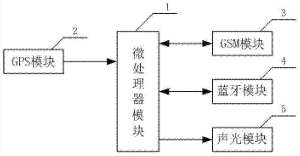
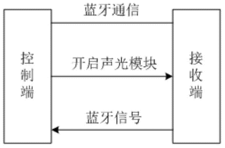
[0025] A mixed positioning system based on bluetooth and GPS, including a control end and a receiving end; the control end is a mobile phone with bluetooth function and system software installed; the receiving end is installed on the object to be positioned. The block diagram of the receiving end is as follows figure 1 As shown, it includes: a microprocessor module 1, a GPS module 2, a GSM module 3, a Bluetooth module 4, and an acousto-optic module 5. in,

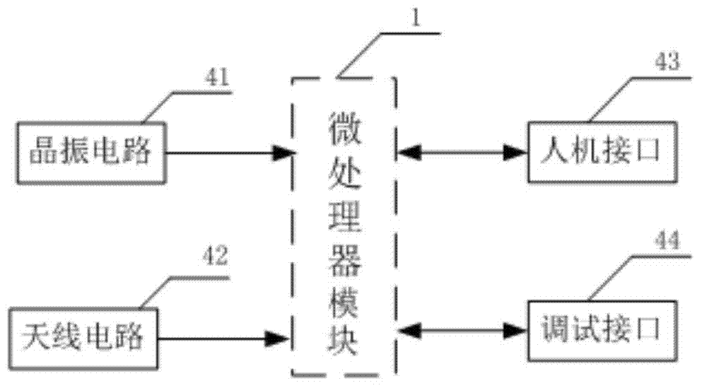
[0026] Microprocessor module 1: complete the data processing and control functions of the receiving end. The microprocessor module 1 of this embodiment adopts STM32. STM32 uses the ARM Cortex-M3 core specially designed for high-performance, low-cost, low-power embedded applications. The Cortex-M3 processor has a 32-bit CPU, a parallel bus structure, a nested interrupt vector control unit, a debug system, and a st...


PUM


Abstract

The invention belongs to the technical field of space location and relates to a system and a method based on bluetooth and GPS (global positioning system) hybrid location. The system comprises a control end and a receiving end, wherein the control end is a mobile phone with bluetooth function and system software installing; the receiving end is arranged on a to-be-located object, and comprises a micro processor module, a GPS module, a GSM (global system for mobile) module, a bluetooth module and an acousto-optic module. The method comprises the following steps: performing short-distance bluetooth location, long-distance GPS location, and converting to short-distance bluetooth location from the long-distance GPS location. In order to overcome the problems that the existing single GPS location mode is poor in location precision, signals are easily shielded by a barrier, and the like, the system and the method based on GPS and bluetooth hybrid location are disclosed by utilizing the characteristics of no angle and direction limitation, strong penetrability and the like of a bluetooth signal. GPS is used for quickly locating at a long distance, and the bluetooth is used for accurately locating at a short distance, so that the location speed and accuracy are improved.

Description

technical field [0001] The invention belongs to the technical field of space positioning, and relates to a hybrid positioning system and method based on bluetooth and GPS. Background technique [0002] GPS technology has the characteristics of all-weather, high precision and automatic measurement, and is widely used in navigation, positioning and other fields. The basic principle of GPS positioning is to use the instantaneous position of the high-speed moving satellite as the known starting data, and use the method of space distance resection to determine the position of the point to be measured. That is, based on the distance (or distance difference) between the GPS satellite and the antenna of the user receiver, the point corresponding to the user receiver is determined according to the known instantaneous coordinates of the satellite, that is, the three-dimensional coordinates (x, y) of the point to be fixed ,z). The accuracy of the civil field opening is about 10 meter...

Claims


Application Information

Patent Timeline
IPC IPC(8): G01S19/48
CPCG01S19/48
Inventor 王燕妮姜余祥杨萍令杰杨桐朱琳肖连生
Owner BEIJING UNION UNIVERSITY
Why Eureka
Try Eureka