Public-network-map-aided land survey method

A land survey and public network technology, applied in the field of geographic information science, can solve problems such as high technical threshold, limited land use status vector data application, time-consuming and labor-intensive problems, and achieve high technical threshold, rapid deployment, and convenient use.

Active Publication Date: 2015-04-08
SOUTHEAST UNIV
View PDF5 Cites 4 Cited by
  • Summary
  • Abstract
  • Description
  • Claims
  • Application Information

AI Technical Summary

Problems solved by technology

[0007] However, the dense coverage and non-level characteristics of the current land use data make the comprehensive algorithm lack a reliable basis, the calculation is complicated, and the processing is time-consuming and laborious. The comprehensive land use data has always lacked a good solution, and the technical threshold is high, thus limiting land use. Application of current situation vector data in land survey, especially large-scale land survey

Method used


Image

  • Public-network-map-aided land survey method
  • Public-network-map-aided land survey method
  • Public-network-map-aided land survey method

Examples


Embodiment Construction

[0031] The present invention will be further explained below in conjunction with the accompanying drawings.

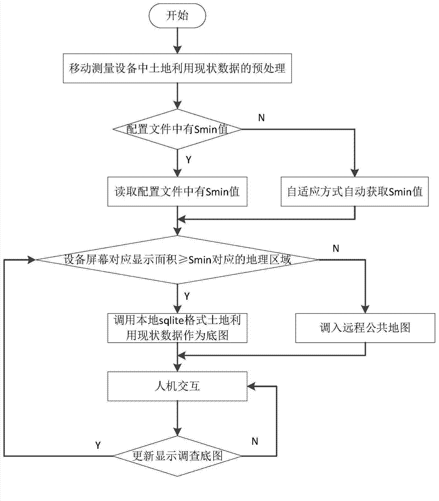
[0032] Such as figure 1As shown, a method of using public network map to assist land survey includes the following steps:

[0033] Step 1), preprocessing of land use status data in mobile measuring equipment:

[0034] Store the current land use data with the embedded database sqlite, and add R-tree index to the spatial features in the current land use data. If the original land use status data is in other formats such as shape or VCT, it needs to be converted into sqlite format in advance; during the conversion process, the area S of the entire land use status data and the number N of spatial features within this range are counted, The average space object in unit area is calculated as N / S.

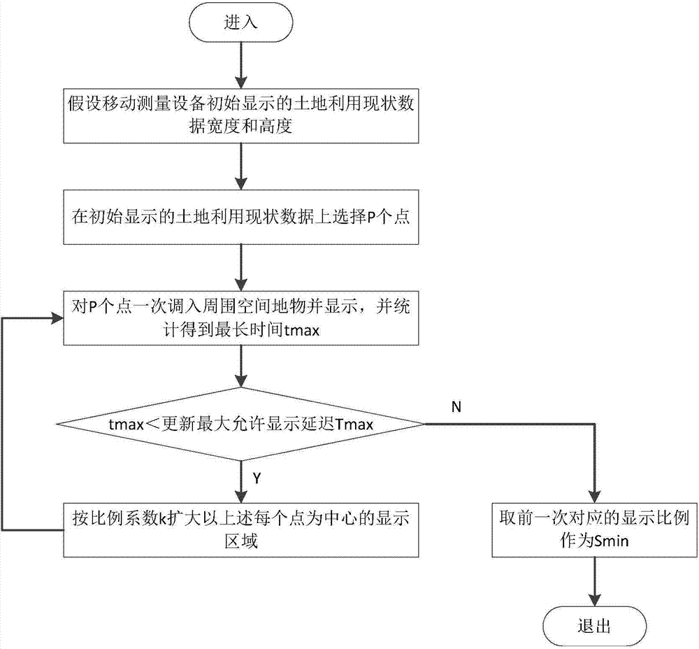
[0035] Step 2), obtain the land use status data of the mobile measuring equipment and display the minimum ratio S min :

[0036] The land use status data shows the minimum p...


PUM


Abstract

The invention discloses a public-network-map-aided land survey method. According to the public-network-map-aided land survey method, when a screen displays a large region, a system invokes a network map or remote sensing map of a public network map (for example, Google, Baidu or Map World) automatically to take the network map or remote sensing map as a survey basic map; when the screen displays a small range or land survey measurement planimetric point coordinates of a region to be surveyed, preinstalled present local land utilization data are selected for quickly calling in a basic map of a corresponding region by an R-TREE spatial index. The public-network-map-aided land survey method has the advantages that when mobile measurement equipment (like a GPS (global positioning system) / PDA (personal digital assistant) all-in-one machine) is used for large-region land survey, complex, time-consuming and high-technical-threshold automatic integration of present land utilization data is not needed, and accordingly, the method is rapid to deploy and convenient to use.

Description

technical field [0001] The invention belongs to the field of computer information technology and relates to geographical information science. Background technique [0002] With the successful completion of the second national land survey, the annual land change survey is gradually put on the agenda. The annual land change survey is the key to the maintenance of the land survey database. The land change survey is a field survey of the current land use situation and the latest image data issued by the county-level land and resources management department. On-the-spot survey, obtain the data of changing land type maps, ownership (land), and administrative divisions, thereby generating incremental data packages, and realizing the process of updating the land survey database. [0003] Field investigation is an important part of land renewal investigation. The traditional method is to carry paper land use status maps, images, and forms to the site to fill in manually, use tape me...

Claims


Application Information

Patent Timeline
IPC IPC(8): G06F17/30
CPCG06F16/29
Inventor 张小国王庆任阳寇海堂
Owner SOUTHEAST UNIV
Why Eureka
Try Eureka