
A method for designing ore storage yards and dumps in gold mines
A technology for dumps and storage yards, applied in computing, image data processing, special data processing applications, etc., can solve the problem of storage yards that cannot accurately reflect the changing trend of storage yards, and cannot intuitively and truly establish a three-dimensional space. Problems such as the dump site model and the difficulty of formulating multi-period dump site plans have achieved the effect of simple and easy to change the design method and the simple and convenient ground surface fitting method
- Summary
- Abstract
- Description
- Claims
- Application Information
AI Technical Summary
Problems solved by technology
Method used
Image

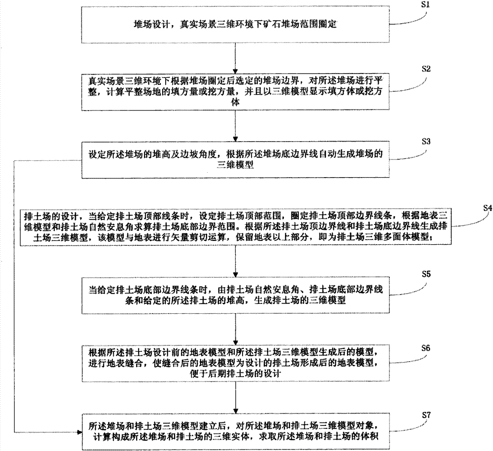
Examples
Embodiment
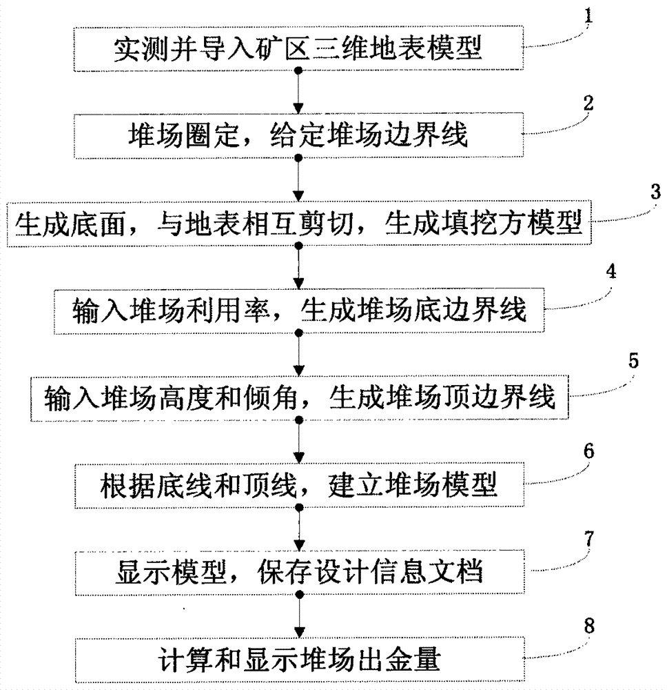
[0065] figure 2 Flowchart for computer-aided design of a yard:
[0066] 1. Import the actually measured 3D terrain data of the mining area surface into the system, generally in DXF format, and build a 3D surface model of the entire mining area from the terrain data, which is the spatial surface of the GRID data model;
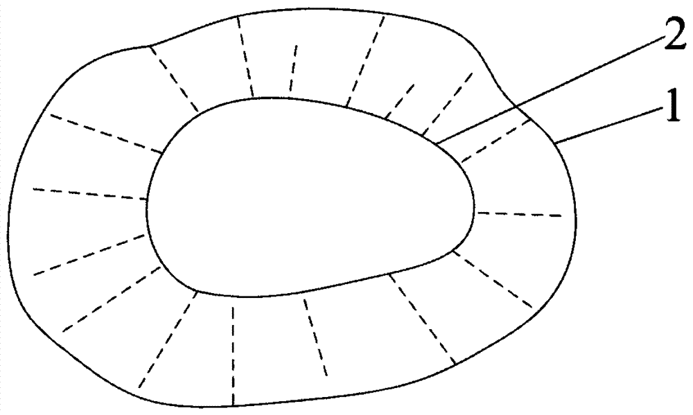
[0067] 2. On the surface model, select the area to build the storage yard according to the change of the terrain. Given the bottom elevation of the storage yard 7, delineate the boundary range of the storage yard at the given elevation in the three-dimensional space with the top view;
[0068] 3. Generate the bottom surface of the storage yard after the storage yard has been leveled based on the delineated bottom boundary line 1 of the storage yard. The bottom surface is the spatial surface of the TIN data model, and the shearing analysis is carried out by using the vector shear analysis module between the spatial surface and the surface , to establish a fill...
PUM
 Abstract
Description
Claims
Application Information