Indoor planimetric map making method based on laser ranging

A technology of laser distance measurement and plane map, which is applied in the directions of measuring distance, measuring device, line-of-sight measurement, etc. It can solve the problems not involved in indoor map making methods, etc., and achieve the effect of solving the bottleneck of drawing efficiency, simple operation and fast processing speed

Active Publication Date: 2015-09-09
WUHAN UNIV
View PDF12 Cites 40 Cited by
  • Summary
  • Abstract
  • Description
  • Claims
  • Application Information

AI Technical Summary

Problems solved by technology

Such as "Indoor Positioning Method" (Application No. 200810043032.4), "Navigation Method and Its Handheld Navigation Device and Navigation System" (Application No. 200810035934.3), "Method for Providing Positioning and Navigation Inside Large Buildings" (Application No. 200980129150.X) , "An Airport Passenger Positioning System and Device" (Application No. 201110177845.4), "A Mobile Space Fo

Method used


Image

  • Indoor planimetric map making method based on laser ranging
  • Indoor planimetric map making method based on laser ranging
  • Indoor planimetric map making method based on laser ranging

Examples


Embodiment Construction

[0038] The technical solutions of the present invention will be further described below in conjunction with the accompanying drawings and specific embodiments.

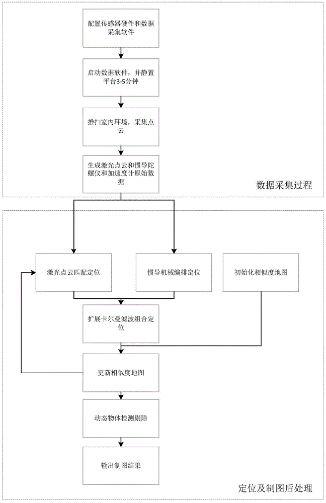
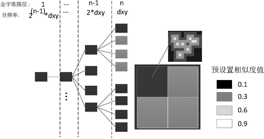
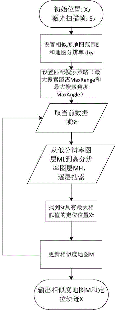
[0039] The concrete steps of the present invention see figure 1 ,include:

[0040] Step 1, data collection.

[0041] The mapping data is collected using a sensor platform consisting of a horizontally placed IMU (inertial measurement unit) and a LiDAR sensor powered by a battery and connected to a computer. The sensor platform is placed on a moving carrier such as a trolley or a mobile robot.

[0042] When collecting data, start the sensor platform, let it stand for 3-5 minutes, and use the LiDAR sensor to scan horizontally to collect indoor environment point clouds, so that IMU zero offset correction can be performed later to improve positioning accuracy. Then, move the moving carrier freely in the indoor environment. When moving, it should drive as smoothly as possible and avoid high-density moving people and obje...


PUM


Abstract

The invention discloses an indoor planimetric map making method based on laser ranging, comprising the following steps: step one, acquiring indoor environmental data by using a mobile sensor platform; step 2, establishing a grid similarity map with multiple resolutions; step 3, acquiring the optimal position and posture of the sensor platform in various epochs by combining the indoor environmental data with the grid similarity map; step 4, updating the grid similarity map according to the optimal position and posture; step 5, educing the grid similarity map in the local coordinate system. According to the invention, the operation of acquiring data is simple, and preknowledge of the environmental space structure is not needed; the cost is low, the map making speed is high, multiple times of quick updating of the indoor map can be realized, and the bottleneck problem of indoor map making efficiency is effectively solved.

Description

technical field [0001] The invention belongs to the technical field of indoor surveying and drawing, and in particular relates to an indoor planar map drawing method based on laser ranging. Background technique [0002] With the rapid development of computer technology, wireless positioning technology, GIS and mobile Internet technology, Location-Based Service (Location-Based Service) has become a reality and has been widely used in practice. In indoor environments, such as airport halls, exhibition halls, warehouses, supermarkets, libraries, underground parking lots, mines, etc., it is often necessary to determine the location information of mobile terminals or their holders, facilities and objects indoors, and provide corresponding Additional indoor location-based application services such as navigation, search queries, etc. However, due to the huge number of indoor buildings and the complex and changeable indoor environment, such as supermarkets and periodic changes in t...

Claims


Application Information

Patent Timeline
IPC IPC(8): G01C21/20G01C21/16G01C3/00
CPCG01C3/00G01C21/165G01C21/206
Inventor 唐健陈育伟
Owner WUHAN UNIV
Why Eureka
Try Eureka