

Comprehensive geographical spatial data coordinate conversion method and system
A geospatial data and coordinate conversion technology, applied in the field of surveying and mapping, can solve the problems of complex conversion process, slow coordinate conversion method and system conversion efficiency, etc., and achieve the effect of powerful conversion function, high coordinate conversion efficiency and high conversion efficiency.
- Summary
- Abstract
- Description
- Claims
- Application Information
AI Technical Summary
Problems solved by technology
Method used
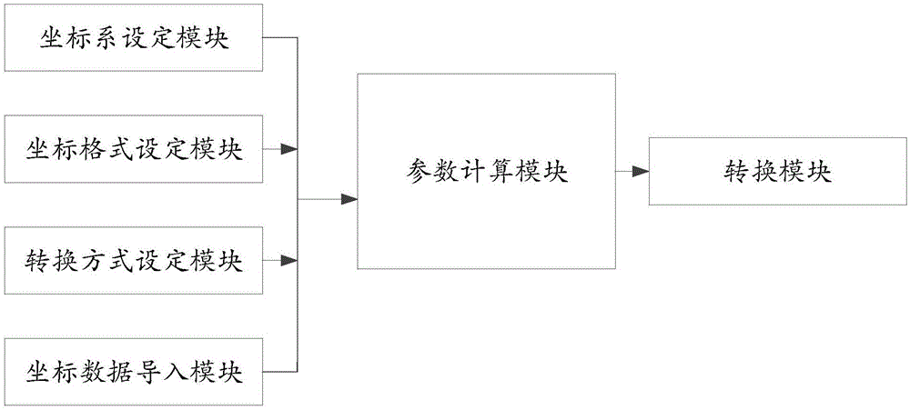
Image

Examples
Embodiment Construction
[0034] The principles and features of the present invention are described below in conjunction with the accompanying drawings, and the examples given are only used to explain the present invention, and are not intended to limit the scope of the present invention.
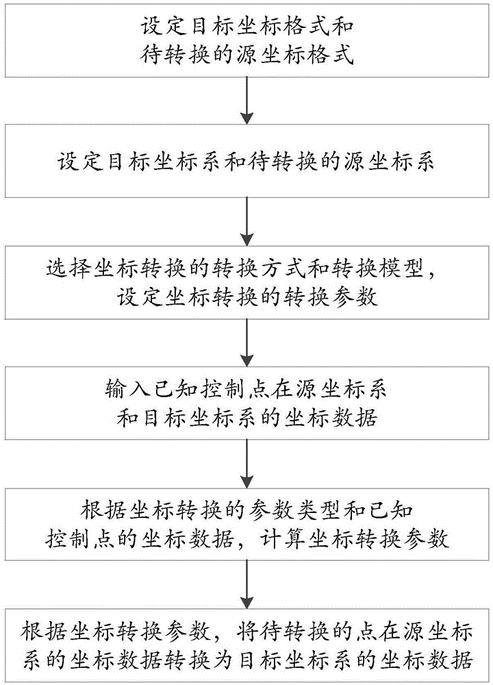
[0035] Such as figure 1 As shown, it is a schematic flow chart of a comprehensive geospatial data coordinate transformation method of the present invention, comprising the following steps:
[0036] Step 1. Set the source coordinate format and target coordinate format;
[0037] Step 2. Set the source coordinate system and the target coordinate system;
[0038] Step 3, select the conversion mode and conversion model of coordinate conversion, and set the conversion parameters of coordinate conversion according to the conversion mode;
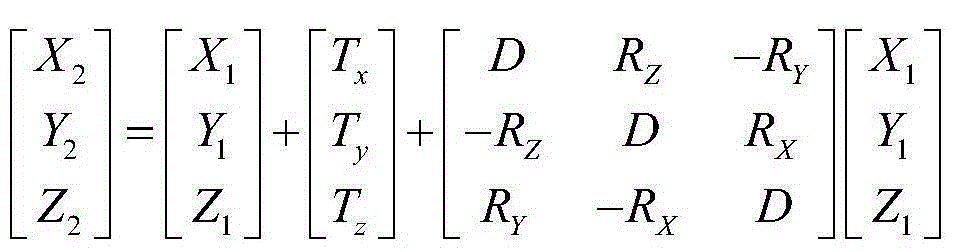
[0039] Step 4. Input the coordinate data of the known control points in the source coordinate system and the coordinate data of the target coordinate system; and input the coordinate d...
PUM
 Abstract
Description
Claims
Application Information