

Urban boundary extraction method fusing multispectral remote sensing data and night light remote sensing data
A technology of remote sensing data and night lights, applied in image data processing, character and pattern recognition, instruments, etc., can solve the problem of not being able to extract city boundaries quickly and accurately
- Summary
- Abstract
- Description
- Claims
- Application Information
AI Technical Summary
Problems solved by technology
Method used
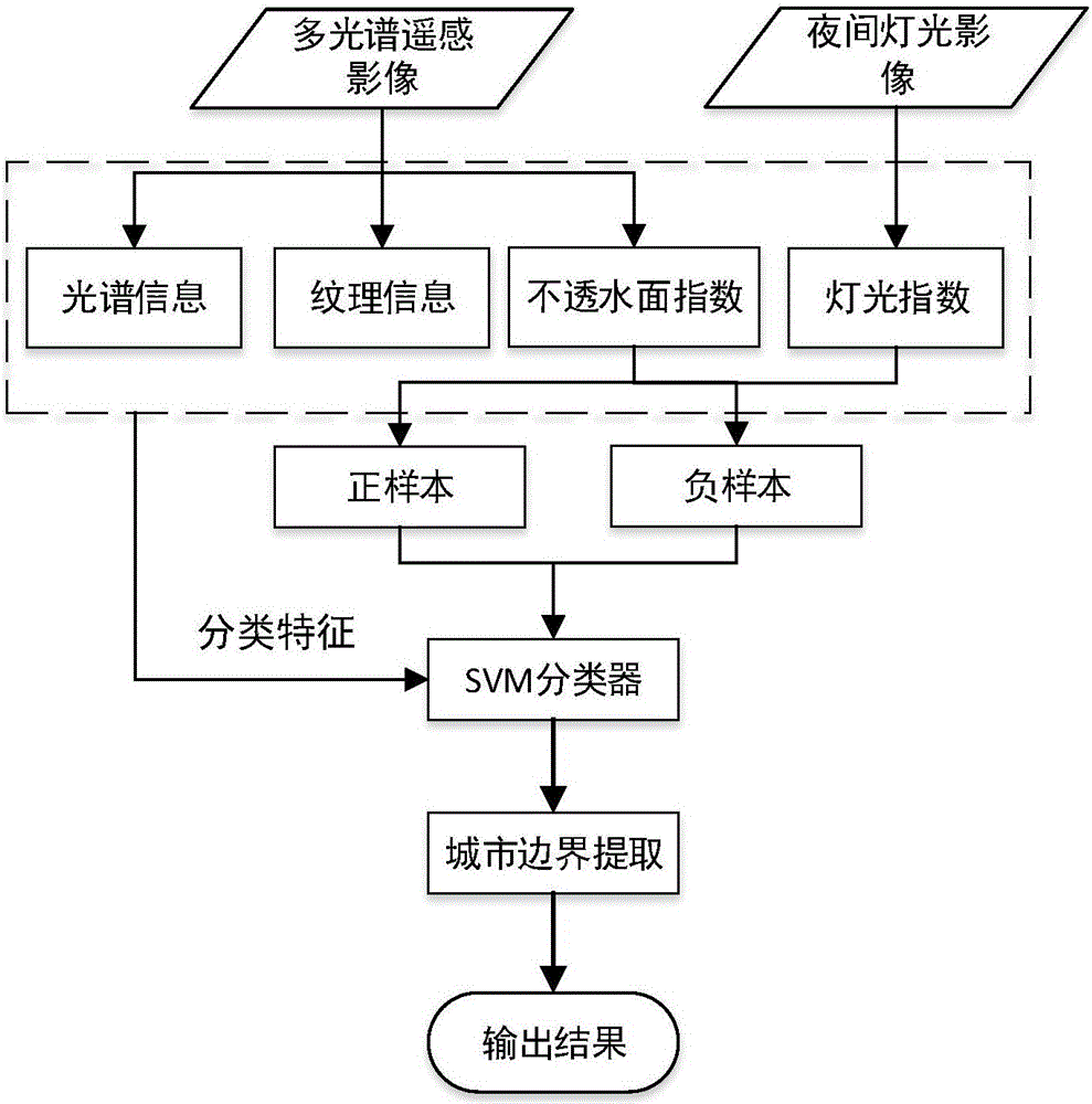
Image

Examples
Embodiment 1
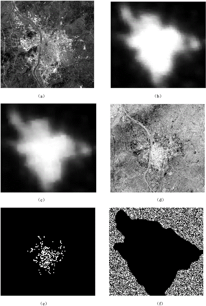
[0092] Embodiment 1: process schematic diagram sees figure 2 .
[0093] (1) Image preprocessing
[0094] right figure 2 (a) and (b), use ENVI software to transform the multispectral remote sensing images and nighttime light remote sensing images into UTM projected coordinate system, and resample the nighttime light remote sensing images to 30 meters, as figure 2 (c) shown.
[0095] (2) Impervious Surface Extraction
[0096] After the multispectral remote sensing image is processed in step 1, the impermeable surface can be extracted. The extraction process is as follows:
[0097] ① Use ENVI software to perform radiometric correction on the multi-spectral remote sensing image, and convert the DN value on the image into reflectance;
[0098] ② Calculate the normalized difference water index MNDWI, the calculation formula is:
[0099] M N D W I = G r e ...
Embodiment 2
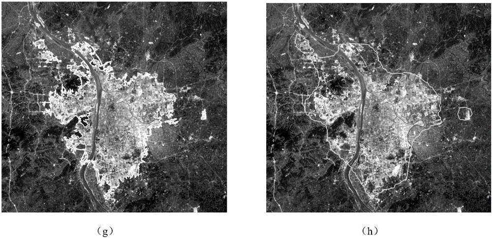
[0123] Embodiment 2: process schematic diagram sees image 3 .
[0124] Its processing step is identical with embodiment 1, and final result figure is as follows image 3 (g) shown.
[0125] The test results of Example 1 and Example 2 are all marked in the figure by solid lines.
[0126] It can be seen that the overall detection effect of the present invention is ideal. In addition, the existing technology (references: XiaoP, WangX, FengX, et al. Detecting China's Urban Expansion Over the Past Three Decades Using Nighttime Light Data [J]. IEEE Journal of Selected Topics in Applied Earth Observations & Remote Sensing, 2014, 7 (10): 4095-4106.) detection results ( figure 2 (h), image 3 (h)) and the results of the present invention ( figure 2 (g), image 3 (g)) for contrast, by statistical correct rate, error rate and kappa coefficient, comparative analysis the present invention is with the advantage of prior art, statistical result sees the following table:
[0127] Em...
PUM
 Abstract
Description
Claims
Application Information