Safety assessment system for river water environment of plain river network
A plain river network and safety assessment technology, applied in data processing applications, instruments, design optimization/simulation, etc., can solve the problem of simple index structure, lack of human activity safety impact and water environment response, water environment safety assessment is rare And other issues
- Summary
- Abstract
- Description
- Claims
- Application Information
AI Technical Summary
Problems solved by technology
Method used
Image
Examples
Embodiment 1
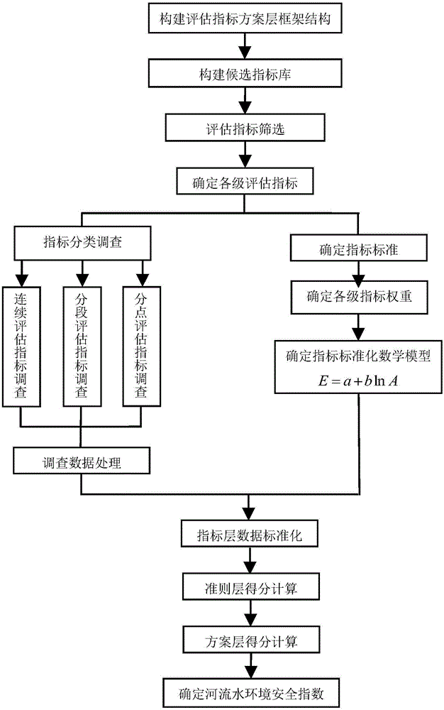
[0068] combine Figure 1-3 , a plain river network and river water environment safety assessment system, its realization steps are as follows:
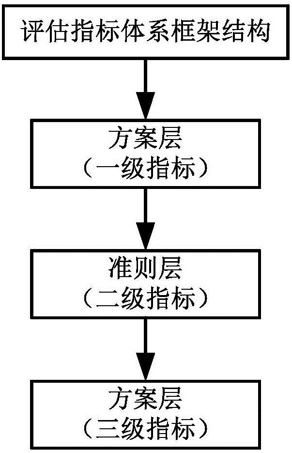
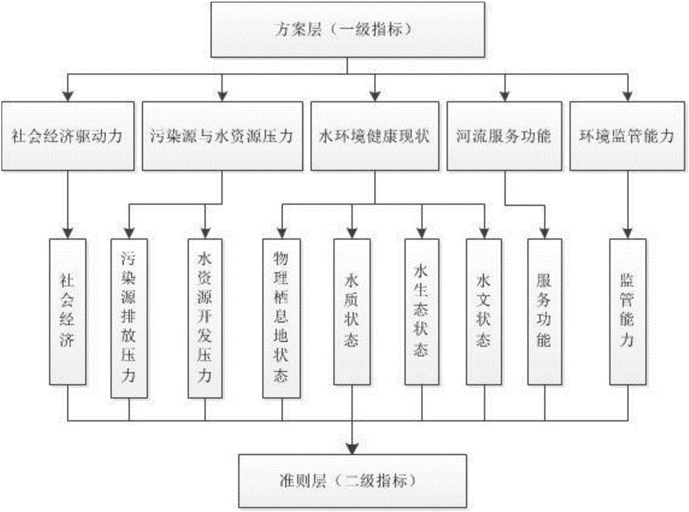
[0069] The first step is to construct the framework structure of the comprehensive evaluation index system for water environment security of rivers in the plain river network area. -Pressure-state-impact-response (DPSIR) model is the theoretical basis, with river water environment safety as the highest goal, and its evaluation index system is divided into three levels of evaluation systems: program level, criterion level, and index level;
[0070] The second step is to build a candidate indicator library;
[0071] The third step is to filter the evaluation indicators;
[0072] The fourth step is to determine the evaluation indicators at all levels;
[0073] The program layer is the first-level index of the evaluation method, including socio-economic driving force D (A1), pollution source and water resource pressure P (A2), water en...
Embodiment 2
[0144] This embodiment is similar to embodiment 1, where the difference is that
[0145] The definitions and calculation methods of the indicators in the indicator layer are as follows:
[0146] Permanent population density (person / km 2 ): Refers to the average population of a certain unit area of land in a certain period of time. The calculation method is the total population of the area / total land area of the area. The calculation formula is as follows:
[0147]
[0148] Per capita GDP (10,000 yuan / km 2 ): That is, per capita gross domestic product, an indicator to measure economic development, an important macroeconomic indicator, and a standard to measure people's living standards. Its calculation formula is as follows:
[0149]
[0150] Proportion of construction land (%): The proportion of construction land area (including traffic and industrial and mining land) in the assessment area to the total area of the assessment area. The calculation formula is as f...
Embodiment 3
[0241] This embodiment is similar to Embodiment 2. Refer to Table 3 for the index construction of the scheme layer, criterion layer, and index layer. The difference is that in the fifth step, four types of index standard determination methods are combined, and the specific standard division refers to Table 7.
[0242] In the seventh step of data investigation, the Taihu Lake Basin is a typical plain river network basin, and a certain river in the upper reaches of Taihu Lake is selected as the object of water environment safety investigation and assessment.
[0243]The river has a total length of 20km and passes through A and B administrative districts. Six sampling sections are set up in the whole river, and the numbers are sample point 1, sample point 2, sample point 3, sample point 4, sample point 5, and sample point 6; x 1 That is, the length of the river section upstream from point 1 is 1.5km, x 2 That is, the length of the river section from No. 1 to No. 2 is 5km, x 3 Th...
PUM
 Abstract
Description
Claims
Application Information
 - R&D
- Intellectual Property
- Life Sciences
- Materials
- Tech Scout
- Unparalleled Data Quality
- Higher Quality Content
- 60% Fewer Hallucinations
Browse by: Latest US Patents, China's latest patents, Technical Efficacy Thesaurus, Application Domain, Technology Topic, Popular Technical Reports.
© 2025 PatSnap. All rights reserved.Legal|Privacy policy|Modern Slavery Act Transparency Statement|Sitemap|About US| Contact US: help@patsnap.com


