

Satellite-ground cooperative in-orbit real-time geometric positioning method and system for optical satellites
An optical satellite and geometric positioning technology, applied in the field of satellite remote sensing data processing, can solve the problems that the internal and platform installation parameters of the optical camera cannot meet the requirements of satellite positioning accuracy, and the geometric calibration cannot be
- Summary
- Abstract
- Description
- Claims
- Application Information
AI Technical Summary
Problems solved by technology
Method used
Image

Examples
Embodiment Construction
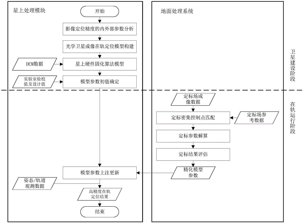
[0063] The technical solution of the present invention will be described in detail below in conjunction with the drawings and embodiments.
[0064] The technical scheme of the invention can adopt computer software to support the automatic operation process. The on-orbit real-time geometric positioning method of the optical satellite in the embodiment of the present invention is as follows: figure 1 As shown, the following steps are described in detail.
[0065] (1) Positioning model construction and algorithm solidification: construct an optical satellite imaging positioning model suitable for on-board real-time processing units, and solidify the algorithm in the on-board hardware environment, and keep the model parameters to update the injection interface.
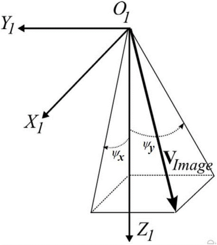
[0066] Further, in step (1), considering the geometric characteristics, statistical characteristics and deformation laws of various errors in the imaging process, an optimized on-orbit imaging positioning model for optic...
PUM
 Abstract
Description
Claims
Application Information