

Nonlinear SAR image geometric correction method based on thin-plate spline interpolation
A thin-plate spline, nonlinear technology, applied in the field of radar, can solve the problems of image distortion, nonlinear error, matching error, etc., and achieve the effect of eliminating interference, improving fitting accuracy, and high correction accuracy.
- Summary
- Abstract
- Description
- Claims
- Application Information
AI Technical Summary
Problems solved by technology
Method used
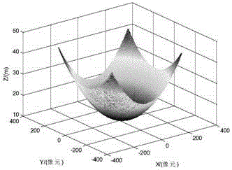
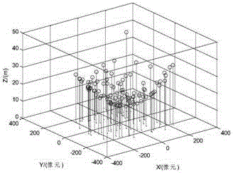
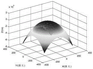
Image

Examples
Embodiment Construction
[0020] The present invention will be described in further detail below with reference to accompanying drawing:
[0021] refer to figure 1 , the implementation steps of the present invention are as follows:
[0022] Step 1, SIFT-Like algorithm extracts feature points.
[0023] There are three main types of image features, namely point, line, and surface. Among them, point feature is one of the most common features, mainly including corner points of houses, edge points of images, intersection points of rivers, roads, etc., point feature extraction method There are Moravec algorithm, Forstner algorithm, SIFT algorithm and its improved algorithm, etc. The present invention utilizes a kind of improved algorithm SIFT-Like of SIFT algorithm to extract the feature points of reference map and airborne real-time map respectively, and its steps are as follows:
[0024] (1a) Using the undistorted image obtained from the spaceborne data as the reference image, generate SAR-Harris scale ...
PUM
 Abstract
Description
Claims
Application Information