A method of reconstructing building outlines from lidar original point cloud

A building and outline technology, applied in the field of building roof outline in discrete point cloud data, can solve the problems of lack of close connection, inability to determine mutual position relationship, non-characteristic of target data, etc.

Active Publication Date: 2019-11-22
AIR FORCE UNIV PLA
View PDF4 Cites 0 Cited by
  • Summary
  • Abstract
  • Description
  • Claims
  • Application Information

AI Technical Summary

Problems solved by technology

The three-dimensional information of the target space acquired by LiDAR technology is discrete point data, and there is no close connection between points. The relationship between the adjacent points that should be the most relevant cannot be determined in the data.
[0007] 2. Non-characteristic problems of target data
For the original discrete point data, it is difficult to use existing methods to quickly extract features to obtain the target area
[0008] 3. Dealing with the regularity of the results

Method used


Image

  • A method of reconstructing building outlines from lidar original point cloud
  • A method of reconstructing building outlines from lidar original point cloud
  • A method of reconstructing building outlines from lidar original point cloud

Examples


Embodiment Construction

[0075] The technical solutions provided by the present invention will be described in detail below in conjunction with specific examples. It should be understood that the following specific embodiments are only used to illustrate the present invention and are not intended to limit the scope of the present invention.

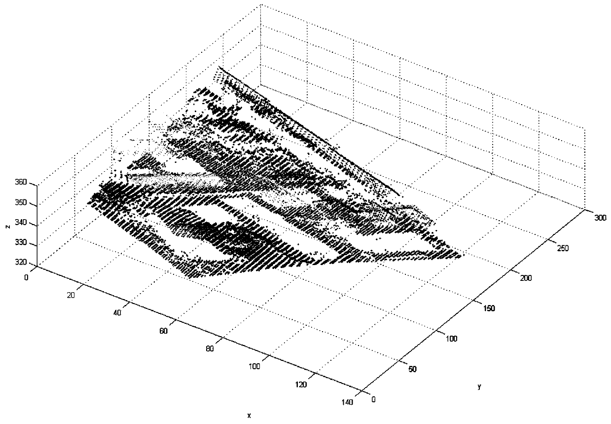
[0076] Raw LiDAR data in one embodiment of the present invention such as figure 1 shown.

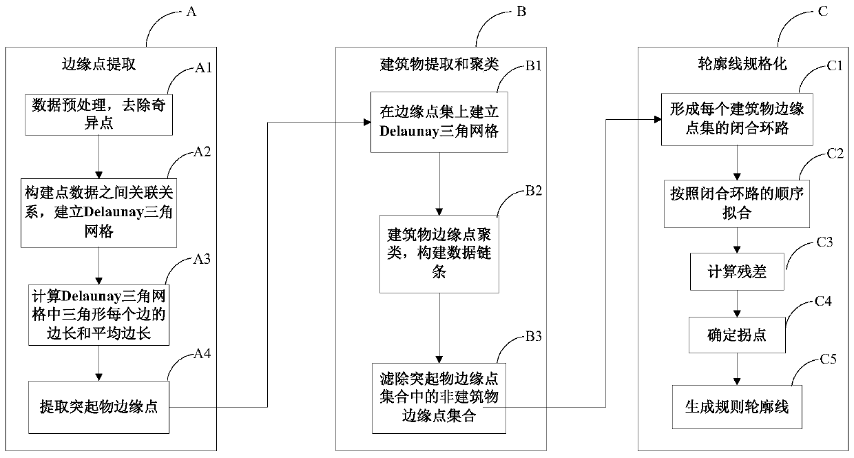
[0077] On the basis of the prior art and the key technical problems to be solved, the present invention proposes a new method for extracting LiDAR original point cloud building outlines, such as figure 2 shown, including:

[0078] Step A: Edge point extraction. On the basis of LiDAR discrete point cloud, construct a triangular grid according to the principle of Delaunay triangulation, establish the association relationship of the data two-dimensional space, calculate the side length of the triangle in the triangulation, and put it in the triangle with the long side in th...


PUM


Abstract

The present invention provides a kind of method of rebuilding LiDAR original point cloud building contour line, comprises on the basis of LiDAR discrete point cloud, constructs triangular grid according to the principle of Delaunay triangular net; Extract two points with relatively large elevation values ​​in the triangle and store them in the form of point pairs; then use the point pairs as "data chain nodes", and form a ring data chain by connecting the "data chain nodes" to complete each protrusion Clustering of object edge points; finally count the number of points in each protruding object point set, and filter out non-building edge point sets; add each point to the fitting data one by one according to the connection order and refit, and use the newly added point The distance from the fitted straight line to the previous step is used as a judgment standard, and finally the intersection points of adjacent fitted sides are connected to obtain the outline of the building; the method of the present invention has high speed, high efficiency and accuracy, and solves the discreteness and Non-characteristic and regular problems of contour line reconstruction.

Description

technical field [0001] The invention relates to a method for extracting the outline of the outer boundary of a building, in particular to a method for reconstructing the outline of the building's roof in the discrete point cloud data obtained by the airborne LiDAR. Background technique [0002] Building outline information has been widely used in many military and civilian related fields, especially in the establishment of urban digital models and planning management, the design of traffic lines, the survey of power lines, the detection and analysis of terrain, forest supervision, etc. As well as the field of precision target strike and damage effect assessment in modern combat plays an important role. [0003] LiDAR is a laser radar detection system that uses the Global Positioning System (GPS, Global Position System) and the Inertial Measurement Unit (IMU, Inertial Measurement Unit) to perform laser scanning to obtain three-dimensional information of the target. The data ...

Claims


Application Information

Patent Timeline
Patent Type & Authority Patents(China)
IPC IPC(8): G06K9/00G06K9/46
CPCG06V20/176G06V10/44
Inventor 程英蕾聂玉泽何曼芸邱浪波王黎光王晓薇胡丹赵忠阳
Owner AIR FORCE UNIV PLA
Why Eureka
Try Eureka