Supercharge Your Innovation With Domain-Expert AI Agents!

A Compensation Method for Geomagnetic Field Model Errors Applied in Geomagnetic Navigation

A geomagnetic navigation and model error technology, which is applied in the field of satellite autonomous navigation, can solve problems such as unsuitable engineering applications, and achieve strong engineering application value, high navigation accuracy, and broad engineering application prospects

Active Publication Date: 2019-08-20
NAT SPACE SCI CENT CAS
View PDF3 Cites 0 Cited by
  • Summary
  • Abstract
  • Description
  • Claims
  • Application Information

AI Technical Summary

Problems solved by technology

However, since the model has as many as N*(N+2) spherical harmonic coefficients (N is the order of Gaussian spherical harmonic coefficients), the real-time estimation of so many state variables is a great challenge to the computing power of the on-board computer , and this method is not suitable for engineering applications

Method used


Image

  • A Compensation Method for Geomagnetic Field Model Errors Applied in Geomagnetic Navigation
  • A Compensation Method for Geomagnetic Field Model Errors Applied in Geomagnetic Navigation
  • A Compensation Method for Geomagnetic Field Model Errors Applied in Geomagnetic Navigation

Examples


Embodiment 1

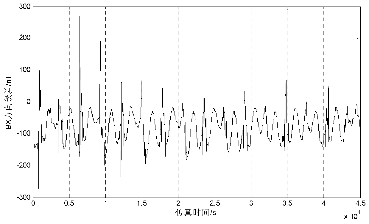
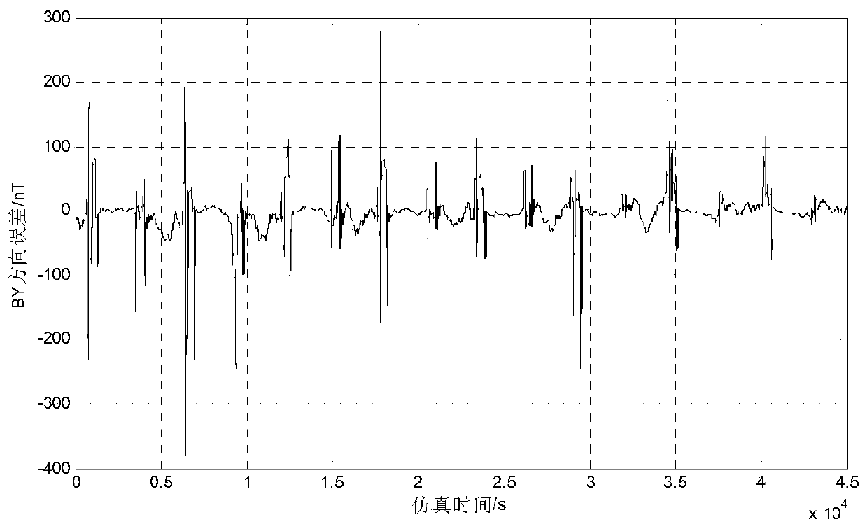
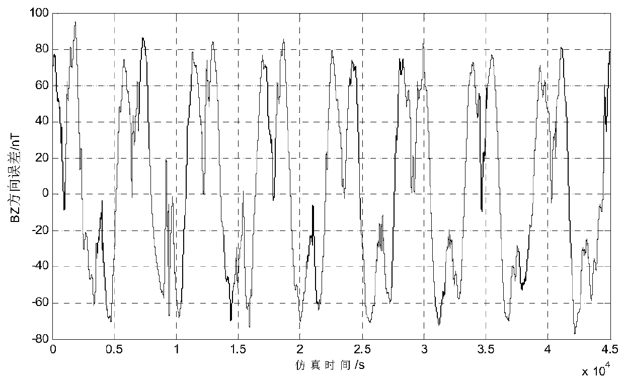
[0083] In this embodiment, the geomagnetic navigation process of using the method of the present invention to compensate the error of the geomagnetic field model is as follows: Figure 7Shown: first establish the measurement equation of the system and the state equation based on the orbital dynamics equation in the earth's fixed coordinate system, and then use the attitude information of the satellite to convert the magnetometer's measurement data into coordinates, and the geomagnetic field model The measurement residuals are obtained after the output of the difference, and input into the designed extended Kalman filter as the navigation correction information together with the state equation and the measurement equation, and finally the navigation information with high precision is obtained. The compensation method proposed by the present invention is used in the stabilized filter, such as Figure 7 As shown, the specific implementation includes three steps: acquiring measure...


PUM


Abstract

The invention provides a geomagnetic field model error compensation method applied to geomagnetic navigation. The method includes the steps of: A. finding change rule of the error relative to geographic latitude by analyzing the error between geomagnetic field measurement data and geomagnetic field model output data when a geomagnetic navigation filtering algorithm enters convergence period; B. through Fourier transform, performing frequency identification to the error data, and performing data fitting on the basis of main frequency to obtain a mathematic model of the geomagnetic field model error; and C. on the basis of the mathematic model, performing real-time prediction and compensation to the geomagnetic field model error during the wave filtering process with combination of the change rule between the geomagnetic field error data and the geographic latitude, thereby finally increasing precision of geomagnetic navigation.

Description

technical field [0001] The invention relates to the technical field of satellite autonomous navigation, in particular to a method for compensating errors of geomagnetic field models applied in geomagnetic navigation. Background technique [0002] Geomagnetic navigation obtains orbit correction information by comparing the measured value of the magnetometer on the planet with the output value (predicted value) of the geomagnetic model. Using this correction information, the orbit can be determined, and the purpose of autonomous navigation of the spacecraft can be achieved. Geomagnetic navigation is an important autonomous navigation method for near-Earth spacecraft, which can realize the autonomous determination of spacecraft position, velocity and attitude information. Compared with traditional GPS satellite navigation, it has the advantages of strong anti-interference ability and strong concealment; compared with inertial navigation, geomagnetic navigation error does not ac...

Claims


Application Information

Patent Timeline
Patent Type & Authority Patents(China)
IPC IPC(8): G01C25/00
Inventor 张涛高东周敬
Owner NAT SPACE SCI CENT CAS
Features
  • R&D
  • Intellectual Property
  • Life Sciences
  • Materials
  • Tech Scout
  • Unparalleled Data Quality
  • Higher Quality Content
  • 60% Fewer Hallucinations
Learn More