
Satellite positioning system and positioning method

A satellite positioning system and server technology, applied in the field of satellite positioning, can solve problems such as weak signal, inaccurate satellite signal receiver clock, easy to be interfered by the atmosphere and ionosphere

Pending Publication Date: 2017-07-07
SUZHOU MIAOXUAN UAV APPL CO LTD
View PDF4 Cites 1 Cited by
  • Summary
  • Abstract
  • Description
  • Claims
  • Application Information

AI Technical Summary

Problems solved by technology

Because these satellites are always in motion, there is an error in the geometry of the triangulation
Another problem with satellite positioning and navigation is that the signal is very weak, the signal cannot enter buildings and is easily interfered by the atmosphere and ionosphere
The inaccuracy of the satellite signal receiver's own clock will also lead to positioning errors

Method used


Image

  • Satellite positioning system and positioning method
  • Satellite positioning system and positioning method

Examples


Embodiment Construction

[0022] The present invention will be described in detail below in conjunction with the implementations shown in the drawings, but it should be noted that these implementations are not limitations of the present invention, and those of ordinary skill in the art based on the functions, methods, or structural changes made by these implementations Equivalent transformations or substitutions all fall within the protection scope of the present invention.

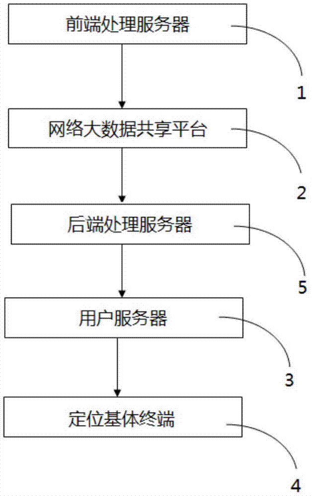
[0023] like figure 1 As shown, the satellite positioning system includes:

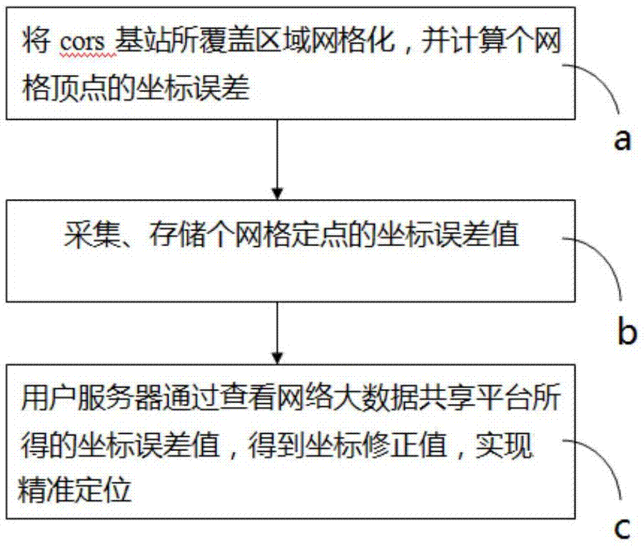
[0024] Front-end processing server 1, which is used to grid the area covered by the cors base station, and calculate the coordinate error of each grid vertex;

[0025] Network big data sharing platform 2, which is used to collect and store the coordinate error value obtained by the front-end processing server;

[0026] The user server 3, the user server 1 obtains the coordinate correction value by checking the coordinate error value obtained by the netwo...


PUM


Abstract

The invention provides a satellite positioning system and a positioning method, which relate to the technical field of satellite positioning. The satellite positioning system comprises a front-end processing server, a network big data sharing platform and a user server wherein the front-end processing server is used for gridding a coverage area of a cors base station, and calculating coordinate errors of grid vertexes; the network big data sharing platform is used for acquiring and storing coordinate error values obtained by the front-end processing server; the user server obtains a coordinate correction value through checking the coordinate error values obtained by network big data sharing platform, and realizes precise positioning; and the front-end processing server is connected with the network big data sharing platform by means of a communication link, and the user server is connected with the network big data sharing platform through an Internet network. The satellite positioning system and the positioning method are capable of using duplicate data and historical data on the premise of precise positioning, saving lookup time, improving efficiency, reducing cost, and improving information flowability.

Description

technical field [0001] The invention relates to the technical field of satellite positioning, in particular to a satellite positioning system and a positioning method. Background technique [0002] At present, satellite positioning technology has been widely used at home and abroad. Since the transmission and reception of satellite signals are easily affected by the environment (blocked by terrain and ground objects), the positioning accuracy is reduced, especially in large cities with tall buildings and overpasses. The positioning error of satellite positioning signals is too large in many places. Can't even locate. [0003] Current positioning systems include the GPS system of the United States, the Galileo system of Europe, the GLONASS system of Russia, and the Beidou system of China. These systems are composed of satellites in low Earth orbit. The accuracy of the positioning is determined by the geometry of the triangulation. Because these satellites are always in mo...

Claims


Application Information

Patent Timeline
IPC IPC(8): G01S19/01H04W64/00
CPCH04W64/003G01S19/01
Inventor 阮征
Owner SUZHOU MIAOXUAN UAV APPL CO LTD
Learn More