Method for production of high spatial and temporal resolution NDVI based on spatial and temporal weight

A time-space resolution and time resolution technology, applied in the field of multi-source remote sensing data fusion, can solve problems such as not considered, and achieve the effect of improving accuracy and fusion accuracy

Inactive Publication Date: 2017-08-29
BEIJING NORMAL UNIVERSITY
View PDF3 Cites 22 Cited by
  • Summary
  • Abstract
  • Description
  • Claims
  • Application Information

AI Technical Summary

Problems solved by technology

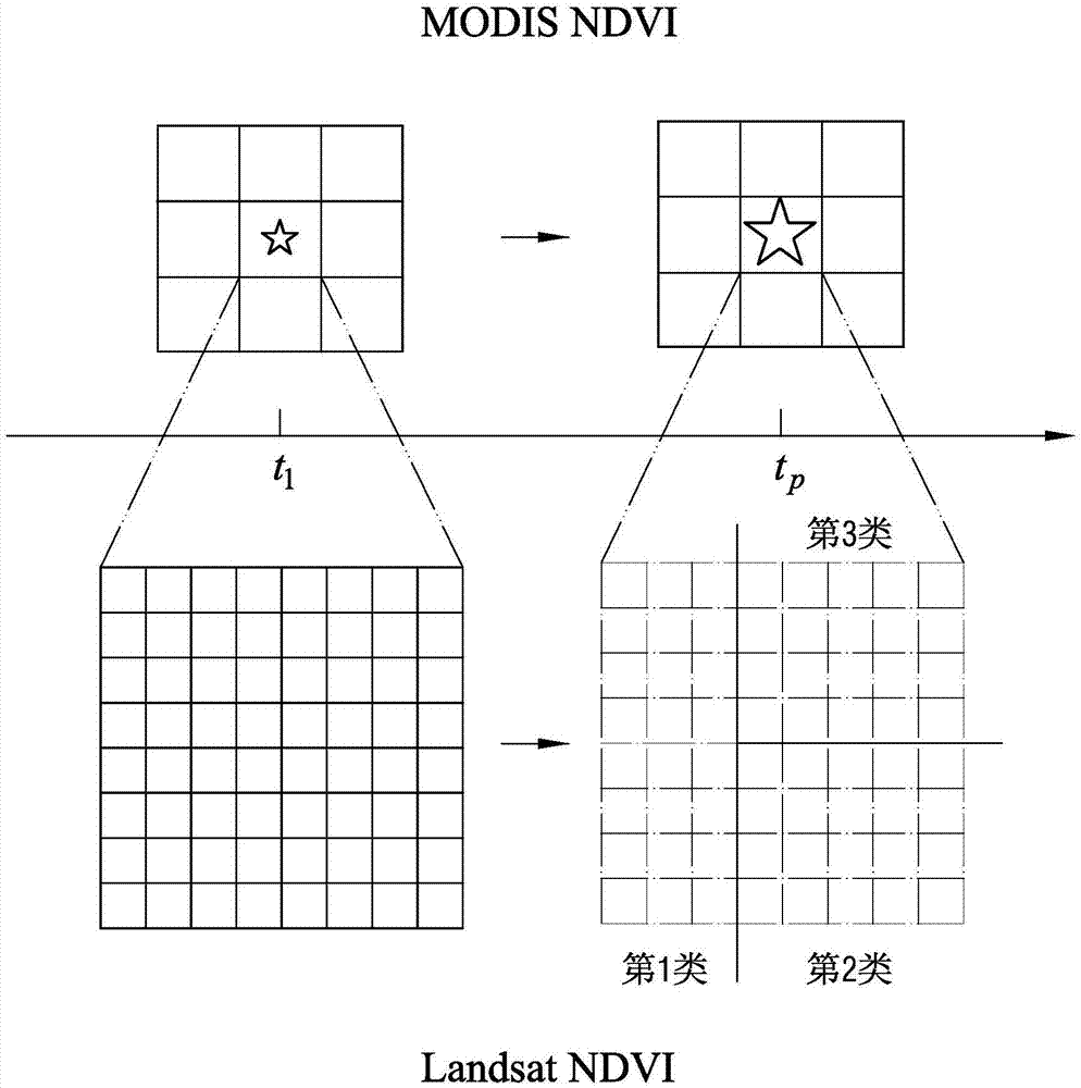
However, none of them considered the method of using two periods of low spatial resolution data to interpolate to high spatial resolution. The increment between the two periods of interpolation results can reflect the increment of the pixel scale to a certain extent, and it also includes land Information on Coverage Changes

Method used


Image

  • Method for production of high spatial and temporal resolution NDVI based on spatial and temporal weight
  • Method for production of high spatial and temporal resolution NDVI based on spatial and temporal weight
  • Method for production of high spatial and temporal resolution NDVI based on spatial and temporal weight

Examples


Embodiment Construction

[0042] In order to have a clearer understanding of the technical features, purposes and effects of the present invention, the specific implementation manners of the present invention will now be described with reference to the accompanying drawings. But those skilled in the art should know that the following examples are not the sole limitation to the technical solution of the present invention, and any equivalent transformation or modification made under the spirit of the technical solution of the present invention should be considered as belonging to the protection of the present invention scope.

[0043] The principle of the method for producing high spatio-temporal resolution NDVI based on spatio-temporal weighting provided by the present invention will be described in detail below. Of course, it is the same as the three types of methods for fusing Landsat NDVI data and MODIS NDVI data described in the background section. The present invention is also a method for fusing r...


PUM


Abstract

The present invention provides a method for production of high spatial and temporal resolution NDVI (Normalized Difference Vegetation Index) based on spatial and temporal weight. The method comprises: NDVI data with a low spatial and temporal resolution at t1 time, NDVI data with a high spatial and temporal resolution and NDVI data with a low spatial and temporal resolution at tp time are subjected to mixed pixel decomposition and spatial interpolation to obtain two NDVI increments with the high spatial and temporal resolution data in time domain; employing Bayesian model average method to perform weight combination calculation of the two DNVI increments, and obtaining the NDVI synthesis increment of each pixel; and finally adding the NDVI synthesis increment to the NDVI with the high spatial and temporal resolution to obtain required NDVI with the high spatial and temporal resolution. The two NDVI increments are subjected to Bayesian integration, and the spatial and temporal relationship between geographical data is fully employed to provide an effective method for production of vegetation indexes with the high spatial and temporal resolution.

Description

technical field [0001] The invention relates to a multi-source remote sensing data fusion method, which is mainly used to produce a normalized difference vegetation index (NDVI) with high temporal and spatial resolution, and belongs to the category of temporal and spatial data fusion. Background technique [0002] The Normalized Difference Vegetation Index (NDVI for short) is a widely used vegetation index. NDVI values ​​can reflect the growth status of vegetation and are directly related to physiological parameters of vegetation such as chlorophyll content, water content and leaf area index. [0003] CN 102831310 B discloses a method for constructing high-spatial-resolution time-series data. Its background technology section describes the relevant knowledge of NDVI data in detail, and mentions two existing NDVI data: Landsat NDVI data and MODIS NDVI data data. Among them, the spatial resolution of NDVI values ​​in Landsat NDVI data is 30m*30m, and the time resolution is 1...

Claims


Application Information

Patent Timeline
Patent Type & Authority Applications(China)
IPC IPC(8): G06T3/40G06T5/50
CPCG06T3/4053G06T5/50G06T2207/10028G06T2207/20221G06T2207/30181
Inventor 曹鑫刘梦陈晋陈学泓杨林清
Owner BEIJING NORMAL UNIVERSITY
Why Eureka
Try Eureka