Fast fusion operation method for multi-source spatial data

An operation method and source space technology, applied in the field of multi-source spatial data fusion, can solve the problems of inconsistent format and resolution, time-consuming, etc., and achieve the effect of simple operation, low cost, and wide application

Inactive Publication Date: 2017-12-01
XINJIANG UNIVERSITY
View PDF7 Cites 12 Cited by
  • Summary
  • Abstract
  • Description
  • Claims
  • Application Information

AI Technical Summary

Problems solved by technology

However, data such as soil, topography, and vegetation distribution often have different sources, formats, or resolutions. If they are processed separately, it is not only time-consuming, but also involves multiple repeated operations.
Therefore, we need a multi-source spatial data fusion method, which

Method used


Image

  • Fast fusion operation method for multi-source spatial data
  • Fast fusion operation method for multi-source spatial data
  • Fast fusion operation method for multi-source spatial data

Examples


Embodiment

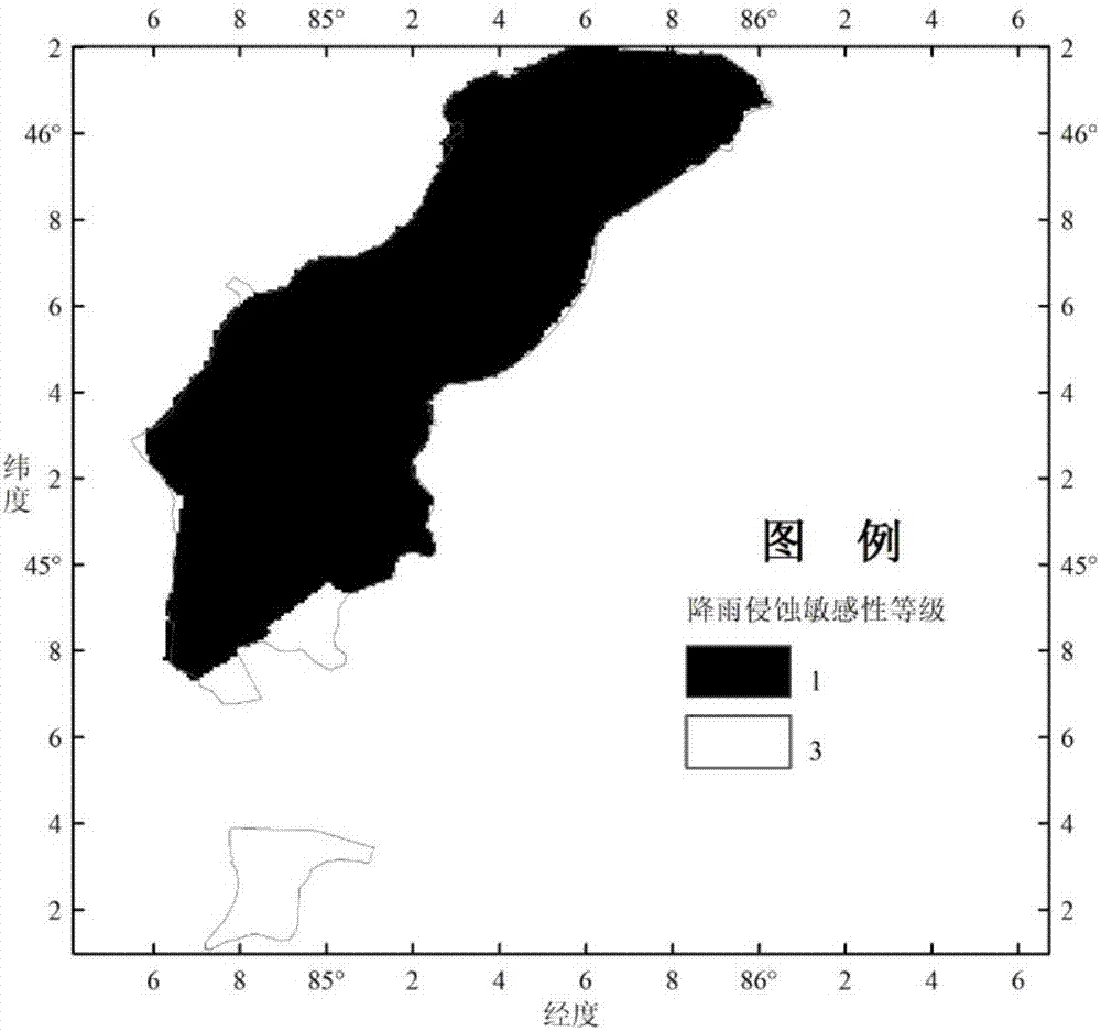
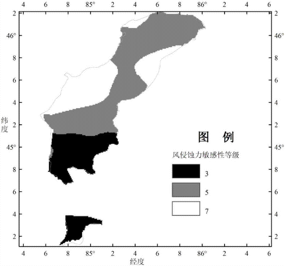
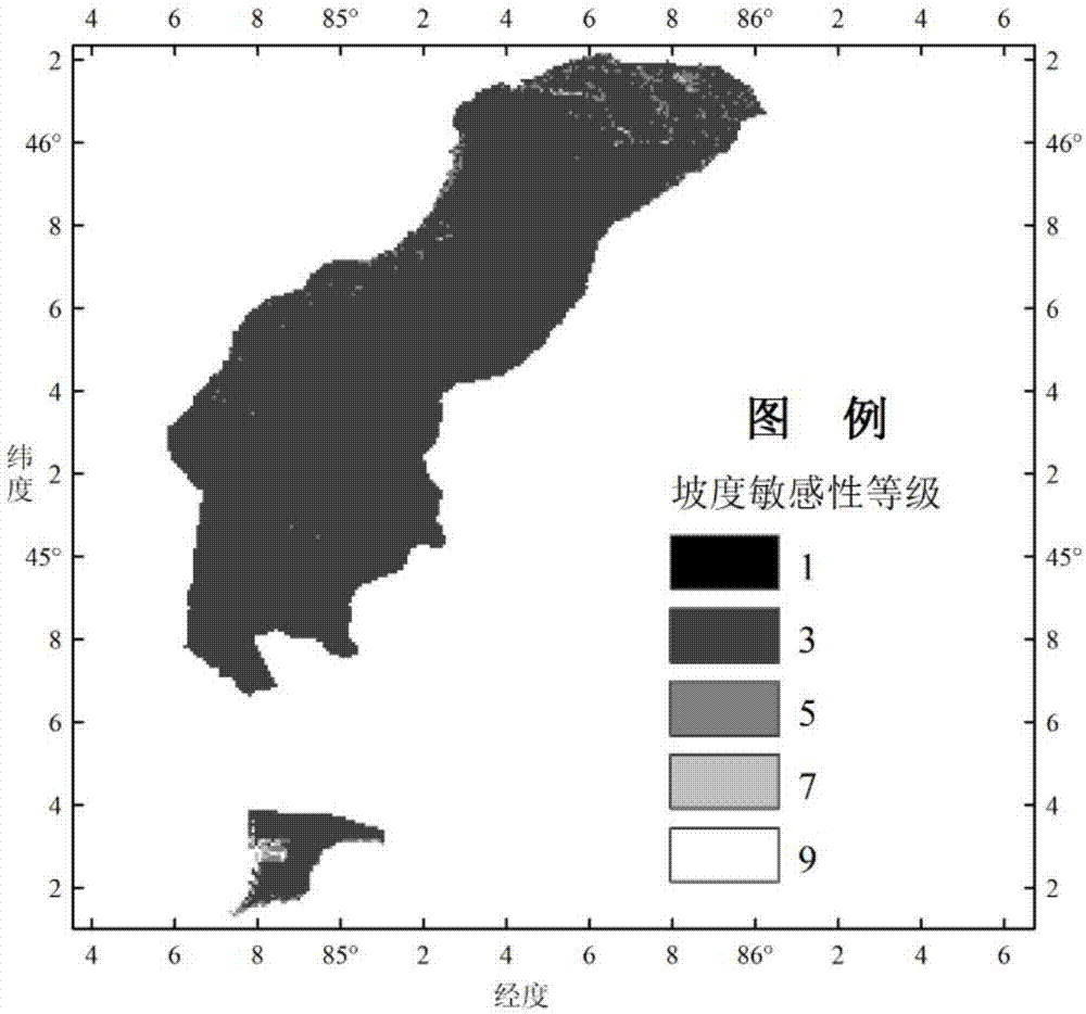
[0031]Taking Karamay's ecological sensitivity evaluation as an embodiment of the present invention: first, obtain the raster data such as Karamay's vegetation coverage (NDVI), soil texture, slope, precipitation erosion, drought sensitivity, gale days, and land use type, industrial and mining land and water. Resource distribution and other vector data. Karamay multi-source spatial data includes multi-source remote sensing data (soil texture, vegetation), multi-source meteorological data (precipitation, wind speed), topographic data (elevation). These multi-source spatial data are mainly raster data in NetCDF format, mainly from different research organizations, such as meteorological data from the China National Meteorological Administration, geographic data and vegetation data from NASA. If some of the data is not in NetCDF format, but in text format or Excel data table. It can read text data or Excel data to generate NetCDF format raster data through NCL language programming...


PUM


Abstract

The invention discloses a fast fusion operation method for multi-source spatial data. The method comprises the following steps of data format conversion, data rasterization, data normalization and data fusion. Data of different formats are converted into raster data files in the NetCDF network universal data format. The R-language program design is applied, and the unified space resolution and grid coordinates are adopted for different raster data layers. The raster data of all layers are standardized, and normalized data sources at the same spatial geographic position are obtained. The resolution ratios and the spatial geographical grids of data layers different in source and format are unified. The R-language program design is applied for cutting different data layers through adopting a vector polygon in a research area, and then a polygonal data layer in the NetCDF format is obtained. According to weight coefficients corresponding to each data layer assigned by a research target, a mathematical model is built. According to the mathematical model, the numerical calculation is carried out to obtain the spatial distribution of an objective function. The method is simple to operate, rapid, efficient, wide in application range and low in cost.

Description

technical field [0001] The invention belongs to the technical field of multi-source spatial data fusion, and relates to a fast fusion operation method for multi-source spatial data. Background technique [0002] The emergence of multi-source spatial data such as different formats, different elements, and different resolutions in research work in the fields of physical and human geography, ecology, and meteorology has brought new challenges to data processing and analysis. Due to the complexity and variety of spatial data, in related research and analysis, data processing often lags behind data acquisition, that is, people's analysis and utilization of remote sensing data lag far behind the speed of data source increase, which directly affects a large number of people with high Benefits of using cost data. As global changes continue to intensify and science and technology develop rapidly, it is urgent to explore a technology that can integrate multi-element data such as ecol...

Claims


Application Information

Patent Timeline
IPC IPC(8): G06K9/62G06F17/30
CPCG06F16/29G06F18/251
Inventor 张雪妮殷刚李周康吕光辉
Owner XINJIANG UNIVERSITY
Why Eureka
Try Eureka