Mass vector data access and rendering method, electronic device and storage medium
A vector data and data access technology, applied in the field of geographic information systems, can solve the problems of slow processing speed of massive data, and achieve the effects of fast rendering speed, reduced consumption, and fast access speed
- Summary
- Abstract
- Description
- Claims
- Application Information
AI Technical Summary
Problems solved by technology
Method used
Image

Examples
Embodiment
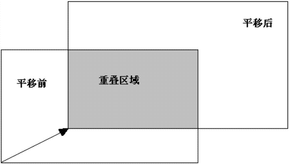
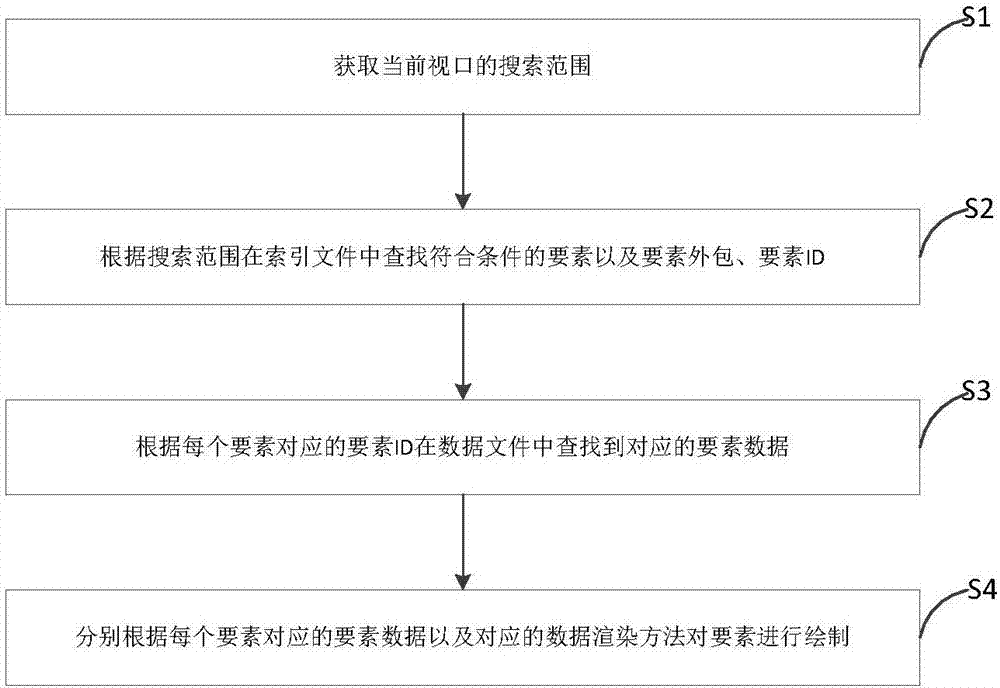
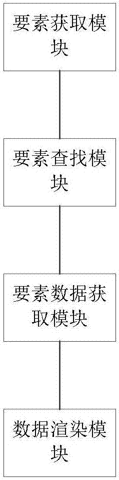
[0061] Based on the defects of data access and rendering in the prior art, the present invention firstly provides a storage format of data, specifically as follows: a complete SGDB (full name South Gis DataBase) stores all data in a separate in the file. That is, the data in the geographic information system is stored in the form of files, that is, data files. The data refers to the attribute information corresponding to each element in the geographic information system, such as size, size, color, etc. The element here refers to the smallest unit of drawing in the geographic information system, and the element can be divided into four types: point, line, area and text annotation. The concept of layers is defined in the map, and elements of the same type form a layer. Each layer can be stored in a file with suffixes of pt, pl, pg, and an respectively. The file name is the layer name, and When storing, geometric information is serialized by type. For example, it is necessary t...
PUM
 Abstract
Description
Claims
Application Information