Information extraction method of traffic signs based on fusion of laser point cloud and image data
A technology for laser point cloud data and image data, which is applied in the fields of laser remote sensing and image processing, and can solve the problems of difficulty in positioning the area of interest, dealing with interference, and general effects.
- Summary
- Abstract
- Description
- Claims
- Application Information
AI Technical Summary
Problems solved by technology
Method used
Image
Examples
Embodiment Construction
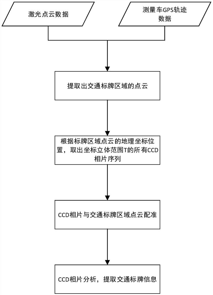
[0038] The technical scheme of the present invention will be analyzed and described in detail below in conjunction with the accompanying drawings and the embodiments of the present invention. For specific implementation, the steps and procedures are as attached figure 1 , the implementation process of the embodiment can be summarized as the following four steps:
[0039] Step 1: Extract the point cloud of the traffic sign area from the original laser point cloud data. Considering that the large number of point clouds is not conducive to the later calculation and processing, the laser point cloud data needs to be filtered first.
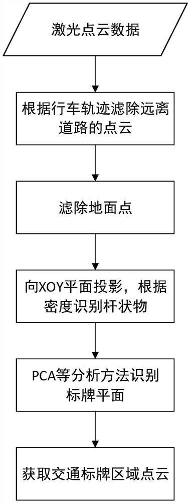
[0040] Such as figure 2 As shown, first, according to the road width requirements in the urban road indicators promulgated by the state, combined with the two data of vehicle GPS trajectory and inertial navigation direction (the mobile measurement vehicle is equipped with GPS and inertial navigation equipment, and these data can be obtained in real ...
PUM
 Abstract
Description
Claims
Application Information
 - R&D
- Intellectual Property
- Life Sciences
- Materials
- Tech Scout
- Unparalleled Data Quality
- Higher Quality Content
- 60% Fewer Hallucinations
Browse by: Latest US Patents, China's latest patents, Technical Efficacy Thesaurus, Application Domain, Technology Topic, Popular Technical Reports.
© 2025 PatSnap. All rights reserved.Legal|Privacy policy|Modern Slavery Act Transparency Statement|Sitemap|About US| Contact US: help@patsnap.com


