Thermal infrared fusion reconstruction method based on hyperspectral image

A hyperspectral image and thermal infrared technology, applied in the field of remote sensing, can solve the problem that the high spatial resolution of thermal infrared images cannot be guaranteed, and achieve the effect of improving the spatial resolution

Active Publication Date: 2018-04-27
SHENZHEN ENVIRONMENTAL MONITORING CENT
View PDF5 Cites 6 Cited by
  • Summary
  • Abstract
  • Description
  • Claims
  • Application Information

AI Technical Summary

Problems solved by technology

[0004] The purpose of the present invention is to provide a thermal infrared fusion reconstruction method based on hyperspectral images, which can solve the problem that the high spatial resolution of thermal infrared images cannot be guaranteed in the acquisition of remote sensing images in the prior art

Method used


Image

  • Thermal infrared fusion reconstruction method based on hyperspectral image
  • Thermal infrared fusion reconstruction method based on hyperspectral image
  • Thermal infrared fusion reconstruction method based on hyperspectral image

Examples


Embodiment 1

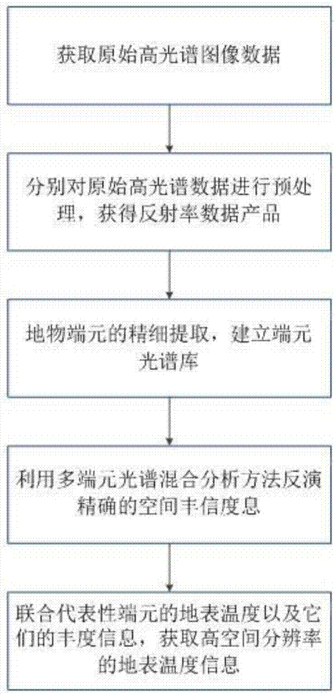
[0036] Such as figure 1 As shown, the thermal infrared fusion reconstruction method based on hyperspectral image of the present invention comprises the following steps:

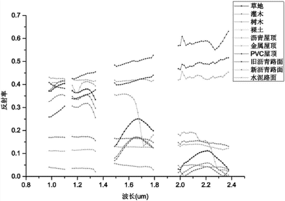
[0037] A: Select pure end members according to the spectral reflectance characteristics and thermal response characteristics of urban materials;

[0038] B: Retrieve accurate spatial abundance information of ground objects by using multi-terminal spectral hybrid analysis method;

[0039] C: Obtain a high spatial resolution surface temperature image by combining the surface temperature of representative endmembers and their spatial abundance information;

[0040] Wherein, the selection of pure endmembers described in A includes the following steps:

[0041] A1: Select representative end-members with unique spectral reflectance and surface temperature, including the selection of three main urban land cover types: vegetation, soil and impervious surface;

[0042] A2: In the actual field sampling, use the GPS ...

Embodiment 2

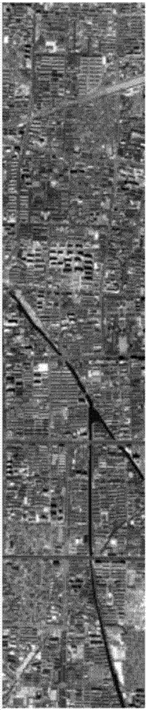
[0056] Such as figure 2 As shown, the method for obtaining hyperspectral image data using a hyperspectral sensor includes the following steps: In this embodiment, taking the reconstruction of an 8-meter-resolution surface temperature image using an aerial sensor SASI hyperspectral image as an example, there are 101 bands in total, and the spatial resolution The rate is 8 meters, and the width is 1.6km; to obtain the original hyperspectral image data.

Embodiment 3

[0058] Preprocess the original hyperspectral image separately to obtain reflectance data. In this embodiment, the preprocessing steps for the original SASI data are: first remove bad lines and bands, and then use FLAASH and other atmospheric correction software modules to perform reflection Rate inversion to obtain reflectance data, and finally remove the low signal-to-noise ratio, strong water vapor absorption and oxygen absorption bands, and retain 70 bands between 950-2450nm.


PUM


Abstract

The invention relates to the technical field of remote sensing, and particularly relates to a thermal infrared fusion reconstruction method based on a hyperspectral image. The method comprises the following steps: A, pure endmembers are selected based on spectral reflectance characteristics and thermal response characteristics of an urban material; B, a multi-endmember spectral mixed analysis method is used to invert accurate terrain spatial abundance information; and C, through the surface temperature of joint representative endmembers and the spatial abundance information of the endmembers,a surface temperature image with a high spatial resolution is acquired. In the technical scheme of the invention, through a data fusion means, based on a hyperspectral remote sensing data reconstruction theory, the urban surface temperature image with a high spatial resolution is obtained, the image can significantly improve the spatial resolution of the urban temperature, and research on a seriesof problems brought about by an urban heat island and global changes can be done conveniently.

Description

technical field [0001] The invention relates to the technical field of remote sensing, in particular to a hyperspectral image-based thermal infrared fusion reconstruction method. Background technique [0002] Thermal infrared remote sensing data provides a large amount of thermal infrared information of ground objects, which is beneficial to urban heat island research and quantitative remote sensing analysis. However, thermal infrared remote sensing has not been widely applied and popularized in the urban field so far. And quantum efficiency and other issues, there are still some difficulties in the manufacture of infrared focal plane devices with high density and small pixel size. The frequency has a certain limit, and the infrared image will cause signal aliasing due to undersampling, resulting in blurred infrared image and low spatial resolution, which greatly restricts its application ability. [0003] At present, the method of data fusion is mainly used to solve the pr...

Claims


Application Information

Patent Timeline
Patent Type & Authority Applications(China)
IPC IPC(8): G01J5/00G06T11/20
CPCG01J5/00G01J2005/0077G06T11/203Y02A30/60
Inventor 刘凯梁鸿王伟民马嵩明珠潘晓峰许旺周志彬余欣繁唐力熊向陨曾清怀赖标汶彭青荣尹淳阳
Owner SHENZHEN ENVIRONMENTAL MONITORING CENT
Why Eureka
Try Eureka