

A method and system for calculating ground resolution of Gaofen-4 images with different orientations
A technology of ground resolution and calculation method, applied in the field of remote sensing image processing, can solve problems such as inconsistent ground resolution, and achieve reasonable changes in ground resolution.
- Summary
- Abstract
- Description
- Claims
- Application Information
AI Technical Summary
Problems solved by technology
Method used
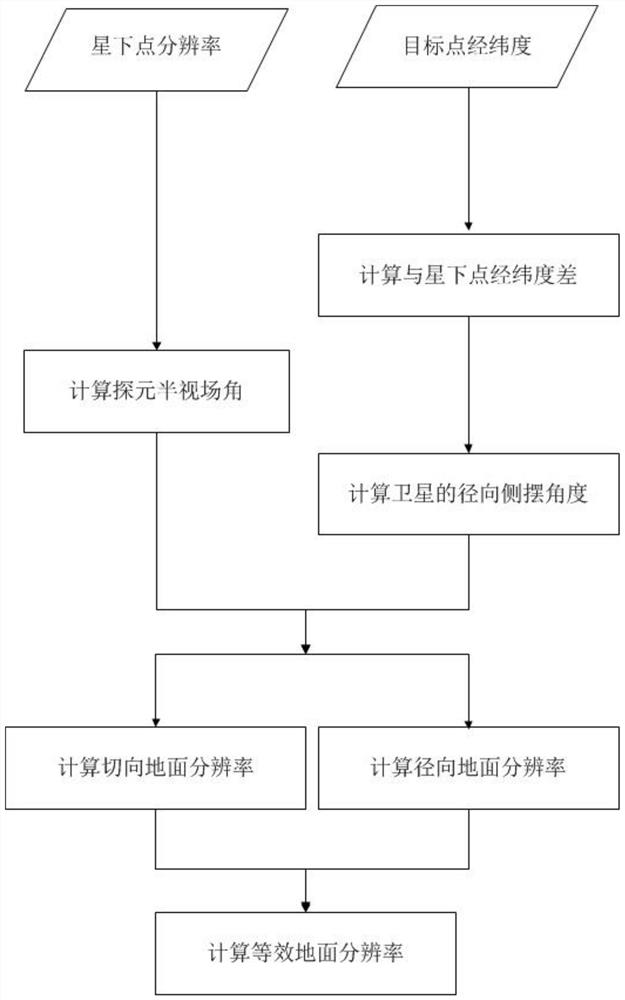
Image

Examples
Embodiment
[0105] Assuming that the coordinates of the point of interest are 120 degrees east longitude and 40 degrees latitude, the steps of calculating the ground resolution of the Gaofen No. 4 image at the point of interest are as follows with reference to the steps of the present invention:
[0106] constant:
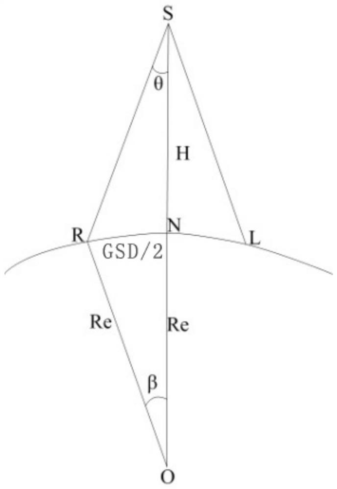
[0107] Earth radius Re=6371km
[0108] Satellite orbit height H=35786km
[0109] Sub-satellite point ground resolution GSD 星下点 =48.62m
[0110] (1) According to the sub-satellite point resolution of the GF-4 image, calculate the half-field angle of the probe;
[0111]
[0112]
[0113] After iterative calculation θ i+1 =6.7932×10 -7
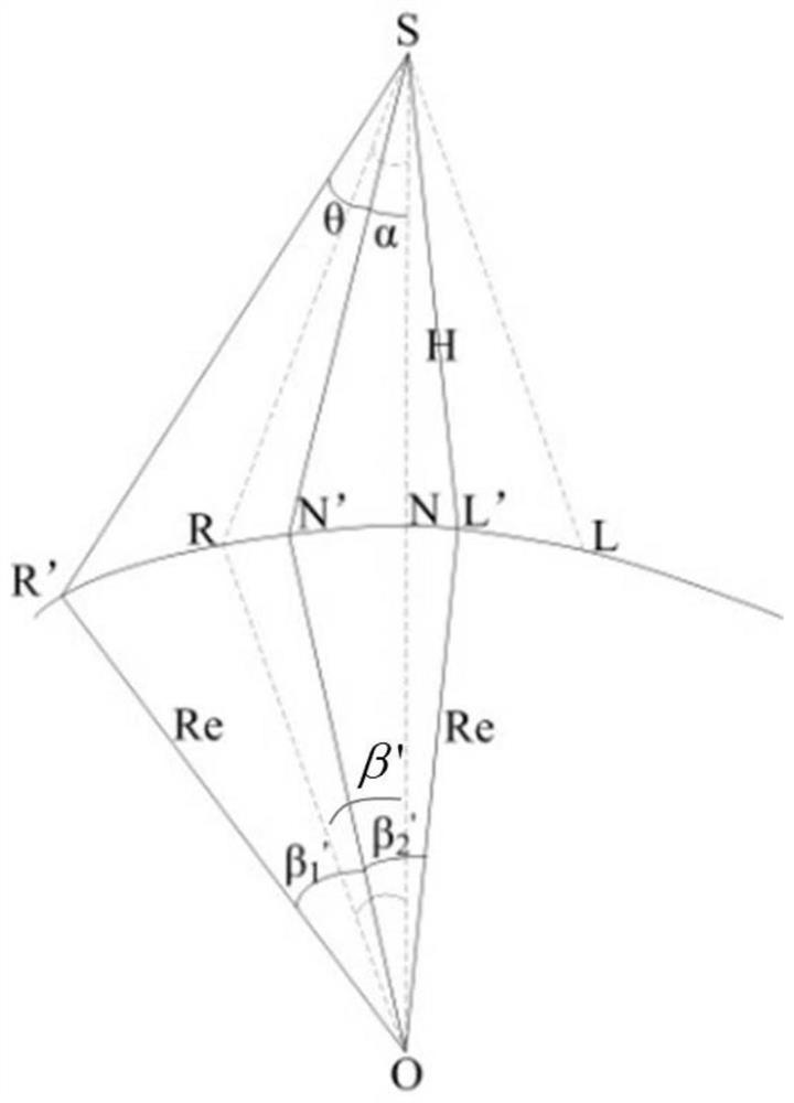
[0114] (2) According to the longitude and latitude information of the obtained interest point, calculate the longitude difference and latitude difference between the interest point and the satellite sub-satellite point;
[0115]
[0116] (3) according to the longitude difference and latitude difference of step (2), calculate the r...
PUM
 Abstract
Description
Claims
Application Information