
A Polarization Autonomous Integrated Navigation Method Based on Confidence

A technology of integrated navigation and confidence, which is applied in the field of integrated navigation, can solve the problems of difficulty in establishing a model, a small number of polarization sensors, and a small number of sensors, so as to improve robustness and anti-interference ability, avoid inaccurate measurement, and avoid sun damage. Accurate effect of vector information

Active Publication Date: 2021-06-25
BEIHANG UNIV
View PDF7 Cites 0 Cited by
  • Summary
  • Abstract
  • Description
  • Claims
  • Application Information

AI Technical Summary

Problems solved by technology

[0003] The existing point-source polarization-assisted navigation uses a small number of polarization sensors, and can only measure the polarization patterns of a few points in space, and the polarization patterns of a single point are easily disturbed by clouds, etc., and the polarization information in the atmosphere cannot be fully utilized.
A Chinese patent for a navigation and positioning method based on sky polarization distribution mode, patent number: 201410012966.7, proposes a navigation and positioning method based on polarization distribution mode, using the whole sky polarization mode for polarization matching, but this mode is easily affected by the environment, and It is difficult to establish a model; the Chinese patent is based on a multi-directional polarized light real-time navigation device, patent number: 201610717237.0, which uses five polarization sensors to measure the polarization vector. It is believed that the polarization vector information measured by the sensor with a large degree of polarization is more accurate, and the most accurate The two vectors are fused to obtain the sun vector, and the accuracy cannot be judged from the sun vector itself. There are many information filters, and the number of sensors is small, and the polarization information obtained from the measurement is limited.

Method used


Image

  • A Polarization Autonomous Integrated Navigation Method Based on Confidence
  • A Polarization Autonomous Integrated Navigation Method Based on Confidence
  • A Polarization Autonomous Integrated Navigation Method Based on Confidence

Examples


Embodiment Construction

[0055] The present invention will be further described below in conjunction with the accompanying drawings and specific embodiments.

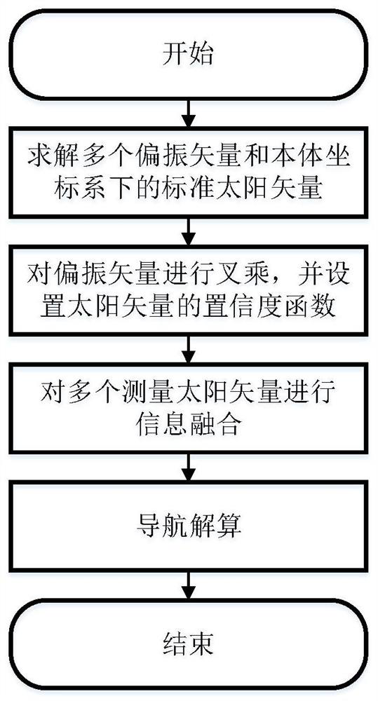
[0056] Such as figure 1 As shown, the specific implementation steps of a polarization autonomous integrated navigation method based on confidence in the present invention are as follows:

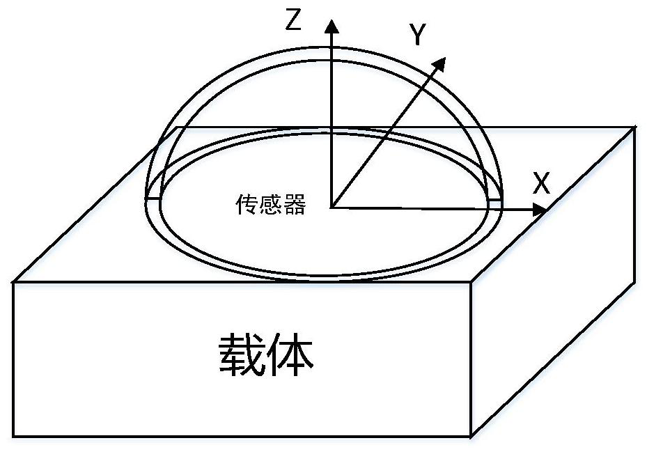
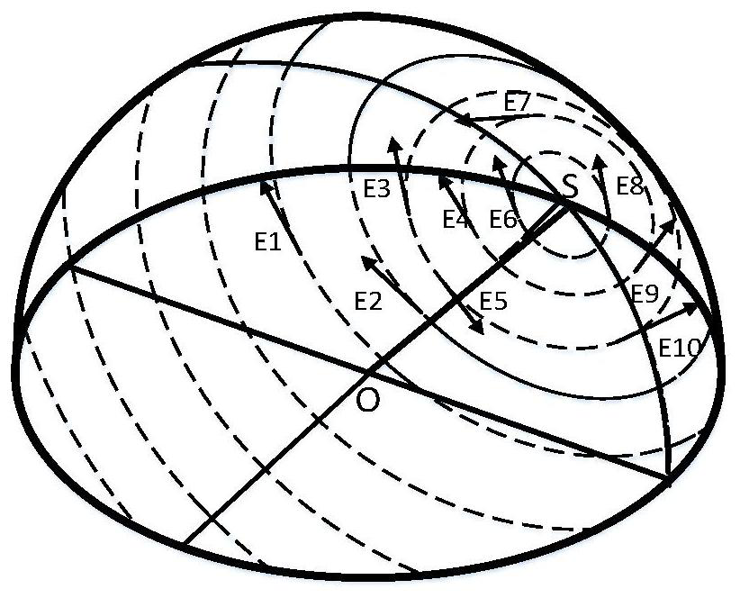
[0057] 1. In figure 2 The polarization sensor shown is installed on the carrier, and the module coordinate system is established based on the polarization sensor. The x-axis of the module coordinate system points to the right along the horizontal axis of the carrier, the y-axis points to the front of the carrier along the longitudinal axis of the carrier, and the z-axis points along the vertical axis of the carrier. Above the carrier, use N polarization sensors to obtain multiple polarization azimuth angles Then the polarization vector under the module system is as follows image 3 As shown, where E1...E10 is the polarization vector, its expression in th...


PUM


Abstract

The invention discloses a polarization autonomous integrated navigation method based on confidence. Firstly, multiple polarization vectors in the sky under the module coordinate system are measured and calculated by using multiple polarization sensor arrays carried on the carrier, and then transformed into the body coordinate system. ; Then the relationship between the polarization vector and the sun vector is established by the Rayleigh scattering model; the relationship between the multi-polarization vector and the sun is used to obtain the measured sun vector by establishing a confidence function, and finally the navigation parameters are estimated by the Kalman filter. This method uses the polarization information of multiple points in the atmosphere to carry out information fusion auxiliary navigation, which has high precision, avoids the interference of a single point by environmental factors, and can achieve high environmental adaptability and autonomous navigation.

Description

technical field [0001] The invention belongs to the field of integrated navigation, and in particular relates to a polarization autonomous integrated navigation method based on confidence. Background technique [0002] Sunlight is incident on the earth, due to various aerosol particles and gas molecules in the earth's atmosphere, the sunlight will be scattered. More than 140 years ago, the British scientist Rayleigh proposed the Rayleigh scattering model, and then people used Rayleigh scattering to obtain the atmospheric polarization distribution model, the model is stable. Through continuous research, it has been found that many creatures use sky polarized light for navigation or auxiliary navigation. For example, sand ants can observe sky polarized light for food and homing, and Vikings use calcite to observe sky polarized patterns for navigation. Polarization navigation has the characteristics of strong concealment, passive, and no radiation, and can be used in a variety...

Claims


Application Information

Patent Timeline
Patent Type & Authority Patents(China)
IPC IPC(8): G01C21/20G01C21/02G01C21/16
CPCG01C21/025G01C21/165G01C21/20
Inventor 郭雷范白清杨健吴煜
Owner BEIHANG UNIV
Learn More