

Multi-direction ship target detection and identification method in high-resolution remote sensing image
A technology for remote sensing images and target detection, applied in character and pattern recognition, instruments, biological neural network models, etc. The impact of experience etc.
- Summary
- Abstract
- Description
- Claims
- Application Information
AI Technical Summary
Problems solved by technology
Method used
Image

Examples
no. 1 example
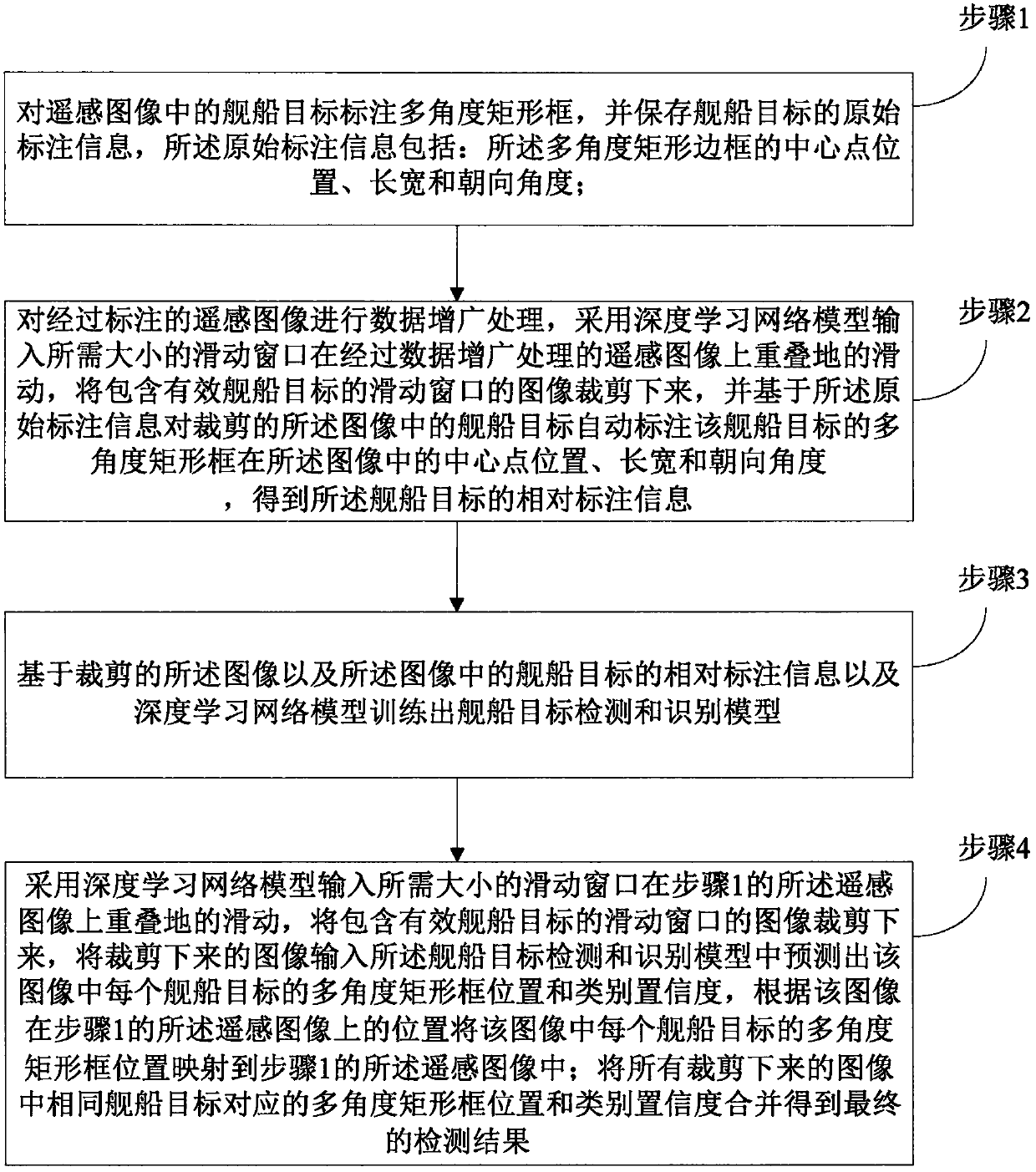
[0072] In the first embodiment of the present invention, a method for detecting and recognizing ship targets with multiple orientations in high-resolution remote sensing images, such as figure 1 shown, including the following specific steps:
[0073] Step 1, labeling the ship target in the remote sensing image with a multi-angle rectangular frame, and saving the original labeling information of the ship target, the original labeling information includes: the position of the center point of the multi-angle rectangular frame in the remote sensing image , length, width and orientation angle;
[0074] Specifically, the step 1 includes:
[0075] For any ship target, first draw a line segment along one long side of the ship target as the long side of the marked multi-angle rectangular frame, and then take any point on the other long side of the ship as the width of the marked rectangular frame, And complete the multi-angle rectangular frame according to the marked length and width...
no. 2 example
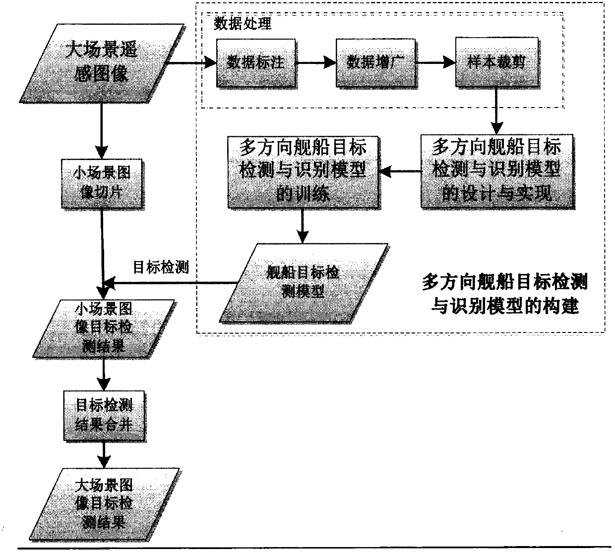
[0128] The second embodiment of the present invention, this embodiment is based on the above embodiments, combined with the attached Figure 2~4 An application example of the present invention is introduced.
[0129] A method for detecting and recognizing multi-directional ship targets in high-resolution remote sensing images based on deep learning in an embodiment of the present invention, the main process of which is as follows figure 2 As shown, the specific steps include:
[0130] Step S1, building a multi-oriented ship target detection and recognition model based on deep learning, including:
[0131] (1) For the annotation of high-resolution remote sensing data in large scenes, for each ship target in the input high-resolution remote sensing image, the "three-point method" is used to mark it with a multi-directional rectangular frame. The so-called "three-point method" is for a ship target, first draw a line segment along one long side of the ship target as the long si...
PUM
 Abstract
Description
Claims
Application Information