Unmanned aerial vehicle power transmission line patrol flight path planning method and system

A technology for transmission line and track planning, which is applied in the direction of navigation calculation tools, etc., can solve the problems of unreasonable UAV inspection track planning and few influencing factors.

Inactive Publication Date: 2018-08-17
YUNNAN POWER GRID CO LTD ELECTRIC POWER RES INST
View PDF8 Cites 27 Cited by
  • Summary
  • Abstract
  • Description
  • Claims
  • Application Information

AI Technical Summary

Problems solved by technology

[0004] The purpose of this application is to provide a method and system for UAV transmission line inspection track planning to solve the unreasonable UAV inspection track planning due to the lack of factors considered in the UAV power inspection. The problem

Method used


Image

  • Unmanned aerial vehicle power transmission line patrol flight path planning method and system
  • Unmanned aerial vehicle power transmission line patrol flight path planning method and system
  • Unmanned aerial vehicle power transmission line patrol flight path planning method and system

Examples


Embodiment Construction

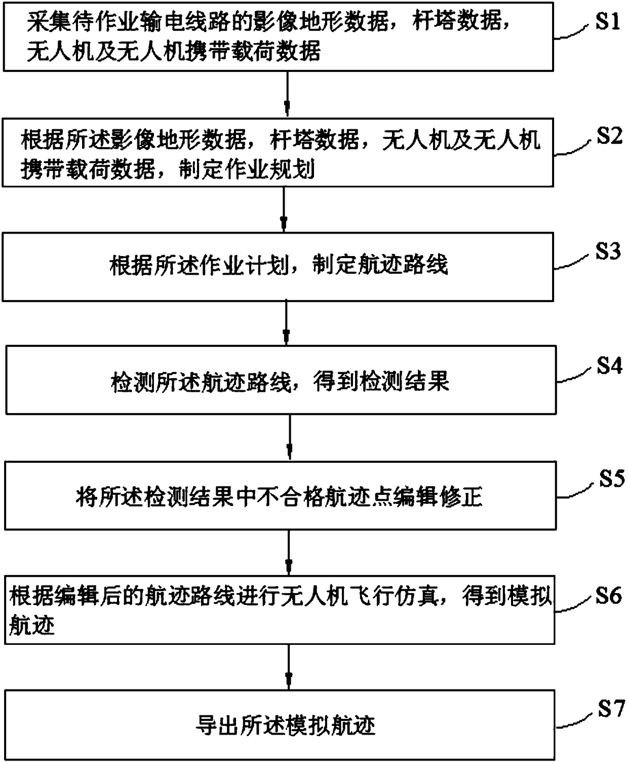
[0052] refer to figure 1 , the embodiment of the present application provides a UAV transmission line inspection track planning method, including:

[0053] Step S1, collect image terrain data of the power transmission line to be operated, tower data, UAV and UAV carrying load data;

[0054] The UAV data includes UAV line inspection speed, climbing ability and fuel consumption data, etc.

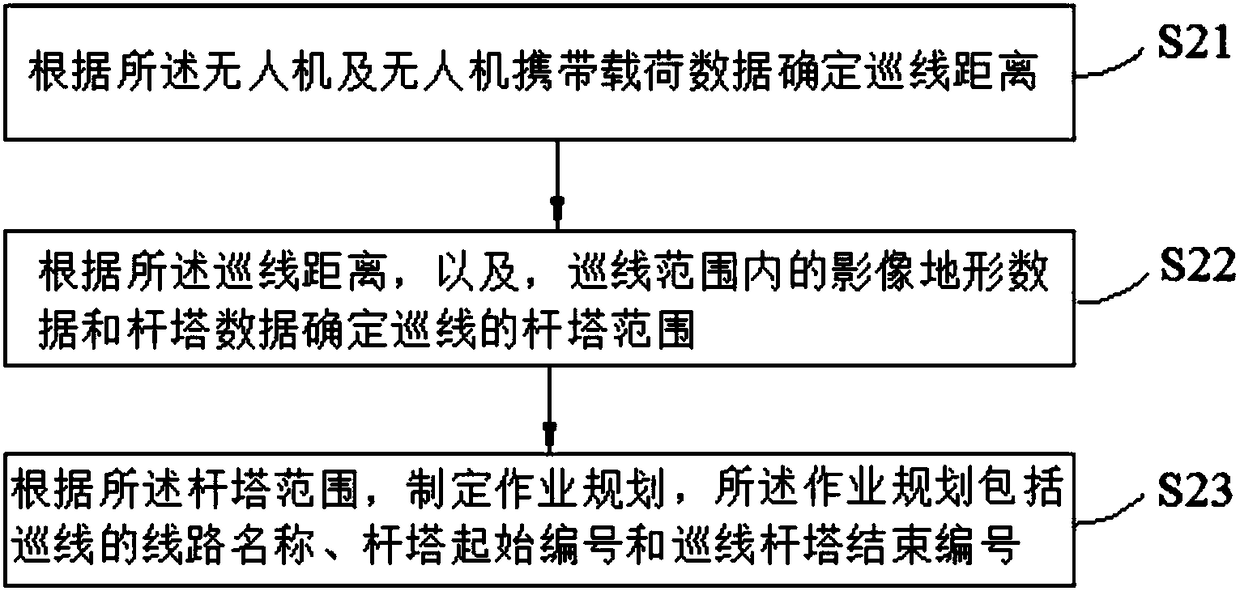
[0055] Step S2, formulate an operation plan according to the image terrain data, tower data, UAV and UAV carrying load data;

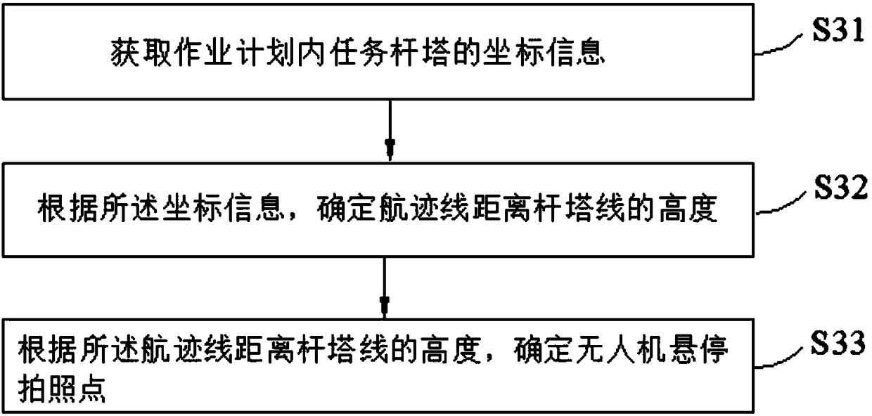
[0056] Step S3, formulate a track route according to the operation plan;

[0057] The established track route must not only meet the safety requirements, but also meet the performance requirements of the drone and its load, including the turning radius of the drone, the climb rate of the drone, the safe height of the tower, the safe distance of the tower and other related information To ensure that the UAV can complete the task of patrolling the line safely and smo...


PUM


Abstract

The invention discloses an unmanned aerial vehicle power transmission line patrol flight path planning method and system. The method includes the steps: acquiring image terrain data, pole and tower data and unmanned aerial vehicle and unmanned aerial vehicle carried load data of a power transmission line to be operated; making an operation plan according to the image terrain data, the pole and tower data and the unmanned aerial vehicle and unmanned aerial vehicle carried load data; making a flight path according to the operation plan; detecting the flight path to obtain detection results; editing and correcting unqualified flight path points in the detection results; simulating flight according to the edited flight path to obtain a simulated flight path; deriving the simulated flight path.Unmanned aerial vehicle line patrol task setting and flight path planning are simpler and rapider, line patrol efficiency is greatly improved, and the unmanned aerial vehicle power transmission linepatrol task and flight path intelligent planning system takes environmental factors of the power transmission line and performance requirements of an unmanned aerial vehicle and a load into full consideration, so that the planned flight path not only meets safety performance requirements, but also meets the performance requirements of the unmanned aerial vehicle and the load.

Description

technical field [0001] The present application relates to the technical field of geological hazard surveying, in particular to a method and system for planning a UAV transmission line patrol inspection track. Background technique [0002] Unmanned aircraft, referred to as "UAV", is an unmanned aircraft controlled by radio remote control equipment and its own program control device. UAV is actually a general term for unmanned aerial vehicles. [0003] Unmanned aerial vehicle (UAV) is an important means of geological disaster survey, and the planning of UAV's power inspection track has become one of the hot research issues. Since the power inspection is different from other regional flight missions, it needs to fly at a higher altitude in order to better obtain the damage and defect information of the tower line, etc., and the complexity of trajectory planning increases. At home and abroad, terrain data is mostly used for track planning on the two-dimensional geographic info...

Claims


Application Information

Patent Timeline
Patent Type & Authority Applications(China)
IPC IPC(8): G01C21/20
CPCG01C21/20
Inventor 于虹马仪
Owner YUNNAN POWER GRID CO LTD ELECTRIC POWER RES INST
Why Eureka
Try Eureka