Three-dimensional point cloud data acquisition method and acquisition system

A three-dimensional point cloud and data acquisition technology, applied in the field of surveying and mapping systems, can solve the problems of unsuitable for the promotion and use of three-dimensional measurement systems, complex structure and large volume of three-dimensional laser scanners, and achieve comprehensive coverage of three-dimensional point cloud information and convenient data. The effect of processing work, storage method is reasonable

Inactive Publication Date: 2018-09-14
苏州中德睿博智能科技有限公司
View PDF6 Cites 24 Cited by
  • Summary
  • Abstract
  • Description
  • Claims
  • Application Information

AI Technical Summary

Problems solved by technology

[0006] However, the structure of the 3D laser scanner is complex, the price is very expensive, and the volum

Method used


Image

  • Three-dimensional point cloud data acquisition method and acquisition system
  • Three-dimensional point cloud data acquisition method and acquisition system
  • Three-dimensional point cloud data acquisition method and acquisition system

Examples


Embodiment

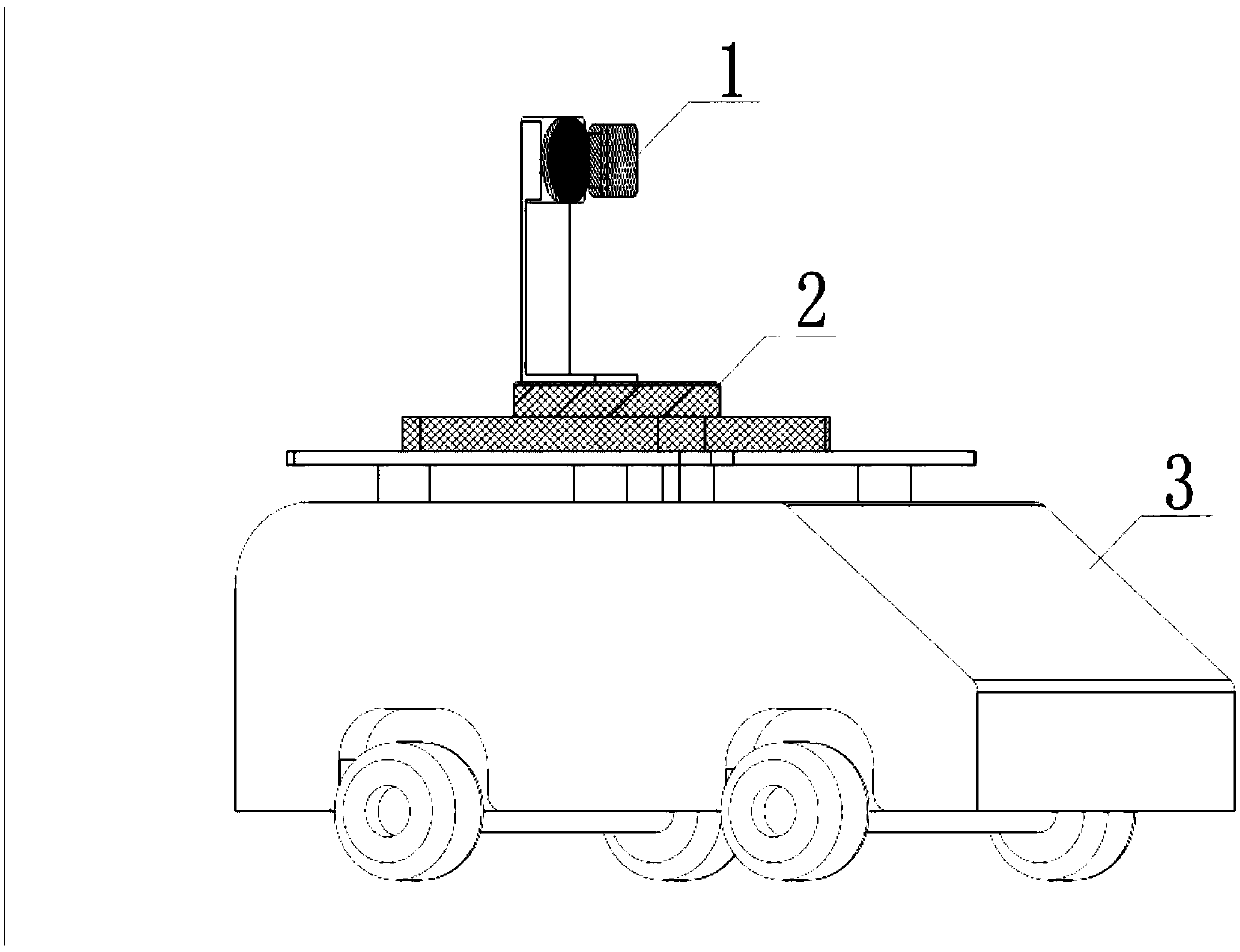
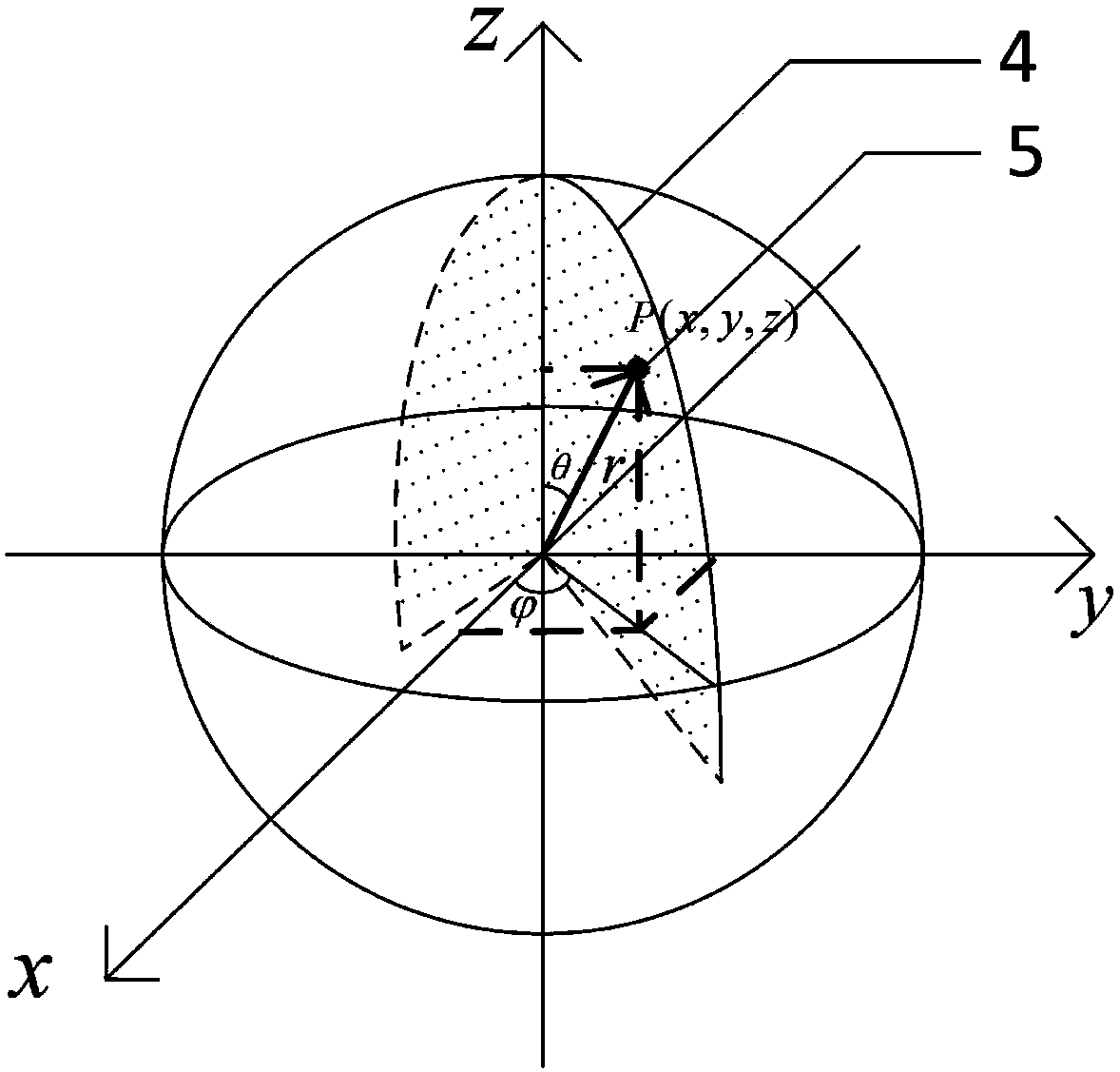
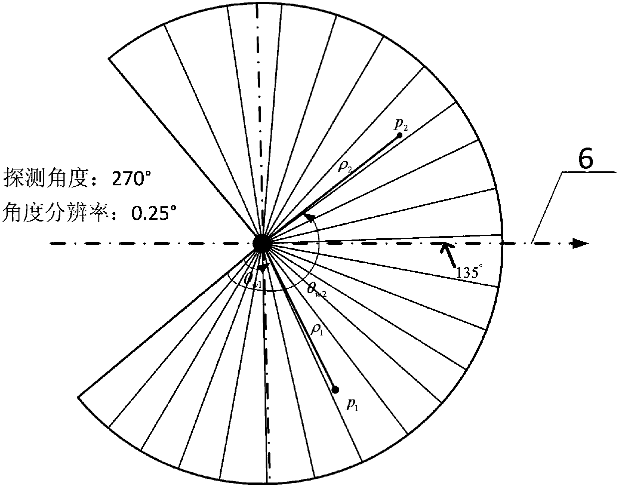
[0035] refer to Figure 1-3 , this embodiment shows a 3D point cloud data acquisition system, the 3D point cloud data acquisition device such as figure 1 As shown, it includes a mobile robot 1, a rotating gimbal 2, and a two-dimensional laser radar 3.

[0036] The mobile robot 1 can move freely on level ground and rough ground. The mobile robot 1 can provide motor driving power, and can provide power and a carrying platform to the rotating platform 2 .

[0037] The rotating platform 2 is mounted horizontally on the mobile robot 1. The rotating platform 2 can rotate horizontally. The horizontal rotation surface of the rotating platform 2 is parallel to the horizontal plane of the mobile robot 1. The horizontal direction of the rotating platform 2 can rotate at least 180 degrees. , the above-mentioned rotary pan / tilt 2 can communicate with the outside world through a serial port or a network port.

[0038] Described two-dimensional laser radar 3 is vertically connected on the ...


PUM


Abstract

The invention provides a three-dimensional point cloud data acquisition method comprising the following steps that: the current position of a rotating holder is acquired and the inclined angle phi<0>of the current position and the initial position is obtained; the rotating holder rotates according to the set step angle and the rotating direction transmitted by an upper computer, the two-dimensional laser radar performs scanning for one time when the rotating holder rotates for one step, and all the point depth rho and angles theta<w> fed back by the radar are recorded, and the current rotating angle phi<1> of the rotating holder is recorded; and the three-dimensional point cloud data information acquired by the two-dimensional laser radar is transformed to the Cartesian coordinates from the spherical coordinates through coordinate system transformation. Three-dimensional environmental information acquisition can be completed by using the two-dimensional laser radar, and the calculation method for converting the radar information into the three-dimensional coordinate information is suitable for multiple types of laser and holder devices so as to be high in transplantability and suitable for ordinary mobile robots and other mobile equipment, the acquired three-dimensional point cloud information has comprehensive coverage, the storage mode is reasonable, and the accurate data can be provided for point cloud data processing of subsequent map reconstruction.

Description

technical field [0001] The present invention relates to a surveying and mapping system. Specifically, it shows a method for acquiring 3D point cloud data obtained by using lidar and pan / tilt in reverse engineering and 3D map reconstruction of mobile robots. At the same time, it also shows An acquisition system for acquiring three-dimensional point cloud data using a three-dimensional point cloud data acquisition method. Background technique [0002] With the increasing demand for spatial data in all walks of life in the information age, conventional data acquisition methods and data processing modes can no longer meet the needs of informatization. In surveying and mapping systems, three-dimensional reconstruction of digital cities, and reverse engineering, the measured data from Form to 3D form conversion, 3D point cloud data acquisition as the basis of the system becomes an indispensable part. High precision, portability, simple structure and easy installation, and price a...

Claims


Application Information

Patent Timeline
IPC IPC(8): G01S17/88G01S17/89G01S7/481
CPCG01S7/4817G01S17/88G01S17/89
Inventor 孙波曾雅丹戴厚德冯经纶
Owner 苏州中德睿博智能科技有限公司
Why Eureka
Try Eureka