

Semi-supervised polarization SAR terrain classification method based on full convolution GAN
A ground object classification and semi-supervised technology, applied in the field of image processing, can solve the problem of inaccurate classification results, improve classification accuracy, overcome repeated storage and calculation of convolution, and enhance robustness.
- Summary
- Abstract
- Description
- Claims
- Application Information
AI Technical Summary
Problems solved by technology
Method used
Image

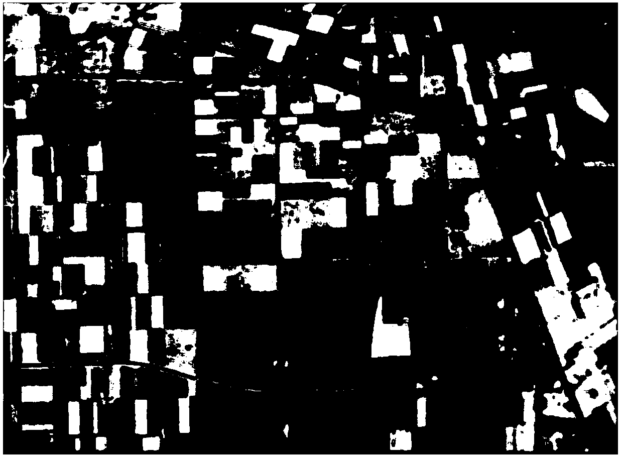
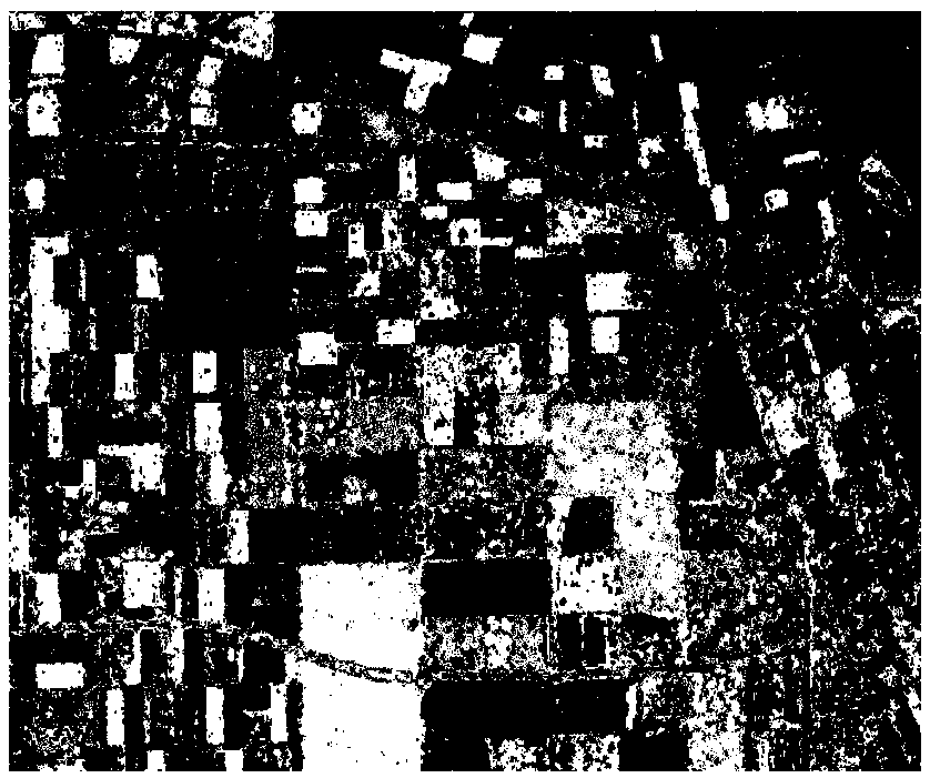
Examples
Embodiment Construction
[0040] The present invention will be described in further detail below in conjunction with the accompanying drawings.
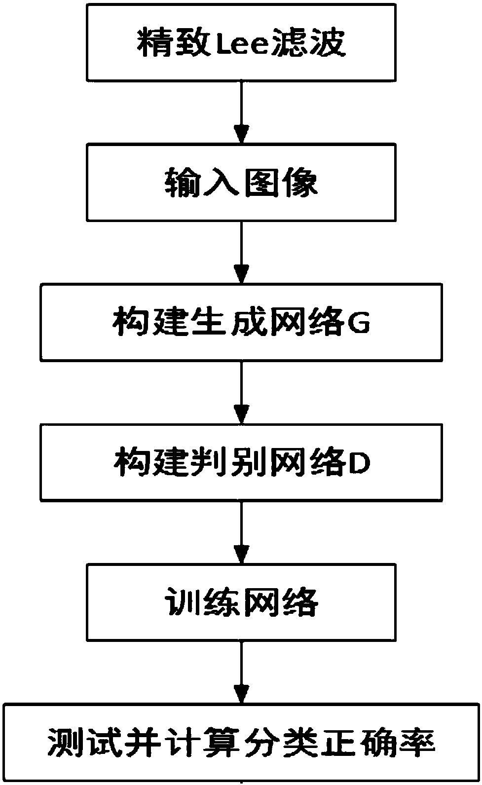
[0041] Such as figure 1 As shown, the semi-supervised polarization SAR object classification method based on full convolution GAN provided by the present invention comprises the following steps:
[0042] Step 1. Refined Lee filtering:
[0043] Exquisite Lee filtering is performed on an original polarimetric SAR image to obtain the filtered polarimetric SAR image to be classified;
[0044] Step 2. Enter data:
[0045] The real polarimetric SAR image to be classified and its corresponding label image are taken as true samples; wherein, the label image and the polarimetric SAR image have the same size;
[0046] Step 3. Build the generative network G:
[0047] The generation network G is a convolutional neural network comprising four deconvolution layers, the first layer of the network is a convolution kernel size of 2 × 2, a convolution step size of 1, and a...
PUM
 Abstract
Description
Claims
Application Information