Method of realizing positioning by utilizing non-cooperative satellite signals

A satellite signal, non-cooperative technology, applied in the field of communications, can solve the problems of uncertain service capabilities, vulnerable signals, and electromagnetic interference, etc., and achieves the effect of not easy to interfere and attack, strong concealment, and rich positioning service system.

Active Publication Date: 2018-12-18
NAT TIME SERVICE CENT CHINESE ACAD OF SCI
View PDF6 Cites 11 Cited by
  • Summary
  • Abstract
  • Description
  • Claims
  • Application Information

AI Technical Summary

Problems solved by technology

However, satellite navigation systems also have inherent vulnerabilities, and their signals are easily shielded or susceptible to electromagnetic interference. Therefore, as a dedicated navigation and positioning system, there is a large uncertainty in its service capabilities.

Method used


Image

  • Method of realizing positioning by utilizing non-cooperative satellite signals
  • Method of realizing positioning by utilizing non-cooperative satellite signals
  • Method of realizing positioning by utilizing non-cooperative satellite signals

Examples


Embodiment Construction

[0035] The present invention will be further described below in conjunction with the accompanying drawings and embodiments, and the present invention includes but not limited to the following embodiments.

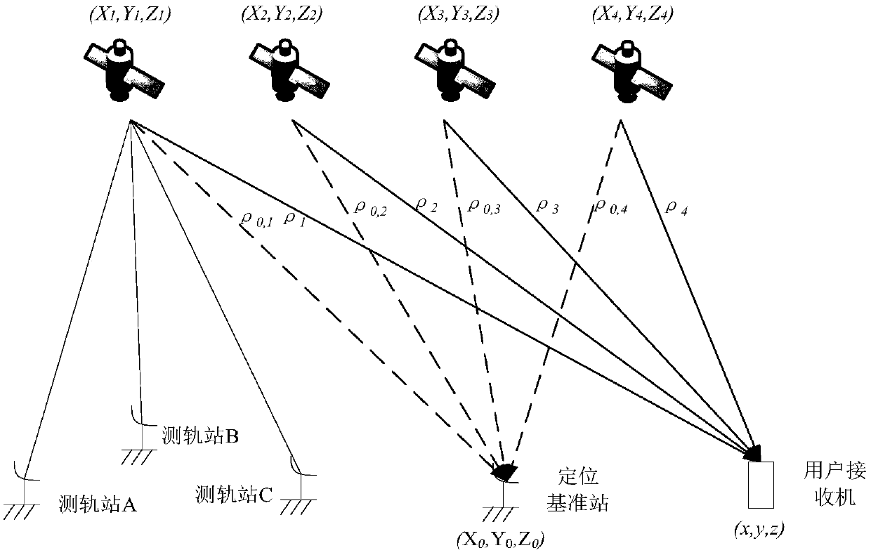
[0036] The technical solution of the present invention is to use VLBI measurement technology to realize the precise orbit determination of non-cooperative satellite signals; to use the time difference measurement technology in passive radar detection and positioning to obtain non-cooperative satellite signals from more than three satellite radiation sources to the positioning reference station The time delay measurement value with the user receiver, thereby obtaining the time difference measurement positioning equation group, and finally solving the equation group to obtain the user position.

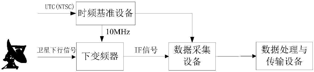
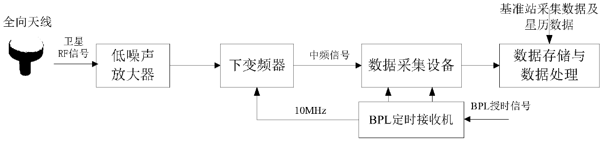
[0037] In this embodiment, according to the test verification platform built, four satellite downlink signals are collected, and the method steps of using non-cooperative satellite si...


PUM


Abstract

The invention provides a method of realizing positioning by utilizing non-cooperative satellite signals. The method comprises the steps of realizing orbit precise determination of the non-cooperativesatellite signals by utilizing a VLBI measuring technique; obtaining time delay measurement value of the non-cooperative satellite signals of more than three satellite radiation sources to a positioning reference station and a user receiver, thereby obtaining a time difference measurement positioning equation set; and finally solving the equation set to obtain a user position. The method of realizing positioning by utilizing non-cooperative satellite signals realizes a purpose of passive positioning of non-cooperative signals without demodulating the satellite signals as the positioning reference station and a user station collect the non-cooperative satellite signals synchronously and the collected data are subjected to second-order mutual fuzzy function processing.

Description

technical field [0001] The invention belongs to the technical field of communication, and in particular relates to a method for locating a target user by using a non-cooperative satellite radiation source. Background technique [0002] The traditional satellite navigation system is to observe the downlink signal of the satellite in a cooperative manner, and use the characteristic value of the signal to measure the pseudo-range between the receiver and the transmitter, so as to obtain the position of the target receiver. This type of navigation and positioning system has the advantages of large area coverage and high positioning accuracy, and has been widely used in various fields. However, satellite navigation systems also have inherent vulnerabilities, and their signals are easily shielded or susceptible to electromagnetic interference. Therefore, as a dedicated navigation and positioning system, there is great uncertainty in its service capabilities. [0003] In the field...

Claims


Application Information

Patent Timeline
Patent Type & Authority Applications(China)
IPC IPC(8): G01S5/10
CPCG01S5/10
Inventor 高媛媛华宇向渝黄长江赵弦王善和
Owner NAT TIME SERVICE CENT CHINESE ACAD OF SCI
Why Eureka
Try Eureka